| ©The Archaeological Settlements of Turkey - TAY Project | ||||||
|
|
||||||
Ispendere |
||||||
|
|
||||||
| Ages | Maps | Photos | ||||
| EBA |
 |
 |
||||
|
|
||||||
|
Type:
|
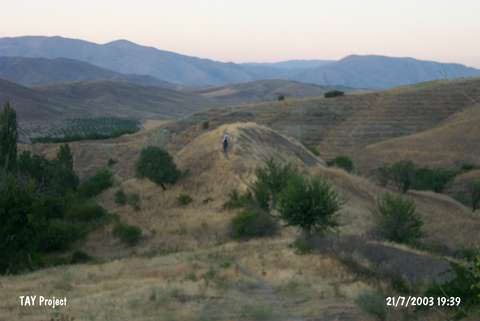
Mound | |||||
|
Altitude:
|
810 m | |||||
|
Diameter:
|
m- Direction: | |||||
|
|
||||||
|
Region:
|
Eastern Anatolia | |||||
|
Province:
|
Malatya | |||||
|
District:
|
Merkez | |||||
|
Village:
|
Bulutlu | |||||
|
|
||||||
|
Destruction :
|
Illicit Digging - Natural causes | |||||
|
|
||||||
|
TAYEx:
|
Visited - 21/7/2003 | |||||
|
|
||||||
|
Registration State:
|
For detailed registration information please refer to Turkish pages. | |||||
 |
||||||
| Location: |
| Geography and Environment: |
| Destruction Details: The mound is being damaged by natural causes and illicit diggings. Northwest and southeast skirts have run down to the stream and there is a pit on top hill extending towards east skirt. A pathway crosses top hill in northeast-southwest direction [TAYEx 21.7.2003]. |