| ©The Archaeological Settlements of Turkey - TAY Project | ||||||
|
|
||||||
Alibeyli |
||||||
|
|
||||||
| Ages | Maps | Photos | ||||
| Neolithic Chalcolithic EBA |
 |
 |
||||
|
|
||||||
|
Type:
|
Mound | |||||
|
Altitude:
|
100 m | |||||
|
Diameter:
|
m- Direction: | |||||
|
|
||||||
|
Region:
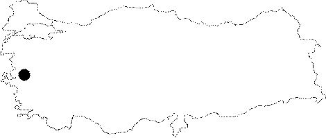
|
Aegean | |||||
|
Province:
|
Manisa | |||||
|
District:
|
Saruhanli | |||||
|
Village:
|
Alibeyli | |||||
|
|
||||||
|
Destruction :
|
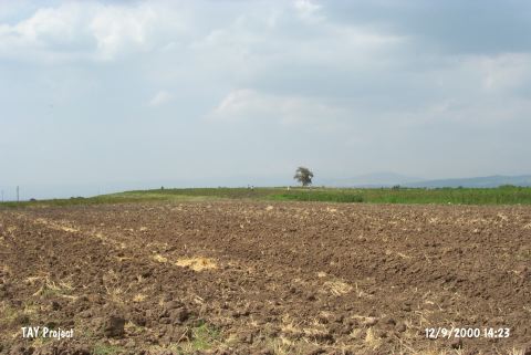
Agriculture - Highways, roads, bridges etc. | |||||
|
|
||||||
|
TAYEx:
|
Visited - 12/9/2000 | |||||
|
|
||||||
|
Registration State:
|
For detailed registration information please refer to Turkish pages. | |||||
 |
||||||
| Location: This site is northeast of the city of Manisa; 4 km northeast of the town of Halitpasa and 3 km north-northwest of the village of Alibeyli. It is possible to get to the mound via the Halitpasa-Alibeyli highway. |
| Geography and Environment: The mound; which is 80 m in diameter and 6 m in height; lies on the Gediz Plain. Today there are no water sources in the vicinity of the mound. The settlers in the area must have obtained their water from the streamlets which feed the Gediz River. The Gediz Plain; which is oriented east-west; formed as a tectonic depression. The mound lies along a trade route. |
| Destruction Details: The mound has been damaged due to agricultural activities. There is a 1.5 m deep profile on the northern section which was formed during the earth removal [TAYEx 12.9.2000]. |