| ©The Archaeological Settlements of Turkey - TAY Project | ||||||
|
|
||||||
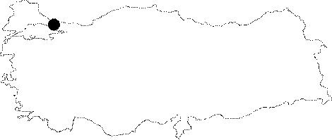
Içerenköy |
||||||
|
|
||||||
| Ages | Maps | Photos | ||||
| Palaeolithic/Epipalaeolithic Neolithic |
 |
 |
||||
|
|
||||||
|
Type:
|
Single Findspot | |||||
|
Altitude:
|
20 m | |||||
|
Diameter:
|
m- Direction: | |||||
|
|
||||||
|
Region:
|
Marmara | |||||
|
Province:
|
Istanbul | |||||
|
District:
|
Kadiköy | |||||
|
Village:
|
Içerenköy | |||||
|
|
||||||
|
Destruction :
|
Contemporary Settlements - Attention | |||||
|
|
||||||
|
TAYEx:
|
Not visited - 24/11/2000 | |||||
|
|
||||||
|
Registration State:
|
For detailed registration information please refer to Turkish pages. | |||||
 |
||||||
| Location: This site lies east of the Istanbul city center (Eminönü); on the Asian side; in Içerenköy; an area that used to be a summer resort place and has since become a district of Istanbul. |
| Geography and Environment: The exact location of this site; reported to be 2 m beneath surface level; is not known. It is believed to be somewhere between Içerenköy and Sahrayi Cedit. The site was found by S. A. Kansu during his research in this area. The site has since been completely destroyed by modern development. |
| Destruction Details: |