| ©The Archaeological Settlements of Turkey - TAY Project | ||||||
|
|
||||||
Hayitligöl Siginagi |
||||||
|
|
||||||
| Ages | Maps | Photos | ||||
| Palaeolithic/Epipalaeolithic |
 |
 |
||||
|
|
||||||
|
Type:
|
Rock Shelter | |||||
|
Altitude:
|
m | |||||
|
Diameter:
|
m- Direction: | |||||
|
|
||||||
|
Region:
|
Mediterranean | |||||
|
Province:
|
Antalya | |||||
|
District:
|
Merkez | |||||
|
Village:
|
Beldibi | |||||
|
|
||||||
|
|
||||||
|
|
||||||
|
TAYEx:
|
Not visited - 21/6/2001 | |||||
|
|
||||||
|
Registration State:
|
For detailed registration information please refer to Turkish pages. | |||||
 |
||||||
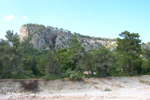
| Location: This rock-shelter site is southwest of the city of Antalya; in the district of Arpalik; northwest of the village of Beldibi. It is 8 km from the Kumbucagi Rock-Shelter in the valley west of it. It cannot be ascertained whether the distance is measured as the crow flies or by highway. |
| Geography and Environment: Bostanci provides no further information on the geographic positioning of this rock-shelter. |
| Destruction Details: |