| ©The Archaeological Settlements of Turkey - TAY Project | ||||||
|
|
||||||
Gre Migro |
||||||
|
|
||||||
| Ages | Maps | Photos | ||||
| Chalcolithic |
 |
 |
||||
|
|
||||||
|
Type:
|
Mound | |||||
|
Altitude:
|
540 m | |||||
|
Diameter:
|
m- Direction: | |||||
|
|
||||||
|
Region:
|
Southeastern Anatolia | |||||
|
Province:
|
Batman | |||||
|
District:
|
Merkez | |||||
|
Village:
|
Biçakçi | |||||
|
|
||||||
|
Destruction :
|
Agriculture - Contemporary Settlements - Highways, roads, bridges etc. | |||||
|
|
||||||
|
TAYEx:
|
Visited - 16/9/2001 | |||||
|
|
||||||
|
Registration State:
|
Registered For detailed registration information please refer to Turkish pages. | |||||
 |
||||||
| Location: |
| Geography and Environment: |
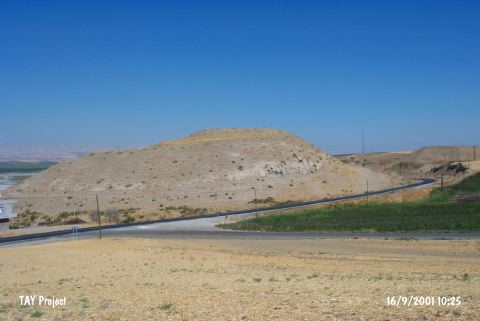
| Destruction Details: The site of Gre Migro is destructed by the causes of a road; constructing and agricultural activities. Batman-Bitlis highway cuts the east and southeast slopes of the mound. Mound extends towards the other side of the highway and this area is being used as cotton field. Soil removal is causing landslide [TAYEx 16.9.2001]. |