| ©The Archaeological Settlements of Turkey - TAY Project | ||||||
|
|
||||||
Gölyolu |
||||||
|
|
||||||
| Ages | Maps | Photos | ||||
| Neolithic Chalcolithic |
 |
 |
||||
|
|
||||||
|
Type:
|
Mound | |||||
|
Altitude:
|
990 m | |||||
|
Diameter:
|
m- Direction: | |||||
|
|
||||||
|
Region:
|
Central Anatolia | |||||
|
Province:
|
Konya | |||||
|
District:
|
Aksehir | |||||
|
Village:
|
Yasarlar | |||||
|
|
||||||
|
Destruction :
|
Agriculture - Contemporary Settlements - Attention | |||||
|
|
||||||
|
TAYEx:
|
Visited - 3/9/2002 | |||||
|
|
||||||
|
Registration State:
|
For detailed registration information please refer to Turkish pages. | |||||
 |
||||||
| Location: This site lies in Gölyolu Mevkii; 300 m northwest of the site of Taslik Höyük; 1 km northwest of the town of Yasarlar; northeast of Aksehir District of Konya Province. |
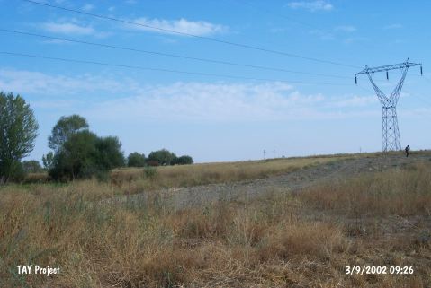
| Geography and Environment: The name of the site; which lies south of Aksehir Lake and in the Aksehir Plain; has been given by Özsait after the district in which it lies. There are many fertile agricultural fields surrounding the mound. The mound is not much higher than the level of the plain and faces the threat of completely disappearing due to continual plowing. Its original height cannot be determined. The dimensions of the base of the mound have similarly not been reported. Finds are scattered in a wide area. |
| Destruction Details: The mound is cultivated and there is a high voltage power tower on top [TAYEx 3.9.2002]. |