|
©The Archaeological Settlements of Turkey - TAY Project
|
|
|
|
|
|
Kumtepe |
|
|
For site maps and drawings please click on the picture... 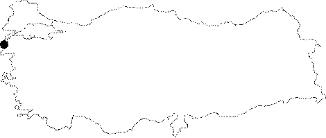 |
For photographs please click on the photo... 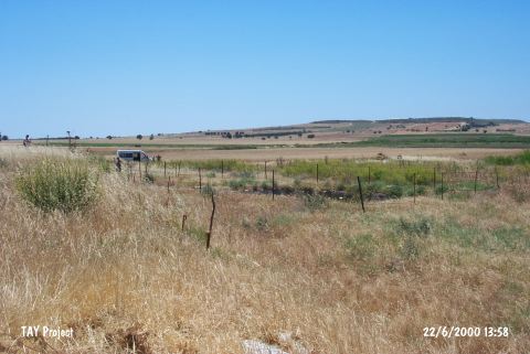 |
|
Type:
|
Mound |
|
Altitude:
|
50 m |
|
Region:
|
Marmara |
|
Province:
|
Çanakkale |
|
District:
|
Merkez |
|
Village:
|
Kumköy |
|
Investigation Method:
|
Excavation |
|
Period:
|
EBA I EBA II |
|
|
|
 |
|
| Location: It lies on the western bank of Kara Menderes Stream; south of Kumkale; southwest of the Çanakkale Province. It is 2.5 km away from Dardanelles and 2 km away from the Aegean Sea. |
| Geography and Environment: Located on the western part of alluvial formed by the Kara Menderes Stream; it is a flat mound measuring 4-5 m in height and ca. 80x100 m in dimensions [Kosay-Sperling 1936:plan at 28]. Eastern slope of the mound has been truncated by Kara Menderes Stream while the upper part has been almost demolished due to recent leveling by bulldozer. Removal of stones by 15 trucks is an indication of the destruction caused on the architecture of the upper levels. |
| History: |
| Research and Excavation: The mound was discovered by J.L. Caskey and J. Sperling during the 1934 campaign of excavations at Troy by Universities of Cincinnati [Arik 1953:79] and was excavated the same year by J. Sperling and H.Z. Kosay. The excavation was conducted in a total of 5 trenches; 4 at the north on the mound; 1 at the northwestern slope. The ditch-like trenches of 1.5x10 m do not constitute an efficient strategy for recovering the architectural texture of the settlement. Years later; the second campaign of Kumtepe excavations were initiated as a joint project of Troy Team and Çanakkale Museum; when it was heard that the mound was being destroyed. This second campaign was conducted by M. Korfmann between 1993 and 1997. |
| Stratigraphy: During the first excavation lasted for one year and in fact was a sounding rather than excavation; virgin soil was reached with two trenches and thickness of the deposit was informed to be 5 m. Lower level was named Level I; and the upper and recent level named Level II. Furthermore; Level I was divided into three building levels as a; b and c; and each building level was divided into sub-phases as follows; Ia1; Ia2; Ib1-Ib4; Ic1; Ic2. During the second excavations carried out by M. Korfmann; the same stratification was followed; but under different numbering for building levels; A; B 2 A-B; B 3 A-C; B 4 A-C; C 1 D; C 1 C; C 1A-B. Those excavations revealed that the upper level (Level II) of Kumtepe was completely demolished and there is a big gap between Kumtepe Levels Ia and Ib. Kumtepe Level Ia is contemporary with Besiktepe and dated to 4800-4000 BC whereas Kumtepe Level Ib belongs to pre-Troy I period and dated to the beginning of EBA. Early phases of Kumtepe Level Ib can be considered; yet uncertain; at transition from Late Chalcolithic Age to EBA or in Late Chalcolithic Age. Kumtepe Level Ic is contemporary with Troy I. |
| Small Finds: Architecture: It is impossible to give details about the architecture as the first period excavations were carried out in a narrow area. Only remains of buildings with stone foundations were uncovered. Second excavations yielded buildings with stone foundations. Outer walls of the buildings were coated with a white plaster. Pottery: Vast majority of the sherds collected during 1934 excavation are preserved at Istanbul Museum of Archaeology and some at Ankara Museum of Anatolian Civilizations while thematerial recovered during the last excavations are stored at Museum of Çanakkale. EBA potteries of Kumtepe Level Ib are usually burnished in grey; brown and black shades. Forms of bowls are common including bowls with inverted; thickened rims; interior-thickened rims; unrolled and out-rolled rims. Sometimes; pierced lugs are placed on sides of the rims. Also found are single-handled or necked forms of pots and shallow fruit stands. As decoration forms; incision decorations are common and they are usually applied to the interior surfaces of the handles made as projections on bowls with interior-thickened rims. Pottery of Kumtepe Ic are identical to Troy I in material and form. Clay: Plenty of spindle whorls in terracotta were recovered. Ground Stone: Polished flat axes and grinding stones were recovered. Chipped Stone: Blades and scrapers in flint and obsidian were found. Bone: Awls in bone were found. Metal: Copper needles were found at levels Ib and Ic of Kumtepe. Also found is a copper dagger recovered from level Ic2 during the first excavation. This dagger with its folded barrel is rather included in category of poniards [Kosay-Sperling 1936:pic.22 (K-37)]. Other: Levels Ib and Ic of Kumtepe yielded bones of shelled sea animals; fish; bird and various cattles Human Remains: Various building levels of Kumtepe level I yielded four graves inside the settlement; one of them (at building level Ic) being exactly dated to EBA. Included in EBA I; it is a simple pit burial uncovered at 3.1 m depth. The dead were placed into grave in hocker position leaning on his right side; and head oriented toward north. Head is positioned as if there was a pillow underneath. Arms were crossed on breasts. The one recovered from building level Ib of Kumtepe is 4.2 m down from the surface. Skeleton is in a bad situation [Kosay-Sperling 1936:pic.23]. No grave goods were found in neither of the graves. |
| Remains: |
| Interpretation and Dating: Kumtepe is one of the most significant mounds illuminating the pre-Troy I period in Western Anatolia Region. Kumtepe Ic is contemporary with Troy I while Kumtepe Ib is dated to the early phase of EBA. 14C results of Kumtepe give the date of 3100 BC. Early levels of Kumtepe can be considered; yet uncertain; with Late Chalcolithic-EBA transition or Late Chalcolithic Age. |