|
©The Archaeological Settlements of Turkey - TAY Project
|
|
|
|
|
|
Limyra |
|
|
For site maps and drawings please click on the picture... 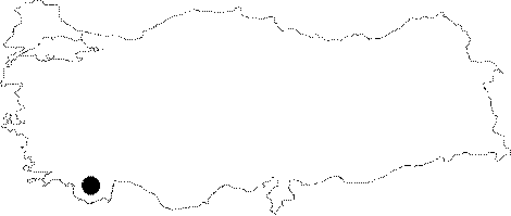 |
For photographs please click on the photo...  |
|
Type:
|
City |
|
Altitude:
|
m |
|
Region:
|
Mediterranean |
|
Province:
|
Antalya |
|
District:
|
Finike |
|
Village:
|
Turunçova |
|
Investigation Method:
|
Excavation |
|
Period:
|
Classical Archaic |
|
|
|
 |
|
| Location: It was a port city founded on the plain of the southern skirt of the Mount Toçak, 4 km northeast of the Finike District in Antalya. |
| Geography and Environment: |
| History: |
| Research and Excavation: In 1838 C. Fellows accidentally noticed the remains of Limyra, and visited the city for surveying two years later. It was later visited by J.A. Schönborn in 1842, followed by British archaeologists Spratte and Forbes, who walked alongside the Limyros Brook, and found the remains. After Spratt and Forbes, no investigation was carried out related with Limyra for a long period of time. J. Borchhardt, an expert from the German Archaeological Institute visited Limyra while he was conducting a survey in Myra in 1965, and conducted excavations here between 1969 and 1974. Since 2002, the excavations have been carried out under the direction of T. Marksteiner and under the auspices of the Archaeology Department of the University of Vienna. |
| Stratigraphy: The previous campaigns yielded 13 strata with a dense sequence in the excavation area. Each of them contain architectural remains; Levels I-V: Hellenistic Period Levels VI-VII: 4th century BC Levels IX-XI: 5th century BC Level XII: 6th century BC Level XIII: 7th century BC |
| Small Finds: Architecture: The earlier levels which were uncovered during the previous campaign at the center of the excavation area (SO9W1, SO9O1) in 2005 were removed to document the underlying stratigraphy and visible architectural remains. Similarly, the western section of the area was excavated deeper for this purpose (SO 31) (levels opened at Plan SO9O-SO31). The excavation area to the north of the classical city wall so called SO35O was expanded for 4 m eastwards to investigate the slope structures identified at SO9O and SO35. The excavations at SO35O yielded eastern extension of the walls which were uncovered in 2003 at SO35 and interpreted as terrace wall. The wall overlay the Level VIII (M3), and it is dated to the 4th century BC, which corresponds to the building level of the classical city wall. The wall M7 communicating with the wall M3 stretching in east-west, extends perpendicular to this wall southwards, and it disappears after almost reaching to the inner surface of the classical city wall because of the Byzantine structures here. It constitutes eastern border of an open area of 20x7 m behind the rear part of the city wall, where a major section was identified during the previous campaigns. It allowed access to the defensive walkway on wooden pillars through a wooden structure with a foundation paved with small stones. On M7 there is a floor reinforced with mortar at the level of the Level VIII to the east. It indicates presence of an inner structure. At upper levels on the wall M3, walls were erected with crushed stones having an uncertain stratigraphy due to destruction and development during later periods, reaching very deep. According to the stratigraphic sequence identified, it appears that M3 had been used until the end of the 4th century BC. With the formation of the Level V, a major part was removed and covered at the beginning of the 3rd century BC. In the area of the sounding 35, a great portion of the Level IX, which belonged to an earlier period, was heavily damaged with the formation of the Level VIII and construction of the M3/M7 structures. The Level X, which was better preserved, yielded corner of a rectangular structure with a floor paved sith small stones (the wall M11). It was found out that M12 stretching westwards under M3 belonged to the Level XI. A small section opened didn't reveal any information about the plan of the structure. A small orthogonal structure was unearthed in Level XIII at SO31. The walls made of undressed small or moderate size crushed stones of this structure were seated on the deposit of the Level XIII. From this structure, another wall again bearing simple masonry characteristics extends eastwards. Inside the structure is a crushed earthen floor with loam, probably having an hearth. There are mudbrick or adobe walls standing on stone foundations. As moved northwards, it is seen that these remains were disturbed by a pit opened for a well at Level II. A small sounding at SO9W1 yielded another anthropogenic level under the Level XIII (Level XIV). Consisting of large undressed blocks, the remains extend from west to east in parallel to the slope. Behind it, a local red erosion material almost forms a horizontal platform on the slope side. This deposit yielded limited number of handmade ware. The Level XIV has the deepest cultural deposit of the excavation area. The soil with no finds at a depth of approximately 1 m under the deposit was removed, and probably the bedrock was reached. |
| Remains: |
| Interpretation and Dating: |