|
©The Archaeological Settlements of Turkey - TAY Project
|
|
|
|
|
|
Yassi Höyük |
|
|
For site maps and drawings please click on the picture...  |
For photographs please click on the photo... 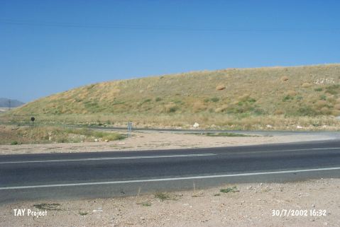 |
|
Type:
|
Mound |
|
Altitude:
|
1145 m |
|
Region:
|
Central Anatolia |
|
Province:
|
Kirsehir |
|
District:
|
Merkez |
|
Village:
|
Karahidir |
|
Investigation Method:
|
Excavation |
|
Period:
|
|
|
|
|
 |
|
| Location: It lies northeast of the road at the Karahidir junction on Kaman-Kirsehir motorway; south of Karahidir Village; about 20 km northwest of Kirsehir Province. It is located about 25 km east of Kaman Kalehöyük. |
| Geography and Environment: It was also investigated by the Kaman Kalehöyük team. It measures 12.5 m in height and 500 m in diameter. The traces of the pits are visible on the eastern foothill. The villagers remove the soil from this part. The northern part of the flat mound ends in a soft inclination. As a result of the measurements taken during the beginning of the excavations in 2009 the mound is measured as 635 m in east-west direction and 500 m in north-south direction and 13 m in height [Omura 2011:361]. |
| History: |
| Research and Excavation: It was discovered by Meriggi, and surveyed years later by the Kaman Kalehöyük excavation team. The excavations are initiated in 2009 by a team from Japanese-Anatolia Archaeology Institute led by M. Omura [Omura 2011.360]. It takes place in the registered archaeological sites list prepared by Ministry of Culture and Tourism. |
| Stratigraphy: 4 levels of construction are detected during the measurements taken in the beginning of 2009 excavations: Building levels 1, 2 and 3 belong to Late Iron Age while building level 4 belongs to MBA [Omura 2011.360]. In Level I, 7 building levels have been detected so far. It is thought that the upper 6 building levels belong to Late IA and the building level 7 is dated to Early IA [Omura 2013:314]. Three levels were determined in Area 1 located in the center of the mound. Level I: IA Level II: MBA Level III: EBA Although it is not yet certain, Level I is divided into two sub-levels as Late IA (4th-7th century BC) and Middle IA (8th-9th century BC). The radiocarbon analyses of level III, which is represented with architectural remains belonging to EBA, indicate the dates 2260-2135 BC [Omura 2017:343-344]. |
| Small Finds: Architecture: 3rd construction level is the best preserved among the three construction levels belonging to Late Iron Age. Stone walls are 130 cm thick. An oven exists in the Southwest corner of the building. It is observed that the building in the 3rd Structure Level is made after the fire soil from the earlier phase is completely flattened [Omura 2011:361]. During the 2010 studies, it was discovered that the large building belonging to the building level 3 was disturbed by the buildings with basement of the building level 2. These buildings with basement were built by partly using the walls of the large building. The rooms of R12, R13 and R14 which were exposed this year belong to the building level 2. R12 and R14 are single roomed and they have basements. After the walls of R13 were removed, a layer of burnt soil belonging to the building level 2 and a mudbrick wall under the floor were exposed. The foundation remains of the large building belonging to the building level 3 were unearthed. These stone foundations are 20-30 cm wider than the stone walls and they were embedded the channel which were dug deeper than the level intended and erected with smaller stones than those above [Omura 2012:272-274]. During the 2011 studies, Room R24 and Room 29 (under Room 24) were partially exposed below the building belonging to the building level 3. Under these buildings, there was a large pit P34 that was partially cut by R29. After removing the thick wall W57 belonging to the building level 3, Pit P41 and the building with basement R33 which is partially cut by Pit P41 were exposed. Building R33 that cut the fire fill belonging to the building level II is an unburned building. Based on its architectural plan, it was suggested that it belongs to IA [Omura 2013:314]. In 2012, stone walls belonging to the last phase of Late IA were exposed in the plan squares E8/d8 and e8. Since the walls have been severely damaged due to the modern agricultural activities, it was not possible to follow the plan of the buildings. The north section of R29 was excavated down to the floor level. As a result of the studies, a shallow bench was found in the northwest section of the room. In addition, four post holes were exposed in the south side [Omura 2014:418]. During the excavations conducted in Level I in 2013, the architectural remains belonging to the building level 3 were exposed. Only large wall foundations of the building are preserved. The foundations of the building indicate that the complex had a comprehensive plan. In the high area at the center, the building is surrounded by the stone paved corridors of the central buildings and other structures. This building complex shares similarity to the large building complex of Kaman-Kalehöyük belonging to Level IIa in terms of architectural plan. The walls and room of this building were exposed. It is observed that the depth of foundations of the building differs from place to place. Fragments of stone pavement were found in the plan squares. These fragments belong to the corridor or the street surrounding the central building. The stone paved corridor is connected to the road leading to the city gate (?) in the northeast of the mound. The buildings belonging to Level 2 were exposed on top of Level 3. These buildings have two phases. The buildings belonging to the earlier phase were constructed by partially modifying or using the large structure of Level 3. The buildings of early phase are single roomed. After a while, weak walls were added to these buildings and they were reused. The black colored, fine burnished pitcher sherds recovered from the buildings of Level II and the pits that destroyed these buildings are similar to the ones found in Gordion and Kaman-Kalehöyük. These sherds indicate the Lydian culture. During the 2013 excavations of Level I, Middle IA buildings belonging to Level 10 and 11 were exposed. The material recovered from the pit P72 in the plan square E8/e8 shows Middle IA characteristics. Below this pit, the structures (R71, R59 and R65) damaged by the pit were found. Some parts of the wall foundation and the floors of these buildings were partially preserved. These structures, which are probably dated to Middle IA, are with basement. In the plan square E8/d8, it is revealed that the rectangular mudbrick installation called Ins14 is the bench of the building R65. The inner surfaces of the walls of building R65 and R59, which is damaged by the pits, are white plastered. This building type, the building with bench and basement, is commonly seen in Level IIc of Kaman Kalehöyük [Omura 2015]. In 2014, the excavations were conducted in Building Level I.1.2 and I.2.3. In the building level I.1.2, three superimposed structures were exposed under the walls belonging to the building level 1 in the plan square E9/f1. After removing the partition walls of two structures on the top, the room no. R86 and R87 revealed. It is believed that these rooms represent the earlier phases of the building level 2. Although the stone pavement of R87 belongs to an earlier complex, it is suggested that this pavement might have been used as a foundation for the floor. In the western trenches, a part of a wall belonging to a room built with a single row of mud bricks and remains of a burnt red floor were determined on the party wall. In the building level I.2.3, remains belonging to the building level 3 were found in the plan square E9/f1 (which spread over a large area) in 2014. The upper structures belonging to large buildings couldn't be preserved. However, the large and intact wall foundations indicate that this building complex was built based on a detailed plan. The central building located at the highest elevation is encircled with stone paved corridors and other buildings. It is believed that the potsherds with two handles found on the floor of R72 with basement might help to date the large building and city [Omura 2016:304-305]. In 2015, the burnt layer and the earth layer covering it were determined in the grid E8/d8 located in the southwest corner. The building levels belonging to Level II are preserved immediately above EBA fire layer of Level III. Especially the walls in E8/d8 were built in accordance with the slope of this level. The mud brick stairs in the east section of the wall W256 are probably a part of a stairs. The large wall foundations exposed in the grid E9/d1 in the east belong to Level II the remains of which was built on the plain area on top of the fire layer which forms a mound. One corner of the building is round and two rooms were determined so far. In one of the rooms with plastered mud brick walls, a round hearth and a cooking pot were found. There is a bench in front of the wall belonging to the smaller room. A shallow passage was exposed on the wall between two rooms. The Level III remains, which is in the shape of a mound, affect not only the architecture of Level II but also Level I. Especially the deep foundations belonging to the large buildings of the building level 4 and 3 and the central building erected on the ridge in the center and the sloping area at the edge create architectural integrity in this inclined area. In Level I in the building level 3, the buildings encircling the large rectangular central building and city wall constitute a city. R24 has a basement that was deeply excavated into the burnt layer of Level III and a single room. It is believed that the outer floor was severely damaged by the large building belonging to the building level 3 of Level I. The mud brick walls were built on a stone foundation and the white plaster on the interior surface is preserved [Omura 2017:344-345]. Pottery: There is no difference between the pieces of ceramics found in building levels I, II and III. Most of the findings are Late Iron Age pieces similar to those found in Level IIa of Kaman-Kalehöyük. IV. Alisar ceramics from IIc Period of Kaman-Kalehöyük are encountered among the pieces found on the surface [Omura 2011:361]. Among Late IA potsherds recovered from the floor of the room R12, a gray vessel and a vessel with a single handle were completed. Potsherds belonging to IA were also found in the room R13 [Omura 2012:273]. In 2011, a great number of Late IA sherds including painted, black and fine burnished sherds were recovered from R24 and R29. Abundance of potsherds with deer and concentric spiral motifs in the style of Alisar IV and sherds resembling pottery belonging to building level IIc of Kaman-Kalehöyük support the idea that this pit is dated to Middle IA. The vast majority of the wares recovered from P41 resemble Kaman-Kalehöyük IIc pottery while some of them look alike Kaman-Kalehöyük IId [Omura 2013:314]. In 2012, the potsherds recovered from the building level I comprise of livid colored wares, gray and red colored sherds, bicolored or tricolored vessels, kraters and plates. These ware are dated to the Late IA. In addition, Alishar IV wares belonging to Middle IA were found as well [Omura 2014:419]. The potsherds found in the building level I.2.3 in 2014 are very thin-walled, with beige or buff colored paste, reddish yellow slipped, well burnished and well-fired. The space between the globular body and the neck with thin rim is decorated with a relief ring bands. These vessels are related to Achaemenid Persian metal wares and similar examples are known from Alisar, Bogazköy and Kayapinar in Anatolia [Omura 2016:306]. In 2015, while removing the walls of R24, a potsherd with a hieroglyph was found. It is suggested that this sherd and the lead fragments with a hieroglyph found in the mound indicate the existence of a culture dated to Mid IA-Early IA of the 8th-9th century BC. The floor of this building also yielded painted pitcher with a strainer and two vessels with handles that have holes on their body and bases. Similar vessels are known from the Destruction Layer of Gordion [Omura 2017:346]. Clay: 150 unbaked clay weights were found in two shallow pits in the basement of R24. A few of these weights are in various forms but most of them are round and perforated. These kinds of weights were also found in Kaman-kalehöyük IId. In Gordion, remains of a loom were found in the building that is thought to be a textile workshop. However, no loom remains were detected despite the existence of a great number of weights in Yassihöyük. Metal: Bronze fibulae, arrowheads and pins were recovered from third building levels of the culture level 1 [Omura 2012:274]. In 2014, a fibula was found in the building level I.1.2. The needle of the fibula recovered from Pit P183 has lost. It is seen that Pedde belonging to North Syrian group is similar to Group C2.1 [Omura 2016:304]. Fauna: A dog skeleton was found in the pit numbered P8 [Omura 2012:273]. Flora: A high density of carbonized wheat remains were recovered from the northwest section of the floor belonging to the rectangular hearth in front of the north wall W45 of R22 [Omura 2017:346]. Other: During the removal of the south wall of R29, a disc shaped seal were found in the soil behind the wall. The seal was made out of hematite. Both surfaces of the seal bear the name of the clerk in hieroglyph [Omura 2014:419]. |
| Remains: |
| Interpretation and Dating: |