|
©The Archaeological Settlements of Turkey - TAY Project
|
|
|
|
|
|
Tilbes Höyük |
|
|
For site maps and drawings please click on the picture... 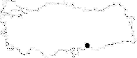 |
For photographs please click on the photo...  |
|
Type:
|
Mound |
|
Altitude:
|
360 m |
|
Region:
|
Southeastern Anatolia |
|
Province:
|
Sanliurfa |
|
District:
|
Birecik |
|
Village:
|
Keskince |
|
Investigation Method:
|
Excavation |
|
Period:
|
Post Assyrian Period |
|
|
|
 |
|
| Location: It was located 2 km north-northeast of Keskince (Tilmusa) Village on the eastern bank of the Euphrates; about 22 km northwest of the Birecik District; west of the Sanliurfa Province. Local meaning of Tilbes is the "Last Hill". |
| Geography and Environment: It was a conical mound located near the Euphrates measuring 12 m in height above the river bank and 110x100 m in dimensions. The cultural deposit was informed to be of 14.5 m thick. The slopes were like stepped terraces; and the western slope facing the Euphrates was steeper than the others. The Euphrates was flowing through a wide basin right below the mound; therefore it can be suggested that this site was a pathway for pedestrians. It was submerged by the Birecik Dam. |
| History: |
| Research and Excavation: It was discovered during the survey conducted under the direction of G. Algaze from Chicago University in 1989 [Algaze et al. 1994:32, map.5]. In 1996 the salvage excavations initiated under the direction of J.G. Fuensanta and auspices of Alicante University by a Spanish team were planned to continue until the release of water from the Birecik Dam. The excavations carried out by a multi-national team were terminated in 2000. It takes place in the registered archaeological sites list prepared by Ministry of Culture and Tourism. |
| Stratigraphy: The excavations revealed presence of settlements from the Late Chalcolithic Age, Early Uruk, EBA phases I-IV, transition from EBA IV to Middle Bronze Age, Late Iron/Achaemenid, Hellenistic, Seleucid/Roman, and Islamic Periods. The Iron Age expansion area at Tilbes Höyük is about 24.7 acres. The Achaemenid and the Achaemenid/Hellenistic transition period which was not identified at Tilmusa existed at this site and it lasted for a long period of time [Fuensanta-Charvat:156]. Although Tilbes Höyük was an important settlement throughout the Early Bronze Age, particularly in regard to the neighbouring settlements such as Tilmusa, Tilöbür, Tilvez, and Surtepe during EBA IV, it is uncertain whether it had a central role in the region [Fuensanta et al. 2000:158-161; Fuensanta et al. 2002a:133-137]. There are two phases of Iron Age at Tilbes Höyük; phase IIIB 1 and phase IIIB2. The phase IIIB 1 is called the Early Achaemenid Period. The Neo-Assyrian multi-room building was re-used during this period and some characteristic data were obtained related with burial customs. This level was disturbed by the silos opened in later periods [Fuensanta-Charvat:156]. The phase IIIB 2 appears to represent the Achaemenid/Hellenistic Period transition period and it was dated to the Late 4th century BC [Fuensanta-Charvat:158]. |
| Small Finds: Architecture: The Achaemenid levels on the mound are not very clear. The data on this building level mainly depend on graves, silos, hearths or altars. The trenches E 4a, E 3, E 8, AE 1-5 and mainly A 2-6 yielded finds from the Achaemenid Period [Fuensanta et al. 2000:158,160]. The Early Achaemenid level which was uncovered at a depth of 1.5 m in trench A 2-A 6E is represented by garbage pits and grave of a presumably poor person. The Early Achaemenid and Middle Bronze Age I finds were found in sounding B1 mixed resulting from the modern settlement [Fuensanta et al. 2002:136]. Grave: The Achaemenid graves found in Iron Age phase IIIB 1 bears characteristic features of the period. Terracotta horseman and female figurines were found inside the grave [Fuensanta-Charvat 2006:156]. Figurine: Similar of these female and horseman figurines recovered from the Achaemenid graves in Iron Age phase IIIB 1 are also observed at Hacinebi, Kargamis/Deve Höyük and Teleilat [Fuensanta-Charvat 2006:156]. |
| Remains: |
| Interpretation and Dating: |