|
©The Archaeological Settlements of Turkey - TAY Project
|
|
|
|
|
|
Tirmil Tepe |
|
|
For site maps and drawings please click on the picture... 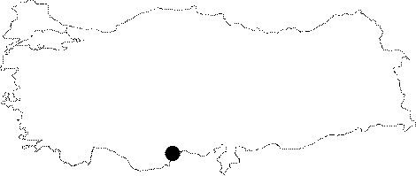 |
For photographs please click on the photo... 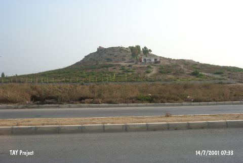 |
|
Type:
|
Mound |
|
Altitude:
|
140 m |
|
Region:
|
Mediterranean |
|
Province:
|
Mersin |
|
District:
|
Merkez |
|
Village:
|
Çilek |
|
Investigation Method:
|
Survey |
|
Period:
|
|
|
|
|
 |
|
| It is situated in the Çilek Quarter to the north of the Mersin-Tarsus railroad, northeast of Mersin. There is a plain ground with a diameter of 30 m on the 12 m high hilltop. The slope is occupied by a modern settlement. It is also known as Turmil or Termil. The Medieval Age Fortress above it was probably called Kale-i Habelleç. Sherds dating from the Chalcolithic Age until the Islamic Period were collected from the surface during the Cilician Survey in 1951 [Seton-Williams 1954:162]. |
| Location: The site lies in Çilek Quarter; northeast of the city of Mersin; and north of the Mersin-Tarsus highway and railroad tracks. The mound can be found on a 1:200;000 map. |
| Geography and Environment: The mound that is also known as Turmil or Termil is 12 m high and has a 30 m diameter. The top part of the mound is flat. Modern buildings have been built on the slopes of the mound. There are stone ruins of a late period structure on the top of the mound. Since the site lies on a trade route; the ruins are believed to have been a stop for travelers. This site is believed to be where the Kale-i Hebelleç castle; which lies between the Mersin and Tarsus; is located. |
| History: |
| Research and Excavation: |
| Stratigraphy: |
| Small Finds: |
| Remains: |
| Interpretation and Dating: |