|
©The Archaeological Settlements of Turkey - TAY Project
|
|
|
|
|
|
Tepecik / Makaraz Tepe |
|
|
For site maps and drawings please click on the picture... 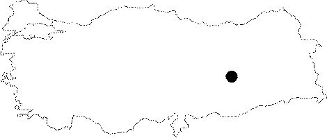 |
For photographs please click on the photo...  |
|
Type:
|
Mound |
|
Altitude:
|
890 m |
|
Region:
|
Eastern Anatolia |
|
Province:
|
Elazig |
|
District:
|
Merkez |
|
Village:
|
Tepecik |
|
Investigation Method:
|
Excavation |
|
Period:
|
|
|
|
|
 |
|
| Location: This site lies approximately 31 km east of the city of Elazig; immediately southwest of the village of Altinova; now flooded by the Keban Dam Lake. The survey code of the site is O 54 / 2. |
| Geography and Environment: Tepecik Höyük; which lies southeast of Altinova is also known as Makaraz Tepe. In many publications; the site is referred to as Tepecik. It is a middle-sized terraced mound; 16-17 m high; with a 200 m diameter. Heringet Stream is believed to have meandered by the mound. Before the land was flooded by the dam lake; this stream fed the Altinova Plain (also known as Ulu Ova). The spring southeast of the site must have supplied the inhabitants of the site with water. |
| History: |
| Research and Excavation: It was discovered in 1967 within the scope of the Keban Project, aimed to identify the historical sites to have been flooded by the reservoir waters of the Keban Dam, conducted under the direction of R. Whallon and S. Kantman [Whallon-Kantman 1970:no.054/2]. It was excavated under Ufuk Esin under the auspieces of the Prehistory Department of Istanbul University between 1968 and 1974. |
| Stratigraphy: The excavations revealed that the site had been continuously inhabited from the Late Neolithic Age (?) until the Middle Age. The mound was used as a cemetery area during the Middle Age. The First Bronze Age levels I-III were exposed in the southern core of the mound (the southern, western and eastern slopes of the mound at the time of excavations) which are called "Old Mound/Eski Höyük". This mound seats on the main mound of the Chalcolithic Age. The northern and western slopes of the mound were called "New Mound/Yeni Höyük" because of the Middle and Late Bronze Age levels [Esin 1976:103]. Tepecik Höyügü represents a sample for multi-core settlements with its changing settlements over time. As it is a multi-core mound, it is suprising to expose First Bronze Age remains on one side and 2nd Milennium BC remains on the other side at the same level of the hilltop trenches. The Late Chalcolithic-EBA I were uncovered at deep sounding of 15 K. Recovery of Early Bronze Age finds from the surrounding fields, which were excavated to identify both the cemetery and size of the mound provides evidence for a wide expansion of the settlement during that age. The upper layer of Middle Age disturbed the underlying Iron Age and Late Bronze Age layers. The Iron Age layer is separated from the Late Bronze Age level II by a a fire level. The Early Iron Age levels were founded on the Late Bronze Age building level. It appears that the Iron Age building level suffered a grave fire. The buildings related finds of the Iron Age were not preserved mainly due to the destruction caused by the Middle Age cemetery. |
| Small Finds: Architecture: As occupied starting from the Late Neolithic Period, it was used as a large cemetery area from the 11th century AD. The excavations on the plain ground to the immediate west of the mound yielded stoen foundations of two monumental structures from the Uruk Culture of the Late Chalcolithic Age known from Mesopotomia. The earlier of these structures has a tetragonal plan. The mound contains superimposed vilalge settlements. The upper Middle Age layer has disturbed the underlying Iron Age and Late Bronze Age building levels. The Iron Age building level is separated from the Late Bronze Age building level II by a fire level. The Early Iron Age level was founded on the 2b 1-3 levels of the Late Bronze Age, and called 2a 1-2. In some sections, the Iron Age levels sit on the Early Bronze Age levels. It appears that the Iron Age level underwent a grave fire, which resulted in heavy destruction on the Iron Age buildings and related architectural finds. Trench YB yielded architectural remains from the Iron Age, which were destroyed by a great fire on the section enlarged towards the western slope. partially exposed, the Iron Age buildings compose a section of 4x32 m. The rooms buit with mudbrick walls on stone foundations have a rectangular plan. Pottery: The Late Neolithic levels include two basic types of ceramics: the dark surface burnished, straw tempered and light colored ware, which are known from the Neolithic Age in the Amuq Plain; and restricted number of Halafian ware, matt purplish, brown Ubaid type of paint decorated sherds with geometric designs and again wheelmade light colored and decorated ware. They bear geometrical and stylized animal and human depictions, red on inside, and black or brown on outside. Although restricted in number, fragments of animal shaped rhytons were found. Very restricted number of Iron Age sherds were uncovered, and they are parallel to the typical Iron Age vessels of the Elazig-Malatya region. They are represented by examples of wheelmade, red slipped vessels and grooved rims. In addition to rims decorated with grooves in parallel, among the common decorations are incision decorations with lines leaning to right and left. Metal: The excavations yielded terracotta melting pot fragments and ore fragments, indicating that the copper was melted since the First Chalcolithic Age and metals such as copper and lead were used through the end of this late phase. Also found are copper slags. Although they were recovered from a copper a hearth, they were porabably melted. Copper and bronze tools and weapons were uncovered. Furthermore, presence of ornaments, although very rare, and combined use of metals indicate advanced metal technology. Seal/Seal Impression: The excavations yielded Hittite type of cylindrical seals, partly with hieroglyphic lines in the form of hammer, knob, cylindrical human figures and animal depictions. |
| Remains: |
| Interpretation and Dating: The Iron Age levels which started during the late 2nd Millennium BC were founded on the northern section of the plain hilltop and to the north of the mound. The excavations here shed light onto a cultural period of seven thousand years, bearing traces of local cultures as well as Halafian, Ubaid and Uruk cultures during the Chalcolithic Age. And the Karaz culture is dominant during the Early Bronze Age. |