|
©The Archaeological Settlements of Turkey - TAY Project
|
|
|
|
|
|
Mezraa Teleilat |
|
|
For site maps and drawings please click on the picture... 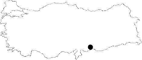 |
For photographs please click on the photo... 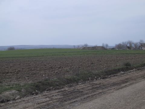 |
|
Type:
|
Mound |
|
Altitude:
|
500 m |
|
Region:
|
Southeastern Anatolia |
|
Province:
|
Sanliurfa |
|
District:
|
Birecik |
|
Village:
|
Mezraa |
|
Investigation Method:
|
Excavation |
|
Period:
|
New Assyrian Empire Period Post Assyrian Period |
|
|
|
 |
|
| Location: The site lies northwest of the city of Sanliurfa; 5 km south of the town of Birecik; immediately to the west and partially beneath the modern village of Mezraa. |
| Geography and Environment: The site lies very close to the large meander of the Euphrates; on the first flood terrace east of the Euphrates River. There is an old canal west of the site. The site is an oval mound; 450 m in north south direction and 160 m in east west direction. It is approximately 4 m high. It has been reported that the total area of the site is 7 hectares. A 160x160 m area in the northern part of the mound was destroyed by a bulldozer when an orchard was planted. The orchard construction created a long 1.5 m high cross-sectional profile of the mound. Parts of the mound are cultivated. |
| History: |
| Research and Excavation: It was discovered during the surveys conducted under the direction of G. Algaze with the participation of R. Breuninger and J. Knudstad within the project carried out for identification and documentation of the historical sites and monuments that would be inundated by the reservoir waters of the Birecik and Kargamas Dams planned to have been constructed on the Euphrates River in 1989 following the Keban, Karakaya and Atatürk Dams. An excavation was initiated under the direction of M. Özdogan in 1999 following the surface collection carried out by the Prehistory Department of the Istanbul University in 1998 with the coordination of METU-TAÇDAM. It takes place in the registered archaeological sites list prepared by Ministry of Culture and Tourism. |
| Stratigraphy: The surface finds recovered during the survey in 1998 revealed that the mound mainly dated back to the Neolithic Period, with only a few Iron Age material. The 1999 excavations yielded a large building complex dating to the Iron Age with at least three rebuilding phases [Karul et al. 2001a:133]. An overall review of the Cultural Layer I at Mezraa Teleilat indicates presence of a single and large building complex. No additional structure or buildings are traced around the complex [Özdogan 2000:21-31]. Mezraa Teleilat consists of two cultural layers with various phases: Cultural Layer I (LBA-Iron Age: ca. 1400-300 BC) Cultural Layer II (Neolithic Age: 6th Millennium and earlier) [Karul et al. 2001b:165-166]. During the 2001 campaign, the cultural progress at Mezraa Teleilat was identified as follows: Phase 1A-Achaemenian/Persian Period Phase 1B- Neo-Assyrian Period Phase 1C- Early Iron Age Phase 2A-Late Neolithic Age Phase 2B- Middle Neolithic Age Phase 2C- First Neolithic Age Phase 3 Ceramic-Aceramic Neolithic Transition Period. |
| Small Finds: Architecture: An overall review of the Cultural Layer I at Mezraa Teleilat indicates presence of a single and large complex. The complex consists of magazine structures in various sizes arranged in two rows around a large central courtyard based on the parts exposed so far [Karul et al. 2004:59]. No additional structure or building is traced around the complex with an exception of some deep pits used for storage or garbage and a few graves near the slope. Thus, it is believed that the building might have been an administrative or religious complex rather than being a domestic settlement [Özdoğan 2000e:29-31]. The Cultural Layer I at Mezraa Teleilat includes a time span of approximately a thousand year from the late 2nd Millennium BC until the 3rd or 4th century BC. The Phase I is represented by three building levels. It appears that there is a gap of at least five thousand years in transition to the Cultural Layer II with no occupation during that period. Furthermore, there is no sediment expected to have been formed during that long period of non-occupation underlying the Late Bronze Age. It suggests that the uppermost parts of the mound might have been leveled during the re-occupation, resulting in a dramatic change in the Neolithic topography of the hill. In this case, the uppermost levels of the Phase II should have been damaged to a great extent. However, presence of a Halafian sherd among the mixed deposits indicate that intact remains may be exposed from that period when the structures of the Cultural Layer I are removed. A well-preserved structure of phase IB was partly uncovered while the phase IA, which is very near the surface, is not clearly defined. This phase is defined mainly by pits, going deeper. The building level IA yielded in situ finds from the Persian-Achaemenian Period, which indicates that the mound was lastly occupied by the Persians, and then abandoned. The large building uncovered at the building level IB is dated to the Neo Assyrian Period. With its present dimension of 43x30 m, it resembles the Neo-Assyrian palatial buildings in Northern Syria. The building of the Persian-Achaemenian Period indicate that it was an important center of its time with abundant number of horse and cavalier figurines and bullae uncovered [Karul et al. 2002a:63-74]. The 2001 campaign revealed that the building level IA is dated to the Achaemenian-Persian Period and it is located at the same place with the Neo-Assyrian palace. Walls of the large building uncovered at trenchs 23 K and 23 L are similar to the Achaemenian buildings in technique. Although the finds uncovered in the Neo-Assyrian building level IB have not been analysed in detail yet, it is believed that it was an administrative center located on the banks of the Euphrates River, engaged in control and export of the local agricultural producs [Karul et al. 2003:166]. Other than the heavily damaged Achaemenian buildings at IA beneath the surface ground, there is a single large building complex and several pits and graves, mainly on the western slope. Discovery of some wall fragments from the Iron Age in the soundings 20R and 14 L in 2002 indicate presence of some other buildings other than the palatial complex on the hill. As the building complex at Mezraa Teleilat consists of various wings with diverse functions like the central buildings of the Neo-Assyrian Period, it is very likely that it had another wing including main living units [Özdogan et al. 2004:239; Karul et al. 2004:59]. Above the Neo Assyrian building level is the Achameanian building level (IV) which has been heavily destroyed due to agricultural activities as it is very close to surface. Although it has distinguished architectural features compared to the Neo-Assyrian buildings, the walls in fragments indicate that the remains belonging to this period are also monumental. Pottery: The 2001 campaign yielded abundant number of in situ storage jars in the building levels IA and IB dating to the Neo-Assyrian Period [Karul et al. 2002b:63-74]. Clay: Plenty of spindle whorls were found in box composed of sun dried mud bricks uncovered within the Neo-Assyrian building complex. Figurine: The terracotta figurines are the most significant finds representing the Persian-Achaemenian Period. Majority of them are horses and cavaliers depicted with their horses in various sizes. The form of the horse figurines are identical; the horses depicted with the front legs stretched out together forward, and very short rear legs have a short tail, the neck with a large curve from the body and the head being depicted more elaborately. In more elaborate horse figurines, the eyes were depicted in relief, and painted sometimes with a single color, and sometimes with two-colors. In the cavaliers seating right behind the neck, the lower part of the body is integrated with the lower body of the horse, and very schematically depicted arms are extended toward the lower part of the horse's neck. Usually with an elaborately carved head and face, all of these cavalier figures have beard and headgear, but each with a different beard and headgear. Also, efforts were made to give a characteristic expression on their faces. There is a rare number of horse figurines with a single or dual goddesses projecting from the belly. Although it is uncertain which one of the many mother goddesses of Mezraa Teleilat are Persian, and which ones are from the Assyrian Period, it seems that the mother goddess of the North Syrian tradition persisted during the Persian Period, and probably was attempted to have been combined with the Persian rider motif. Epigraphic Material: The building known as the Neo-Assyrian Palace defined as phase IB yielded preserved, but somewhat shattered cuneiform tablets in a wall corner during the cleaning of the floor in 2002. As a result of deciphering by V. Donbaz, it was found out that the tablets were dated to the Neo-Babylonian Period, not to the Neo-Assyrian Period. According to this, the level defined as Neo-Assyrian should be re-evaluted over time [Özdogan et al. 2004:239]. |
| Remains: |
| Interpretation and Dating: The Middle Euphrates Basin which includes Mezraa Teleilat was a significant part of the Neo-Assyrian Empire until the late 7th century BC. The Assyrian dominance in Mesopotamia came to end in 612 BC when the capital Nineveh fell to a coalition of Medes-Babylonians. Following a short period of chaos, the Medes gained control over a great portion of Anatolia while the Mesopotamia and the Middle Euphrates Basin were dominated by the Neo Babylonian Empire. Nebuchadnezzar, son of Nabopolassar, defeated the Assyrians trying to hold at Carchemish and its vicinity with the support of the Egyptians in 605 BC, and thus captured their remaining land, and annexed the entire Middle Euphrates Basin into his kingdom. It is known that following this, the region remained under the political dominance of the Neo Babylonian Empire for a long period of time. In the mid-6th century BC, Cyrus conquered the Median Empire, and founded the Persian Empire under Achaemenid Dynasty. With increased power, after defeating the Lydian King Croseus in 547 BC, the Persians set their eyes on the land of the Neo Babylonian Kingdom to dominate the entire Asia Minor. After a series of wars which resulted in the Neo Babylonian King Nabonid taken as prisoner, Persians became the dominant force in the region from 539 BC. It is known that the Persians maintained control over a vast region extending to Egypt and Greece in Asia Minor, achieved through satrapies during the reigns of Cyrus, Darius and Xerxes. Following death of Xerxes in 465 BC, the Persians had to fight with the Hellenes on one side while dealing with internal disputes on the other side. The Persian-Hellenic fight continued to turn against the Persians, and immediately after the peace treaty with Hellenes in 449 BC, Megabyzos, the Satrap of Syria provoked a great revolt againts the weakening Persian Dynasty. This regression period that proceeded with internal uprisings was followed by the Hellenistic dominance in Mesopotamia after Alexander the Great defeated the Persian army in 331 BC at Issos (near Iskenderun). It is known that the Middle Euphrates Basin including Mezraa Teleilat was under the dominance of Neo Babylonians, Achaemenian/Persians and Hellenistic/Seleucus Kingdom respectively following the Assyrian dominance. The impact of these new formations emerged during that course can be traced in the Iron Age levels at Mezraa Teleilat [Senyurt 2006:182-183]. |