|
©The Archaeological Settlements of Turkey - TAY Project
|
|
|
|
|
|
Saraga |
|
|
For site maps and drawings please click on the picture...  |
For photographs please click on the photo... 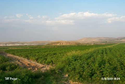 |
|
Type:
|
Mound |
|
Altitude:
|
520 m |
|
Region:
|
Southeastern Anatolia |
|
Province:
|
Gaziantep |
|
District:
|
Karkamis |
|
Village:
|
Kelekli |
|
Investigation Method:
|
Excavation |
|
Period:
|
Early Iron Age |
|
|
|
 |
|
| Location: Saraga is located on the west bank of the Euphrates; about 800 m northeast of the village of Keleklioglu; in the Karkamis district of the province of Gaziantep. The village is reached by an asphalt road that runs parallel to the river after leaving the Gaziantep-Urfa highway at Birecik. The mound is 10 km north of the ancient site of Carchemish. The sites of Gre Virike; Akarçay Tepe and Akarçay Höyük are all opposite of Saraga; on the east bank of the river. |
| Geography and Environment: A small stream with its source in the foothills of the Nizip Plateau runs into the Euphrates just south of the mound. The mound extends 200 m north-south and 150 m east-west; and is approximately 22 m high. Apart from the natural section created by the Euphrates on the northeast; all skirts of the mound have been cut back in order to create agricultural land and for road construction. |
| History: |
| Research and Excavation: It was discovered by a team under the direction of G. Algaze in 1989. A survey was conducted by the Gaziantep Museum within the scope of the "Salvage Project of the Archaeological Heritage of the Ilisu and Carchemish Dam Reservoirs Activities" by METU TAÇDAM in 1998. In 1999 and 2000, salvage excavations were carried out within the scope of the same project under the direction of K. Sertok (Gaziantep Museum) and F. Kulakoglu (Ankara University DTCF). It takes place in the registered archaeological sites list prepared by Ministry of Culture and Tourism. |
| Stratigraphy: Stratifications belonging to the Late Uruk Period, Early Bronze Age, Middle Bronze Age, Late Bronze Age, Iron Age and Middle Age were identified. The Early Bronze Age has three phases, and the Middle Bronze Age has at least two phases. No remarkable change is observed to define the transition between the Middle and Late Bronze Ages. The Iron Age finds were found immediately below the ground surface. The cultural deposit of Middle Age are mainly in the southern trenches of the mound. The stratification identified on the mound is as follows: Level I: Early Iron Level II: Late Bronze/Early Iron Level III: Late Bronze-A Level IV: Late Bronze-B |
| Small Finds: Architecture: The first cultural layer exposed when the surface soil was removed was of the Iron Age. The architectural levels of this age were traced on the trenches I and partially H, O, and P which are on the upper section of the slopes. One of the most important finds of this age is a kiln for ceramics uncovered in trenches H and I. The kiln consists of three deep horse-shoe shaped coves on each side, placed mutually on an axis. The coves open into a wide and deep channel at the center. Such kilns are also observed in the Late Bronze Age levels of settlements such as Nuzi and Tel Jigan [Sertok-Kulakoglu 2001:459]. The excavations in trenches K/18 and L/18-20 were started in 2001, reaching down the Early Iron Age levels until the end of the campaign. Four building levels were observed in the Early Iron Age layer, which consists of simple domestic buildings. The area A at the uppermost level was uncovered in 2001. A room situated almost within the plan square L/18 and used as a kitchen and a cellar composes the core of the structure that belongs to this phase. The best preserved northern wall of the room is east-west oriented, and preserved only up to two courses of mudbricks. The walls, bench and the floor are plastered and painted in white. In situ sherds were recovered from the room [Sertok et al. 2004a:139]. It appears that the Early Iron Age layer was disturbed by the Late Iron Age/Achaemenid Dynasty period settlement and that the pithoi presumably belonging to the Early Iron Age were removed and reused during the Late Iron Age [Sertok et al. 2004a:139]. The phase C and traces of plaster and walls hardened due to a fire were uncovered when the foundation stones of the Early Iron Age phase were removed. When the building completely uncovered, it was observed that it was similar to the building at phase A. The best preserved room of the building is situated in plan squares L/18 and L/19. The wall is plastered and painted inside and outside. Absence of any in situ finds suggests that the room was emptied before the fire. D is the first building of the Early Iron Age and presence of this phase was identified through a two-level floor and the stone foundation of the first room in trench L/18. The difference between the two floor levels is 15 cm. A tandoor in the northeastern corner from the early phase and a stone column pillar at the center of the room belong to this phase. The traces of fire also observed on the floor suggests that this phase was also terminated with a fire. B is the fourth phase between A and C. This phase was identified after the removal of phase C walls with the exposure of foundation stones. These four building levels were dated to the Early Iron Age based on the in situ vessels uncovered. In 2002, a new urban level was unearthed when the cultural layer of the Early Iron Age was removed. A north-south oriented road between the trenches K-L/18-19 composes the main axis of the second cultural layer. The ceramics recovered from this level consist of a mixed material of the Early Iron and Late Bronze Ages. Therefore, considering their stratigraphical locations, this cultural layer may be dated between the Early Iron Age and the Late Bronze Age [Sertok et al. 2004a:140-141]. Pottery: The foundations and overlaying fragments of amphoras with narrow rims, pointed bases, narrow and long cylindrical bodies recoved from a 1 m thick deposit in 2001 indicate that these levels between at +343.50 and 342.00 m belong to the Late Iron Age [Sertok et al. 2004b:298-299]. While the fragments of pithoi uncovered in situ in 2002 provided evidence for the presence of an Early Iron Age settlement, it was found out that these pithoi were removed and reused during the Late Iron Age. The main features of these vessels include exteriorly thickened rim using a thick convex shaped band, narrow, massive and cylindrical bases and noticeable horizontal and rough marks of ropes on a larger portion of their exterior surfaces. These marks are from the ropes used during the drying procedure to keep the vessels from falling apart before the baking process rather than decorative purposes. A trefoil mouthed jug yielded in cultural level 2 has similar characteristics with the one uncovered in the Early Iron Age cellar [Sertok et al. 2004a:141]. Figurine: Plenty of horse figurines were found. A woman figurine with a missing head was also found. Seated on a rectangular plate made out of mould and holding one hand on her chest, she wears dress with a long pleated skirt, leaving her breasts uncovered [Sertok-Kulakoglu 2001:460]. The northeastern trenches of the 2000 campaign yielded terra cotta figurines as products of the Achaemenid art at 1 m depth [Sertok-Kulakoglu 2002:107]. A terracotta woman figurine and a terracotta horse figurine, both dating to the Late Iron Age were also unearthed (ca. 4-5th century BC) [Graves-Helwing 2001:463-509]. Grave: A simple earth burial was found in a grave uncovered under a pebble-paved floor to the west of the kiln in the trench I. The burial gifts include a bronze mirror, a perfume container consisting of two bronze tubes with lids tied to each other by a chain (?), and an agate necklace. Two simple burials were uncovered on a building foundation to the west of the trench L/20; one northeast-southwest oriented while the other north-south oriented. The burial pit partly destroyed the foundation. The burials were placed in hocker position and hands placed on the abdomen. No burial gifts were found other than a jug with a spherical body, plain rounded rim and squat belly in the grave B4. Based on the foundation and the graves on it, there was an intense housing in plan squares K/18, L/18-20 [Sertok et al. 2004b:298-299]. |
| Remains: |
| Interpretation and Dating: |