|
©The Archaeological Settlements of Turkey - TAY Project
|
|
|
|
|
|
Pulur |
|
|
For site maps and drawings please click on the picture... 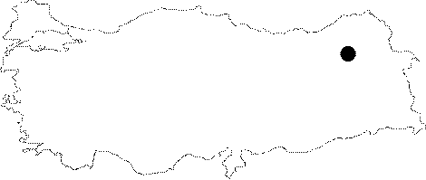 |
For photographs please click on the photo... 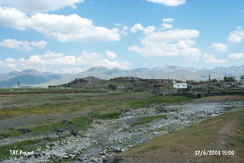 |
|
Type:
|
Mound |
|
Altitude:
|
1800 m |
|
Region:
|
Eastern Anatolia |
|
Province:
|
Erzurum |
|
District:
|
Ilica |
|
Village:
|
Ömertepe |
|
Investigation Method:
|
Excavation |
|
Period:
|
Middle Iron Age |
|
|
|
 |
|
| It is situated in the Ömertepe (Pulur) Village of the Ilica District in Erzurum. An excavation was conducted by H.Z. Kosay and H. Vary in 1960. The prehistoric remains dating back to the 4th Millennium BC are represented by four building levels on the hilltop. The archaeological material recovered from Pulur Höyük are successors of the Karaz culture. There is no detailed information about the 2nd and 1st Millennia BC sherds. No particular Urartian Period building level dating to the 1st Millenmium BC is observed. However, it seems that there is an insignificant settlement from the Early Iron Age. Measures should be taken immediately to prevent further destruction of Pulur Höyük. It takes place in the registered archaeological sites list prepared by Ministry of Culture and Tourism. |
| Location: It is located in the village of Pulur (Ömertepe); 7-8 km south-southeast of the Ilica District; 15 km west-southwest of Erzurum Province. |
| Geography and Environment: Adjacent to the mound; the Pulur Stream flows about 17 m high above the Erzurum Plain. It is surrounded by a fertile land. Although no information was provided about the dimensions of the mound; the drawing [Kosay-Vary 1964:pl.II-III] and the photographs indicate that it is not a big mound. The publications reveal that it has been severely damaged by the villagers as a result of removal of stone and earth. |
| History: |
| Research and Excavation: |
| Stratigraphy: |
| Small Finds: |
| Remains: |
| Interpretation and Dating: |