|
©The Archaeological Settlements of Turkey - TAY Project
|
|
|
|
|
|
Minareli / Tilwa Höyük |
|
|
For site maps and drawings please click on the picture...  |
For photographs please click on the photo... 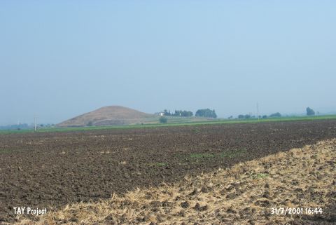 |
|
Type:
|
Mound |
|
Altitude:
|
90 m |
|
Region:
|
Mediterranean |
|
Province:
|
Osmaniye |
|
District:
|
Toprakkale |
|
Village:
|
Aslanpinari |
|
Investigation Method:
|
Survey |
|
Period:
|
|
|
|
|
 |
|
| It is situated on a basaltic elevation to the immediate west of the motorway to the Toprakkale Subdistrict from Huriusagi Village, 7 km north of Toprakkale, east of Adana. As a result of the Cilician Survey conducted in 1951 by a team under the direction of M.V. Seton-Williams, it was reported that the site had been inhabited from the Chalcolithic Age until the Islamic Period. It is also known as Tilva Höyük [Seton-Williams 1954:131-164]. Sherds in Coba ware of Chalcolithic Age are recovered. It is assumed that this location is the settlement named Magarali Höyük found 7 km from Sayhöyük Village of Toprakkale District in 2008, by F. Tülek [Tülek 2010:74-75]. |
| Location: |
| Geography and Environment: |
| History: |
| Research and Excavation: |
| Stratigraphy: |
| Small Finds: |
| Remains: |
| Interpretation and Dating: |