|
©The Archaeological Settlements of Turkey - TAY Project
|
|
|
|
|
|
Kanligeçit |
|
|
For site maps and drawings please click on the picture...  |
For photographs please click on the photo... 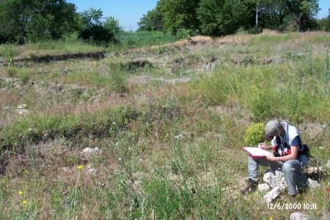 |
|
Type:
|
Mound |
|
Altitude:
|
138 m |
|
Region:
|
Marmara |
|
Province:
|
Kirklareli |
|
District:
|
Merkez |
|
Village:
|
Merkez |
|
Investigation Method:
|
Excavation |
|
Period:
|
Classical Early Iron Age |
|
|
|
 |
|
| The mound; divided by the thin stream running west of Asagi Pinar Höyügü and east of the city; lies 250 m south of Kirklareli; 100 m southwest of the road that leads to Asilbeyli village. The Kanligeçit settlement has been destroyed as it was divided by the Kirklareli railway. The settlement areas truncated by the railway and the stream during the time when discovered in 1981 were excavated as three different sites and listed as Kanligeçit North (B5/17), Kanligeçit South (B5/18) and Kanligeçit East (B5/16). The acropolis section named Kanligeçit North is a flat mound. The site was discovered by M. Özdogan in 1981, and considered as one of the mounds extending from the Neolithic Ages throughout the Iron Age [Özdogan1982a:66]. The excavations were started by a team under the direction of M. Özdogan and H. Parzinger in 1994. Following the leave of H. Parzinger from the team, the excavations went on under the direction of M. Özdogan. Part of the Kanligeçit North deposit was leveled by a bulldozer in previous years, and a large amount of stones were removed by the plough and used in the constructions. Therefore, the latest periods of the settlement have not been well preserved, but based on the Classical and Hellenistic Period material, it seems that either a small settlement or a farm existed here in the 5th century BC [Özdogan et al. 1997a:61]. It takes place in the registered archaeological sites list prepared by Ministry of Culture and Tourism. |
| Location: It lies on both banks of the Haydar stream; 250 m east of the road running to the Asilbeyli Village from Kirklareli; about 500 m south of the Kirklareli Province. |
| Geography and Environment: The Kanligecit settlement has been partly destroyed by the Kirklareli railroad. It divides the settlement into two. When discovered in 1981; the settlement was evaluated separately in three parts; Kanligecit north (B5/17); Kanligecit south (B5/18) and Kanligecit east (B5/16). Kanligecit North is an acropolis of the EBA settlement. After the excavation; the walls in the trenches were supported with wooden beams; the trenches were covered with nylon for protection. |
| History: |
| Research and Excavation: |
| Stratigraphy: |
| Small Finds: |
| Remains: |
| Interpretation and Dating: |