|
©The Archaeological Settlements of Turkey - TAY Project
|
|
|
|
|
|
Hasköy |
|
|
For site maps and drawings please click on the picture... 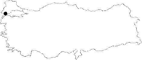 |
For photographs please click on the photo... 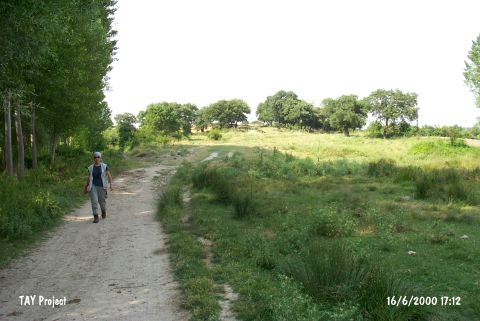 |
|
Type:
|
Mound |
|
Altitude:
|
70 m |
|
Region:
|
Marmara |
|
Province:
|
Edirne |
|
District:
|
Enez |
|
Village:
|
Hasköy |
|
Investigation Method:
|
Survey |
|
Period:
|
|
|
|
|
 |
|
| Two mounds were identified in 1991 during a survey conducted by A. Erzen and S. Basaran while excavating Enez [Erzen-Basaran 1993:211]. One of them is located outside Hasköy among the natural elevations on the left side of the Enez-Kesan motorway, approximately 100 m inside the road to the east of the health care center of the village. It is hardly noticable as it is lower than the natural elevations rising to its south and east as well as the motorway running over these elevations. It looks like an extension of a ridge as it joins with the ridge on the north at the same level. Being approximately 9 m higher than the field to the west, it almost looks like an island with the streams running from east and west to north and south, joining on the southwestern corner of the mound. The mound is approximately 65 m long, and 30 m wide in north-south direction, with an oval shape. On the southern slope, there is an active spring, a plane tree and a barn. Abundant number of Hellenistic, Roman and Byzantine sherds were found particularly on the western ridges as well as sherds dating to the Early Bronze Age I and II. |
| Location: It lies east of the Hasköy Health House on the northern side of the Enez-Kesan motorway; southeast of the Enez District; south-southwest of the Edirne Province. It is easily accessible since it is only 100 m far from the motorway; but it can not be easily noticed from a far distance. |
| Geography and Environment: It is an oval flat hill. It measures 65x30 m in dimensions located between the higher hills on the south and east. Since it is combined with the northern ridge on the same level; the rocky block looks like an extension of the ridge. However; it is 9 m high from the field on the west. S. Basaran reports that the mound looks like an island in the middle of the streams flowing on the east and the west. As the hill is protected against the cold winter winds; the site was occupied not only during the prehistoric ages; but also in later periods. The spring on the southern slope still supplies water to the modern village. |
| History: |
| Research and Excavation: |
| Stratigraphy: |
| Small Finds: |
| Remains: |
| Interpretation and Dating: |