|
©The Archaeological Settlements of Turkey - TAY Project
|
|
|
|
|
|
Asagi Sögütönü |
|
|
For site maps and drawings please click on the picture...  |
For photographs please click on the photo... 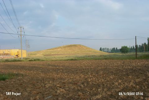 |
|
Type:
|
Mound |
|
Altitude:
|
830 m |
|
Region:
|
Central Anatolia |
|
Province:
|
Eskisehir |
|
District:
|
Merkez |
|
Village:
|
Asagi Sögütönü |
|
Investigation Method:
|
Survey |
|
Period:
|
Early Iron Age Middle Iron Age Late Iron Age |
|
|
|
 |
|
| It lies north of the Eskisehir-Bozüyük highway; 5 km northwest of Eskisehir Province. It measures 160 m in diameter and 13 m in height. It includes material groups from EBA II-III, 2nd Millennium BC and 1st Millennium BC. It takes place in the registered archaeological sites list prepared by Ministry of Culture and Tourism. |
| Location: |
| Geography and Environment: |
| History: |
| Research and Excavation: |
| Stratigraphy: |
| Small Finds: |
| Remains: |
| Interpretation and Dating: |