|
©The Archaeological Settlements of Turkey - TAY Project
|
|
|
|
|
|
Akçay 1 |
|
|
For site maps and drawings please click on the picture...  |
For photographs please click on the photo... 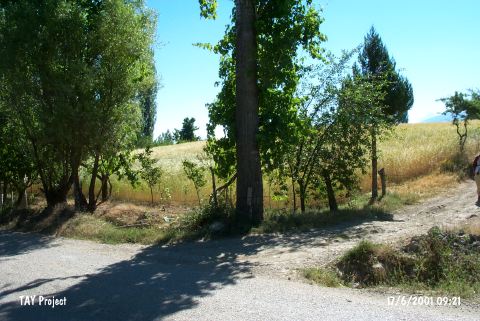 |
|
Type:
|
Mound |
|
Altitude:
|
1100 m |
|
Region:
|
Mediterranean |
|
Province:
|
Antalya |
|
District:
|
Elmali |
|
Village:
|
Akçay |
|
Investigation Method:
|
Survey |
|
Period:
|
|
|
|
|
 |
|
| The mound lies southwest of Antalya; 1 km southeast of Akçay; just east of the road. It is located in Elmali Plain. The mound has a diameter of 125 m and a stream runs by the north and east of the mound. J. Mellaart considers Akçay I as a Chalcolithic Age settlement in the preliminary reports. Most of the pottery assemblage of the mound date back to the Neolithic; Late Chalcolithic; EBA and Byzantine Period. The mound was surveyed again by M. Mellink in 1997. It takes place in the registered archaeological sites list prepared by Ministry of Culture and Tourism. |
| Location: This site lies 25 km northwest of the city of Antalya; 23-25 km southwest of the town of Elmali and 1 km southeast of the village of Akçay. |
| Geography and Environment: The diameter of the Akçay I mound; which lies on the Elmali Plain; is 125 m. It is reported that the mound is flat but its height has not been given. The surface has been leveled by continuous plowing. A stream flows east and north of the mound. The name Akçay I was given by the researchers. |
| History: |
| Research and Excavation: |
| Stratigraphy: |
| Small Finds: |
| Remains: |
| Interpretation and Dating: |