|
©The Archaeological Settlements of Turkey - TAY Project
|
|
|
|
|
|
Degirmenözü |
|
|
For site maps and drawings please click on the picture...  |
For photographs please click on the photo... 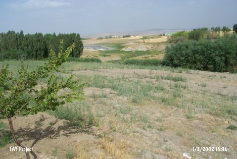 |
|
Type:
|
Mound |
|
Altitude:
|
1155 m |
|
Region:
|
Central Anatolia |
|
Province:
|
Aksaray |
|
District:
|
Ortaköy |
|
Village:
|
Gökleryaylasi |
|
Investigation Method:
|
Survey |
|
Period:
|
Ceramic |
|
|
|
 |
|
| Location: This site lies in Degirmenözü Mevkii of Gökler Village; 5 km northeast of Ortaköy District of Aksaray Province. |
| Geography and Environment: Todd describes Degirmenözü as a low mound along the skirts of a natural hill [Todd 1980:40]. Except for a nearby stream; there are no fresh water sources in the site's vicinity today. In 1966; when the site was surveyed; it was under cultivation. The narrow valley that the site lies in is bounded by mountains. |
| History: |
| Research and Excavation: The site was discovered during the 1966 survey of Central Anatolia conducted by Todd. The site was revisited by the Japanese crew under the direction of S. Omura in 1990. Omura notes that he collected finds from both sides of the river. |
| Stratigraphy: In addition to the Neolithic; the site yielded Early Bronze Age finds. |
| Small Finds: Pottery: The survey yielded a total of two Neolithic sherds. One is a light; yellowish-brown rim sherd. A similar one was found at Kösk Höyük. The other is a red slipped bowl fragment. Chipped Stone: The chipped stone industry at this site includes bifacially worked obsidian points; a few blades; a scraper on a flake and several scrapers on blades [Todd 1980:64-66]. |
| Remains: |
| Interpretation and Dating: Todd reports that the main habitation at the site was close to the stream; on the southeastern bank; along the skirts of the natural hill. He further points out that the obsidian finds suggest that there is a low lying mound on the hill. Omura; like Todd; assigns the site to the Neolithic. In ASPRO; the site is placed into the fifth phase and dated between 8;000-7;600 BP [Hours et al. 1994:113]. |