|
©The Archaeological Settlements of Turkey - TAY Project
|
|
|
|
|
|
Çakmaktepe |
|
|
For site maps and drawings please click on the picture...  |
For photographs please click on the photo... 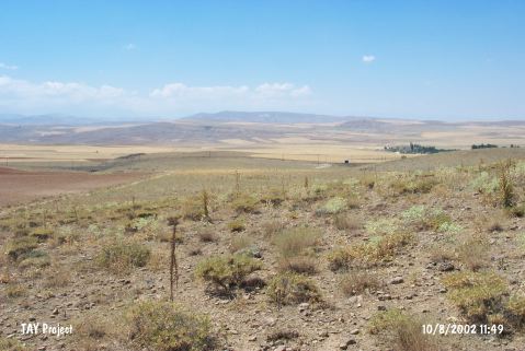 |
|
Type:
|
Single Findspot |
|
Altitude:
|
1206 m |
|
Region:
|
Central Anatolia |
|
Province:
|
Nigde |
|
District:
|
Ulukisla |
|
Village:
|
Altay |
|
Investigation Method:
|
Survey |
|
Period:
|
OP |
|
|
|
 |
|
| Location: This open-air site is named after a small hill that lies south-southeast of the city of Nigde; west of the village of Altay and 6-8 km northeast of the town of Ulukisla. Minzoni-Deroche reports that this site is approximately 15 km (by highway) northeast of the town of Ulukisla. |
| Geography and Environment: Çakmaktepe; which is approximately 1;000 m above sea level is one of the hills southeast of the Bor Ova Plain. The literal name of Çakmaktepe; "flint-hill"; refers to the numerous deposits of black flint concentrated especially at the base of this hill. The quality of the flint is varied. All the chipped stone tools from this site are surface finds. The Eregli-Nigde railroad tracks pass by the base of Çakmaktepe. |
| History: |
| Research and Excavation: Research in this area was conducted by Minzoni-Deroche; who hoped to find Palaeolithic artifacts during her survey of the northern fringes of the Taurus Mountains. This hill was surveyed especially because of its name. We have no information on the frequency and density of the artifacts or on survey methodologies the researchers used. |
| Stratigraphy: |
| Small Finds: Of the 96 pieces collected at this site; 8 were cores; 84 were blades and flakes and 4 were debitage products. Among them were a few discoid cores; many large flakes and some blade type tools. Continual edge retouching was frequent; although Levallois technique was not used [Minzoni-Deroche 1993:147; fig.5.3]. Based on their technical qualities; Minzoni-Deroche assigns these tools to the Middle Palaeolithic. They resemble the Zagros tools. |
| Remains: |
| Interpretation and Dating: |