|
©The Archaeological Settlements of Turkey - TAY Project
|
|
|
|
|
|
Civelek Magarasi |
|
|
For site maps and drawings please click on the picture... 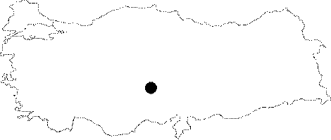 |
For photographs please click on the photo... 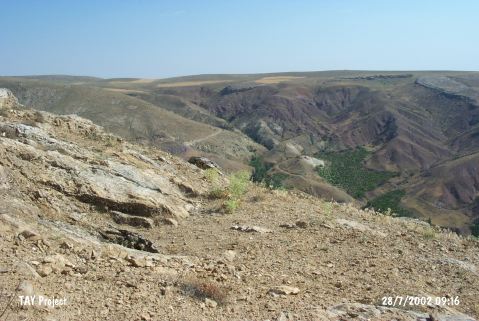 |
|
Type:
|
Cave |
|
Altitude:
|
1230 m |
|
Region:
|
Central Anatolia |
|
Province:
|
Nevsehir |
|
District:
|
Gülsehir |
|
Village:
|
Civelek |
|
Investigation Method:
|
Survey |
|
Period:
|
|
|
|
|
 |
|
| Location: The site lies north of Nevsehir; 2.2 km north of Civelek Village; 4.8 km north-northeast of Gülsehir; at the southern ridges of Hirka Mountain; 7 km from Gülsehir District; at the northern bank of Halys. |
| Geography and Environment: The cave is located 600 m north of a water depot at Görlek Tepe; at the upper parts of the eastern slope of a ridged area. It was possible to reach the cave through a gallery; 14 km in length. The main living gallery measures 22x11 m. There are calcite pieces and debris fallen from the roof. Small galleries were observed. It was not possible to locate the main entrance; because some of the galleries were blocked by big rocks. The entrance might be closed thousands of years ago. |
| History: |
| Research and Excavation: In 1974; some hunters recognised water vapor coming out of a small hole. They blew the hole with dynamites; revealing an entrance that one person could go through without much difficulty. All of the vessels and a few stone finds were collected and brought to the Nevsehir Museum. A research was conducted jointly by the Nevsehir Museum and R. Bixon from the Italian National Natural Speleology Institute in 1993. A small sounding was made and sherds between large rock blocks were carefully collected. It is listed in the inventory of the registered archaeological sites prepared by Ministry of Culture and Tourism. |
| Stratigraphy: The stratigraphy is not known; because excavations are not yet conducted inside the cave. |
| Small Finds: Pottery: Sherds were examined in details by a team under the leadership of A. Schachner; and were published [Schacher et al. 1997:9-38]. Nine wares according to the properties were observed. Fine sand; mica and chaff tempered; brown pasted jar with a short neck; small floor; and circular flat handle from the rim to the neck was recovered from the northwestern part; blackish brown paint decorated mug with checkerboard on the neck; hatched tringle and rectangles one inside each other on the shoulder and the body; and a stylized goat just below the handle; and beaker-shaped vessels with single handles were recovered from the southern and western parts of the cave; on the floor. Ground Stone: A stone spindle-whorl and some stone objects were found by the villagers. Bone / Antler: A piece; cut from the femur of an animal; was pierced and used as a spindle-whorl. |
| Remains: |
| Interpretation and Dating: According to A. Schachner; the recovered sherds from the cave belong to the Late Chalcolithic Age [Gülyaz 1996:275; Schachner et al. 1997:20-21]. Because there are no stratigraphical excavations; the researchers try to establish a link with all the Chalcolithic Age sites from Central Anatolia to Northern Anatolia. It was not possible to understand whether the cave was used as a the centre of a death cult; as a worshipping place or as a settlement. |