|
©The Archaeological Settlements of Turkey - TAY Project
|
|
|
|
|
|
Adada |
|
|
For site maps and drawings please click on the picture... 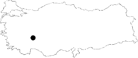 |
For photographs please click on the photo...  |
|
Type:
|
City |
|
Altitude:
|
1200 m |
|
Region:
|
Mediterranean |
|
Province:
|
Isparta |
|
District:
|
Sütçüler |
|
Village:
|
Sagrak |
|
Investigation Method:
|
Survey |
|
Period:
|
Hellenistic Roman |
|
|
|
 |
|
| Location: It lies 2 km west of the Sagrak Village; north of the Sutculer District; southeast of the Isparta Province. Situated to the southeast of the Lake Kovada; it is at the 50th km of the Egirdir - Sutculer motorway. |
| Geography and Environment: The Karabavlu upland of the Toros Mountains; where the ancient city of Adada is located at; is surrounded by hills covered with juniper and pine trees. |
| History: The name of the city was first referred by Artemidorus in the 1st century BC [Strabo 12; 7; 2]. Ptolemy lists it among the Pisidian cities [Ptolemy 5; 5; 8]. On the other hand; according to Hierocles; the city was named "Odada" [Hierocles 674; 4]. The known history of Adada dates back to 190-164 BC based on a treaty signed with Termessus. The treaty is about the alliance of Termessus and Adada against possible agression by Selge externally; and the anti-democratics internally; as well as Adada's accomplishment of a democratic administrative structure. According to this treaty; Adada would have provided mercenaries to Termessus. The city minted her first coins in the 1st century BC. The bronze coins are depicted with the head of Zeus and Nike figures. The mints can be traced up to the Period of Emperor Gallienus [Lang 2003: 26]. The city flourished particularly following the Traianus Period. |
| Research and Excavation: The first investigations were performed by A. Schönborn in 1841. The idea of Schönborn to relate the finds in Adada with the ones in Pednelissus was also accepted by C. Ritter [Ritter 1859: 572] and C. Texier. In 1844; J.R.S. Sterrett claimed that the ruins belonged to the ancient city of Adada [Sterrett 1888b: 283]. The city has been investigated by Buyukkolanci from 1970; with a main focus on the temples. It takes place in the registered archaeological sites list prepared by Ministry of Culture and Tourism. |
| Stratigraphy: |
| Small Finds: |
| Remains: Among the buildings of the city acropolis built on the slopes of the Aktepe Hill and the rocky valley are city wall; towers; and structures with unknown functions. During the Roman Period; temples; theater; agora (?); market building or a governor's palace; and stoas were built on the plain ground of the city and its vicinity; and the road was renovated. The Roman road is traceable 600-700 m to the south of the rocky valley. City wall: The city wall and towers; dating to the 2nd century BC; were constructed on top of natural rocks surrounding the acropolis; approximately 10 m higher from the city's plain ground. At present; the city wall has been mixed with the Byzantine buildings and occupied by a dense vegetation. The towers surrounding the acropolis have a fine masonry; and survived to 8x6.5 m with a height of 8 m. The corners of the walls of a tower on the southwestern part of the acropolis are in good condition. There is a second tower in same dimensions; but in better condition 30 m to the southeast of that tower. The second tower is connected with other parts of the wall on the northern slopes of Aktepe. The walls and towers are reminiscent of the examples in Pednelissus; Perge and Side. Street: Approximately 600-700 m to the south of the valley; the paved part of the Roman road from Adada to Perge can be traced. The paved road known as the "King's Road" stretches from the city center all the way to the mountain's skirts. Inscriptions and statue bases related to several festivals are seen on the street crossing by the west of the forum and basilica. Agora: The plain ground to the south of the Temple of Traianus possibly had a function of a courtyard with a portico ornamenting the façade of an agora or a temple. The stoa is visible to the northwest of the area. The heart-shaped double corner column in the center of the court indicates the presence of stoas at other façades as well. An inscription related to a love horoscope was found in the courtyard. Such data strengthens the possibility that the courtyard was; in fact; the agora. Market place: The two-story building to the north of the acropolis is called the "Market Building" or the "Governor's Palace". It measures 16.4x11 m. The antae of the first story on the western part of the building have been preserved. In the mean time; another gate-like opening was found on the east wall as well. Both entrances are slightly displaced from the center. The extant part of the south wall is approximately 10 m high. The outer walls were elaborately processed; while the inner walls were left unworked; and probably covered with wood. There are at least six battlement-like windows with bars at the lower story. The upper story has two windows and possibly a balcony door. It is similar in plan with the "Market building" in Pednelissus from the Hellenistic Period. Among other alikes; "Customs Building" in Selge and the Bouleterions in Alabanda and Kyra can be listed. Forum: It was constructed between the Open Air Assembly Area and east of the Hellenistic tower. It is delimited by the street in the west; and Doric stoas in the north and south. It is 32x45 m; and the floor was paved with well trimmed stone blocks. There is a large cistern in the center. The shops possibly were located across the street. The forum is dated to the Roman Period. Basilica: A building found to the north of the Forum is presumably a basilica. It lies in the east-west direction with a size of 9.5 x 43 m. It has a narrow and long plan. The podium and stylobate sections were already unearthed. No find is available from the upper story of the basilica. Open Air Assembly Area: It lies to the west of the acropolis. It is 24 m long; including 20 steps. The city assembly gathered in this area with a capacity of approximately 1000 people. Later on; a forum and a basilica were constructed in front of it. There are also theater-like open-air assembly areas in the ancient settlements of Sia and Kapikaya (Guneyce environs). Theater: It was constructed on the slope to the west of the city's plain ground. It has been currently obscured completely with soil except for the ends of the cavea. The rows of seats were made of marble-like limestone. To the north six rows of seats are traceable while to the south there are eight rows of seats. The capacity of the theater is estimated to be around 3000 people. The stage building consists of one or two stories; with statues on the façade. Gymnasium: No remains are available from the gymnasium. However; an inscription was uncovered recording that a gymnasium was built during the Severuses period (180-210 AD). Nymphaeum: To the southeast of the forum lies a structure under deposits. It has a rectangular plan with a 12 m wide façade. There is a semicircular niche of 6 m diameter in the center. Based on the fragments of architrave; frieze and cornice; it seems that it had an ornamented façade. Depending on the section that looks like a water tank in the back; presumably it might have been a monumental nymphaeum. Temple: Adada is one of the richest small cities of Pisidia in terms of temple architecture. All the temples built on the plain ground forming the city center during the Roman Period were made of limestone. Temple of Trajan: It is the earliest and largest-known temple of the city. It is located near the Temple of Aphrodite to the east of the city center. The front façade faces northwest; the area supposed to be the agora. The northern side of the façade survived up to the level of the cornice. The overall height of the building is 9.7 m. The temple is in prostyle plan and the dimensions are 19.4x11.6 m. It probably stood on a podium or a crepis of three steps. The façade may have been arranged with six columns having a narrow intercolumniation; erected on high pedestals (three of them currently visible). The almost-square planned naos was erected in pseudo-isodomic technique using dressed rectangular blocks. The inner walls of the naos were covered with wood. The plain architrave with three fasciae of the temple ends up with a fascia at the top. The frieze is "S" shaped and it has no ornaments except the unique ornament of a shield relief on the rear pediment. The temple probably was bordered by colonnaded galleries at the front. The depiction of a temple in Ionic order with six pedestaled columns on the reverse of the Gallienus-Valerianus (253-260 AD) coinage of Adada was defined as the "the Temple of Trajan at Adada" [Aulock 1977: 21]. The temple was constructed before the visit of Emperor Trajan in 110-114 AD which has been confirmed by the plain and undecorated structural elements of the temple. Temple of Emperors: It is located in the city center; across the Temple of Jupiter-Serapis; facing the area presumed to be the agora. The façade faces south. The naos walls have been preserved up to the level of the entablature. As the rear pediment is partly preserved; it provides the total height of the temple. The doorways and inscripted lintel of the naos gate are in situ. The walls of the temple were erected in the isodomic technique. Traces of the propylon are available in front and in the same axis of the temple. The temple is in Ionic order with three steps; and the dimensions are 15.3x7.1 m. With its pronaos plan; it is the most interesting temple in the city. Pronaos is flanked by two columns on sides and four in the front. The plan is unique in Pisidia except the Temple of Augustus at the Pisidian Antioch. Most probably it was inspired by the Temple of Dionysus in Pergamon. The inner walls of the naos that were erected without any clamps were possibly covered with wood. The main beam hole of the wooden roof of the temple was unearthed. The only ornamented architectural element known is the Ionic capital. An identical style of this capital was applied at the second phase of the Temple of Apollo Clarios at Sagalassos in 105 AD The frieze of the structure has a "S" profile. The cornice blocks are unornamented. The inner part of the pedimental triangle is covered with two rows of well-cut stones. It is similar to the Temple of Trajan with its architrave; frieze; cornice profiles; and order. It should have been built by the masters of the Temple of Trajan before the Emperor's visit in 110-114 AD According to the inscription on the lentil; the temple was dedicated to the Emperors' cult by Theodorus; the son of Nicomachus along with xoanons and statues. The above mentioned person lived before the Hoplan family who financed the construction of the temples of Aphrodite and Jupiter-Serapis [Sterrett 1888b: 30]. Temple of Emperors and Jupiter-Serapis: It is located to the west of the city center. The façade faces the area which is presumably the agora to the east. The walls of the naos have been preserved up to the architrave section. The wall between pronaos and naos is still visible. Fragments of pedestals; columns and entablature have been scattered around the temple. The temple walls were erected in pseudo-isodomic technique without any clamps. It rises on a three-step podium with a prostyle plan. It measures 19.2x10.8 m. There are four columns in the pronaos. The intercolumniation in the middle is wider. The columns of the pronaos are unfluted; and they probably have Corinthian capitals. The architrave with three fasciae ends up with a plain fillet. The architrave bears an inscription on the façade. The frieze is "S" profiled and fluted. The cyma has a stylized row of open and closed palmettes. A round shield relief that belongs to the pediment was unearthed. The walls of the naos were presumably covered with wood. Fragments of blocks were found in situ at the front; 10 m away from the temple. The surface of the blocks facing the temple are finely processed while the rear sides were left coarse. It reminds of the small altars of the Temple of Demeter at Pergamon. As the inscriptions yielded; the temple had the wooden cult statues called "xoanon"; and it was dedicated to the God-Emperors; and Zeus Megistos Serapis by Antiochus; the son of the monk Tlamoas; and his wife; the abbess Anna; daughter of Hoplon; and his sons Tlamoas and Antiochus. The temple is dated to the end of the 2nd century AD and the beginning of the 3rd century AD Temple A: It is located on a slightly inclining slope to the north of the city's plain ground. The façade faces east. It is assumed that the destructed building was prostyle with four columns and no podium. The columns and the architrave with three fasciae have a plain fillet. The corbelled cornice and the "S" profiled fluted frieze suggests that the temple was in Corinthian order. The alternating ornament with a row of open and closed palmettes on the cyma was initiated during the Antoninuses Period and it became much more common during the Severuses Period. The cyma of the gate from the Late Period at Perge and the stage building of the Theater of Hierapolis has a similar style. However; it is still unknown to which deity or cult this temple from the Severuses Period was dedicated. The location near the necropolis suggests that it may have been related with a burial cult [Buyukkolanci1998: 40]. Temple of Aphrodite: It is located to the northeast of the market building or the governor's palace; between the area which is presumed to be the agora and the forum at the city center. A modern road runs over the foundations of the temple. It seems that it was circular in plan in 6 m diameter. No colonnade was found around the naos. The style of the frieze reminds the Temple A and the Temple of Emperors-Jupiter Serapis. The temple which was dedicated to the Aphrodite cult was constructed by the same family who financed the construction of the Temple of Emperors-Jupiter Serapis. Domestic Area: The southern slopes that were the initial site where the city was founded during the Late Hellenistic Period; were converted into residential areas on terraces during the Roman and Byzantian Periods. Fragments of terra sigilata and roof tiles were unearthed. Necropolis/Grave: It lies on the northern slope of the city. A burial monument known as the "Bone Tower" has been in preserved condition compared to others. It looks like a small temple in prostyle plan with a dimension of 6.4x5.4 m. Two walls of the building facing west are extant. The façade was left coarse and it bears no friezes. The graves in the main chamber are presumably at the same level with the podium. There is a stele in the burial chamber of another monument inside the valley to the south of the city [Buyukkolanci1998: 40]. |
| Interpretation and Dating: |