|
©The Archaeological Settlements of Turkey - TAY Project
|
|
|
|
|
|
Kiran Gölü |
|
|
For site maps and drawings please click on the picture... 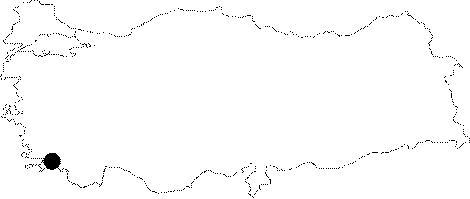 |
For photographs please click on the photo...  |
|
Type:
|
Sanctuary |
|
Altitude:
|
m |
|
Region:
|
Aegean |
|
Province:
|
Mugla |
|
District:
|
Marmaris |
|
Village:
|
Taslica |
|
Investigation Method:
|
Survey |
|
Period:
|
Classical Hellenistic Roman |
|
|
|
 |
|
| Location: It is located within the borders of the Taslica Village on the southern end of the Bozburun Peninsula of the Marmaris District of the Mugla Province. It lies to the north of the ancient city of Loryma. It is not accessible by car [Saner-Kuban 2000:287; Kuban-Saner 2002:203]. |
| Geography and Environment: |
| History: The tributers of the Delian League also included the people of the peninsula (Chersonesos). It is known that they paid tribute in 428-427 BC. The League; presumably with at least three members; used to meet at a certain location; which in fact; might have been the Kiran Lake. Although there is no certain evidence; it is a probability. Among the potsherds collected are some fragments probably belonging to a red figured bell crater; and this vessel is dated to the end of the 5th century BC [Kuban-Saner 1997:438]. As a result of the survey conducted in the sacred area; which was presumably not constructed as a whole but developed with additional buildings in time; it is concluded that it was erected before the Hellenistic Period [Kuban-Saner 1997:439]. |
| Research and Excavation: Surveys were performed by Kuban and Saner in and around the sacred area in 1995; 1998; 1999; 2000; 2001 and 2003; where the name was not mentioned in any of the researches that took place in the 19th and 20th centuries [Kuban-Saner 2001:163]. |
| Stratigraphy: |
| Small Finds: |
| Remains: The Kiran Lake is approximately 30 m in diameter. The distribution of the buildings on the surrounding land suggests that the lake was about the same size during the Ancient Period; and it was taken into consideration during the construction of the buildings [Saner-Kuban 2000:287-288]. It is assumed that a fortification on the nearby Asar Mountain could be related to the sacred area. There are graves on the way leading to the Asar Mountain [Saner-Kuban 2000:287]. The masonry on the surface of the building inside the fortification on the Asar Mountain is similar to the one at the temple of the Kiran Lake. The distance between the Asar Mountain and the Kiran Lake sacred area is approximately 15 minutes by walking. The grave steles seen on this route indicate that the road was also used in the ancient period. Therefore; it is believed that the Kiran Lake sacred area might have been a center within the borders of the Asar Mountain. No dating was performed depending on the potsherds and architectural remains uncovered during the surveys in the lake and its environs [Kuban-Saner 2002:205]. The presence of so many olive workshops in such a small area is an indicaton of an intense production volume [Saner-Kuban 2000:289]. The construction technique based on artificial terracing; which was common during the Hecatomnus Period is not traceable here. It is similar to the sacred areas of Hemithea in Castabos in the vicinity; and Apollo Erethimios located in the Camiros region of Rhodes; dating to the 4th century BC. With its small theater; order of the buildings; and extramural position; it is compared with the above mentioned sacred areas. It is also comparable with Panionios; the meeting place of the 12 Ionian cities [Kuban-Saner 1997:439]. It is emphasized as a religious and political meeting point of the cities in the Rhodian Peraea [Saner-Kuban 2000:289]. Harbor: In the Hidirlik Mevkii to the north strecthes a harbor fortification along the sea shore. It is accessible from the sacred area through a pathway. It was found out that the road was enlarged at certain places partially by carving the rocks [Saner-Kuban 2000:289]. A building found at the harbor measures 9.6x7.6 m; with windows on the southern façade. The western section is apsidal in plan with a rectangular shape; made of embossed blocks. The features of its plan; and presence of many windows suggest that it was not built for military or religious purposes. Due to its location and its relation with the breakwater in front; it is suggested to be related with the harbor activities [Kuban-Saner 2001:163-164]. It is probably of the Hellenistic Period [Saner-Kuban 2000:289]. It has similarities with the building #1in the sacred area in terms of construction techniques; which suggests that both buildings were constructed at the same time; and even by the same people. Although its function is still unknown; it is assumed that it might have been served as a lighthouse [Kuban-Saner 2002:206]. To the west of this building lies a small construction with a single room; of a mortared wall masonry [Kuban-Saner 2001:164]. There are rectangular planned large buildings on the slope behind the harbor; and 50 m to the east; graves with stepped bases in a necropolis [Saner-Kuban 2000:288-289]. It is believed that the visitors coming to the harbor lodged in the buildings on the slope; and then followed the ancient road to reach to the sacred area [Saner-Kuban 2000:289; Kuban-Saner 2001:164]. An olive workshop and a cistern found near the buildings on the slope are indications of a small self-sufficient society. Based on all information available; it is concluded that this settlement is of agricultural quality. It is suggested that there are at least two phases at the Hidirlik Harbor and in the settlement on the slope behind it. The first phase was presumably contemporary with the sacred area of the Kiran Lake; and the second phase can be dated later than the Ancient Period; based on the buildings with mortared walls at the settlement and the harbor; and the crosses carved onto the grave bases in the necropolis in later periods [Kuban-Saner 2001:164]. Some remains of a small agricultural settlement were uncovered to the east of the Hidirlik harbor; at a place currently called Bugday Inecegi. A fluted floor stone found inside a room was probably used for olive presssing [Saner-Kuban 2003:283]. Theater: The theater facing the east is located on the skirts of a hill surrounding the west side of the sacred area. The walls forming the cavea were erected in a row type of polygonal masonry technique as seen in Amos and Castabos. No architectural remains were found from the stage building [Kuban-Saner 1997:435-436]. It was found that the plan of the theater exceeded the size of a semi-circle [Saner-Kuban 2000:288]. The theater plan of Amos is similar of the one at the Kiran Lake in terms of dimensions; seating rows without profiles; and masonry. The masonry observed at the theater of the Kiran Lake is similar to the city walls in Amos from the 4th century BC [Kuban-Saner 1997:439]. Cistern: A cistern was found on the pathway leading to the Hidirlik Mevki to the north [Saner-Kuban 2000:289]. Temple/Sanctuary: It was built on a rock to the east of the theater. The temple which arises above a rock to the east; and on a soil deposit to the west; measures approximately 7.4x29 m. It is found out that the dimensions were arranged according to the Attican or the Cycladian foot in a ratio of 1:4. It is thought that the temple; a hecatompedos; does not have a peristasis due to the presence of another building (building#1) to the immediate southwest. No binding stones were found on the walls. It is indicated that it resembles the Cycladian architecture with its columnless thin and long naos; and lower wall base. The altar approximately 2 m east; is on the same axis with the temple [Kuban-Saner 1997:436-437]. It is compared to the temple in Teos Acropolis in Anatolia. Various analyses and comparisons showed that the Hecatompedon characteristics prevailed in most of the temples dating from the 7th century BC to the Hellenistic Period. The researchers emphasized a trend towards archaism; which appeared during the 5th and 4th centuries BC. When the other buildings in the sacred area dating to 4th century BC are combined with this trend; it is thought that the sacred area can be dated to the 4th century BC; and based on the potsherds uncovered; it could be dated to the 5th century BC [Kuban-Saner 1997:440-441]. There are several buildings around the temple. Of those buildings; the double sided east wall of the building #1; measuring 12 x 9 m; with lintels to the immediate southwest of the temple has been well preserved. No clamp or mortise was used [Kuban-Saner 1997:437; 441]. On the west side facing the theater; the door is flanked by two windows. In that respect; it has similarities with the façade order of the androns in Labraunda. It is even similar to Andron C in terms of style and dimensions. There is a cavity on the upper part of the base on the door axis to place a second block. A similar base was found inside a building in the sacred area of Kastabos Hemithea. However; the function of that structure is still unknown [Kuban-Saner 2002:204]. The construction techniques employed indicate the 4th century BC [Kuban-Saner 1997:441]. The building #3 lies to the west of the sacred area. With a long rectangular plan; it has three door openings on the façade; facing the the lake. The architectural features resemble the stoas; which have significant place in the sacred areas [Saner-Kuban 2000:287]. It is believed that this building measuring 19.2 x 4 m might have been a "hestiatorion"; a building for feasts. Similar buildings can be seen in the sacred area of Labraunda; and the sacred areas of Demeter and Kore in Corinthia. However; the researchers approach suspiciously to this argument as well [Kuban-Saner 2002:204-205]. There is a rectangular cavity and the trace of a 20 cm circle on a rock levelled by man; approximately 10 m south of this building; which is believed to have been arranged to place a stel on it. As there are no other architectural finds beyond this point; it is suggested that the sacred area is bordered by this stele [Kuban-Saner 2002:205]. Building #2: The rectangular planned building lies to the east of the lake. A door opening was found in the façade facing the lake [Saner-Kuban 2000:287]. The building #Z.1: The external walls of the rectangular planned building situated in the north of the sacred area; were constructed from irregular blocks. An analysis revealed that it consists of rooms around an internal courtyard. There are remains of olive press base stones found inside [Saner-Kuban 2000:288]. There is an olive workshop with a press base stone; lying to the east of the sacred area; with some remains of a wall nearby. There are graves between these buildings and the sacred area [Saner-Kuban 2000:288]. Necropolis/Graves: There are stelai belonging to the base of graves called stepped pyramides around the Lake of Kiran. This type of graves are very common in the Bozburun peninsula [Saner-Kuban 2000:287]. It is presumed that the graves around the sacred area might have been belonging to the people using the olive workshops and the sacred area. And; there is no finds related with residences in the area [Saner-Kuban 2000:289]. The graves typologically categorized by Carter can also be seen in the Lake of Kiran. There are blocks called Type C and Type D as well as the equilateral triangle three stepped pyramides; almost square three and four stepped pyramides; and rectangular three stepped pyramides. Also found is a rectangular piece like a stele possibly fitting into a rectangular cavity on some of the stepped pyramides. Furthermore; some graves were found; measuring 90x90x25 cm; one of them with a barrel vault shaped cover [Kuban-Saner 1997:442-443]. Tomb: It is located on a rectangular platform supported by surrounding walls. The stepped bases around the grave are also on that platform. Stelai were found in the cavities of these bases. The blocks on the front façade are circularly embossed. The long façade of the platform was constructed of polygonal blocks. Also; there is an difference of angle between the long façade and the front façade. Possibly the front façade was added onto the polygonally constructed structure from an earlier period [Saner-Kuban 2000:288]. To the southeast of the temple lies a rectangular building; with walls constructed from rectangular; and trapezoid blocks [Kuban-Saner 1997:437]. The masonry of the structure described as a Monumental Grave; is also observed at the eastern wall of the Athena terrace in Priene; which is known to have become common during the 3rd and 2nd centuries BC. The amphora handles found on the surface indicate the 2nd and 1st centuries BC. Thus; it can be concluded that the activities on the sacred area continued throughout the Hellenistic Period [Kuban-Saner 1997:441]. A monumental grave was found to the east of the Bugday Inecegi at the Kocar harbor. It consists of four adjacent rooms. The northern façade seen from the sea was delicately processed with an embossed masonry. There is another grave approximately 70 m further to the west [Saner-Kuban 2002:204]. A stepped base grave was found on the pathway to the Hidirlik Mevkii to the north of the sacred area [Saner-Kuban 2000:289]. There is a grave structure with an emphasis on the façade on a slope reached after a half hour walking to the south of the Kocar harbor. In that respect; it is similar to the other grave structure in the Kocar harbor. Three bases for grave stelai were found on the platform of the grave structure. There is a cistern and a group of buildings in the northwest of the grave. One of these buildings include a press base stone. Based on these findings; the area indicates a threesome architectural arrangement consisting of residential; agricultural and burial functions; typical to that environment. Workshop: Olive workshops were found on the pathway leading to Hidirlik Mevkii in the north [Saner-Kuban 2000:289]. |
| Interpretation and Dating: |