|
©The Archaeological Settlements of Turkey - TAY Project
|
|
|
|
|
|
Kaunos / Kbid |
|
|
For site maps and drawings please click on the picture... 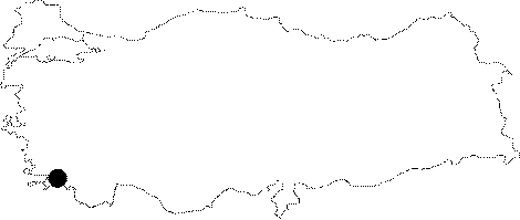 |
For photographs please click on the photo...  |
|
Type:
|
City |
|
Altitude:
|
m |
|
Region:
|
Aegean |
|
Province:
|
Mugla |
|
District:
|
Ortaca |
|
Village:
|
Dalyan |
|
Investigation Method:
|
Excavation |
|
Period:
|
Archaic Hellenistic Classical Roman |
|
|
|
 |
|
| Location: It is located in the Town of Dalyan to the west of the Ortaca District of the Mugla Province. At present; it is 3.22 km away from the sea [Bean 2000:174]. The asphalt road strecthing towards the southwest, diverting from the main road 7 km after Köycegiz on the Mugla-Fethiye motorway provides access to the village of Dalyan. The road is 17 km long from the junction to the village. The Dalyan Village is located on the eastern bank of the Dalyan Brook (Calbis), which discharges the waters of the Köycegiz Lake into the Mediterrenean coast while the ruins of Caunus are situated on the opposite bank [Umar 1999:308]. |
| Geography and Environment: Used to be a port city; Caunos lost this feature along with the formation of the Dalyan delta. To the north and west is surrounded by the Ölemez (Imbros) Mountain. Investigations revealed that the 150 km Köycegiz Basin was formed during the Late Pleistocene. The Lake of Köycegiz measures around 5200 hectares; and it is rated as the second largest lake of Caria after the Lake of Bafa. Supplied by many brooks; it is 1 m high from the sea level; with its deepest point over 70 m. The lake drains its water to the sea via the Dalyan Brook [Ogün et al. 2001:2-3]. |
| History: The name Caunos is mentioned as "Kbid" in Lycian on the inscribed pillar found in the agora of Xanthos and on the "Trilingual Stele" found in Letoon. The symbol "kb" on the ancient coins of the city is reported to be an abbreviation of this name [Ögün et al. 2001:16-17]. Following the defeat of the Lydian Kingdom by Persians and their domiance in Anatolia; Caunos sided with the Ionians. She became a member of the Delian League during the second half of the 5th century BC and paid tribute until 421-420 BC whereas in 412-411 BC. Kaunos sided with Lacedaimonians; and became a Persian garrison. An inscription found with the statue of Konon; the Athenian general of the Eastern Mediterrenean Fleet of Persia revealed a revolt initiated by the Cypriot mercenaries in 395 BC in Kaunos who fighted against the Spartans together with Persians at the beginning of the 4th century BC Caunos was incorporated into the satrapy under the Hecatomnid dynasty following the King's Peace agreement in 387 BC. A fragment of a Stoichedon inscription was found providing details about this revolt to Mausolus. Similar inscriptions were also found in Mylasa (367-366 BC). Bronz statues of Mausolus and his father Hecatomnus on two pedestals; and a marble statue on another pedestal were uncovered in the Sanctuary of Apollo; but no dating is available. It is believed that these three pedestals might have belonged to an important monument; and dedicated to Basileus Kaunios [Ögün et al. 2001:14-16]. Pixodarus; the successor of Mausolus; made some arrangements related with Caunos. According to the "Trilingual Stele" including inscriptions in Lydian; Aramaic and Greek uncovered in Letoon; it was decided to built an altar for Basileus Kaunios. From 334 BC the city was under the reign of Alexander the Great who succesfully made Persians to retreat from Anatolia. When Alexander died; Asandros became the satrap of Caria; and ruled between 323 and 318 BC. However; it is told that Caunos; like Athens; Rhodes and many other cities; fighted against the Macedonians. A bilingual inscription uncovered in the Sanctuary of Apollo in Caunos refers to honorary of two Athenians. One of them is Nicocles; who might have been arrived in Caunos due to the Lamian War in 323-322 BC. The Attalus's attack against Caunos and Rhodes after Athens lost the sea war near Amorgos in 321-320 BC was defeated by Rhodians. It is an indication of the presence of an alliance between Rhodes and Caunos at that time and of a Rhodian Peraea in Anatolia [Ögün et al. 2001:18-19]. Caunos changed hands a number of times; passing to the control of Diogonos in 313 BC; Ptolemy in 309 BC; and Antigonus Gonatos in 268 BC. Zenon; a native of Caunos; was a keeper of records in Alexandria. It is clear from Zenon's correspondences that Caunos was already separated from the government of Antigonus before 257 BC [Ogün et al. 2001:20-21]. At the beginning of the 2nd century BC. Caunos was under the protection of Rhodes against the emerging power of the Seleucid Empire. Rhodes claimed that she purchased Caunos from the generals of Ptolemy for 200 talents; and annexed the entire Caria and Lycia between 197 and 191 BC depending on a decree by the Roman Senate. When riots against the reign of Rhodes was initiated in 167 BC; the Senate declared freedom for Caria and Lycia [Ogün et al. 2001:22-23]. In 129 BC Caria was incorporated into the Province of Asia; but according to the inscriptions Caunos was not included in the province. Caunos supported Mithridates; King of Pontus; who invaded Anatolia in 88 BC. Many foreign merchants in the city were killed. For this she was given back to Rhodes by Sulla. In 83 BC Caunos was again freed from Rhodes after referring to Licinius Murena; Roman governer of Asia in 83 BC. It is clear from a letter sent by Cicero to the governer around 50 BC that Caunos was within the borders of the Province of Asia [Ogün et al. 2001:23-24]. However; Dio Chrysostom's oration in 70 AD states that Caunos suffered from a double government of Rome and Rhodes; which indicates that Rhodians later regained some sort of control in the administration of Caunos [Ögün et al. 2001:24; Bean 2000:180]. An inscription from the 1st century AD found in a building next to the harbor refers to a customs tax amnesty. It is known that the shore line started to fill up during the same period. This amnesty should have been announced to refresh the interrupted trade. The same inscription states that salt; resin and pitch were among the major trade materials. Resin and pitch were used for the construction and repair works of ships in the shipyards of Caunos. It is also known that the city was involved in slave trade [Bean 2000:181-182]. |
| Research and Excavation: It was discovered by Hoskyn in 1840; and visited by Collignon in 1976 and Maiuri in 1920. Bean who conducted detailed survey works in 1950s was followed by Aström who studied the rock tombs; and Roos who conducted surveys in 1864-70. Excavations at Kaunos/Kbid were conducted by Ögün between the years 1966 and 2000. Since 2001, C. Isik has been leading the excavations. |
| Stratigraphy: |
| Small Finds: |
| Remains: The city center extends to the north and east of the harbor. It has two acropolis hills. The main one lies to the east; and it is a calcerous rock; 152 m high from the sea level [Ogün et al. 2001:44]. To the west of the acropolis lie graded terraces. The lower terrace is accessible through a gate from the east. The lower parts of the terrace walls are mainly of polygonal; and the upper parts of Byzantine wall. The dimension and masonry of the polygonal walls are similar to the polygonal wall of the western city walls [Ögün et al. 2001:46-47]. Based on the information provided by Herodotus; it is known that the Caunos Acropolis was surrounded by a defensive wall during the Persian Wars [Herodotus 1; 176]. To the southwest of the acropolis lies a terrace surrounded by early defense walls; overlooking the southern harbor [Ögün et al. 2001:50]. Masonry of the threshold blocks and a few black glaze potsherds uncovered indicate that the gate was erected in the 4th century BC Reconstructions carried out during the Roman Period are traceable [Ögün et al. 2001:50-51]. Absence of any structures earlier than the 4th century is presumably due to the destruction of the area by the Byzantine buildings in the vicinity and the Temple of Demeter [Ögün 2001:51]. The second acropolis of the city; called "Small Fort" lies to the south; overlooking the both harbors. The defense walls cut the rocky hill; which is about 50 m high; exactly in half to the northwest and southeast. The southeastern slope of this hill with at least two temples and church had been occupied as a necropolis area from the Late Classical Period [Ögün 2001:153]. Harbor: The city of Caunos has two harbors; South Harbor and Inner Harbor. The South Harbor lies to the southeast of the Small Fort [Ögün et al. 2001:42]. It is believed that the gate discovered between the Terrace of Demeter and the Northeastern Terrace linked the harbor to the city (See City Wall) [Ögün et al. 2001:43]. It is likely that the South Harbor had been in use from the foundation of the city until it was silted up by the Dalyan Brook at the end of the Hellenistic Period [Ögün et al. 2001:42]. Based on the New Customs Regulations inscribed on the outer surface of the Nymphaeum in the Agora; it is believed that the silting-up of the harbor increased during the Roman Period and customs regulations were revised as an inducement to merchants in order to revive the trade that had declined [Ögün et al. 2001:43]. The southeast of the harbor; which is a land now; is bordered by the Dalyan Brook. The Inner Harbor lies to the northwest of the Kuyruklu Kale; at the place known as Sülüklü Lake today [Ögün et al. 2001:42]. It is an inlet between the Small Fortress and Cömlekci Hill. According to Strabo; the city had an harbor; that could have been closed; and dockyards [Strabo 14; 2; 3]. The researchers agree upon the fact that the harbor was closed by a chain [Bean 2000:174-175; Ögün et al. 2001:43]. The harbor was in use until the last days of Caunos. The Brook of Dalyan (Calbis) was convenient for trade ships because of its depth. The harbor is like an inland lake at present [Ögün et al. 2001:43]. City Wall: The defense walls of Caunos can be evalauted in two sections; earlier and later walls. The earlier wall is from the Archaic and Early Classical Period [Ögün et al. 2001:33]. To the south it encloses a terrace located to the southwest of the acropolis; strecthing toward the southwest and it passes from the southeast of the Small Fortress; including it too. Extending up to the summit of the Small Fortress; the wall was erected with limestone blocks in semi-cyclopean style. The interstices between the stone boulders (2.1x1.2x0.9 m) were filled by smaller stones. With a width up to 3.3 m; it has been mostly well-preserved [Ögün et al. 2001:33-34]. The bastions on the Small Fortress were built as a measure to any potential attacks from this side. The bastion to the southeast of the summit has a square-plan with walls erected in isodomic technique. A sealed Rhodian amphora uncovered inside the building indicates a construction date later than 250 BC The wall starting from the Small Fortress; extending to the north and northwest direction and reaching the harbor was built in the isodomic technique with qualified limetone blocks. The contour surface of these blocks were roughly carved to have an embossed appearance; and placed with binding narrow blocks when necessary. These features are comparable with the western city wall. Use of various techniques indicates multiple construction phases [Ögün et al. 2001:34]. The Northern Wall mainly extends in the east-west direction; reinforced by four towers. The wall material is yellowish limestone derived from the local bedrock. The Western wall; mainly in the north-south direction; has two fronts and it is about 2 m wide. For construction; qualified local limestone derived from the bedrock was used [Ögün et al. 2001:38]. Although the wall between the harbor and the Sivrihisar hill is of polygonal; the great variety of masonry and style indicates construction in different periods [Ögün et al. 2001:39]. The part between Tower I and Tower XI was erected in double while the inner wall was removed in the section extending toward the north after the Tower XI. Comprising the northern part of the Western wall; it has characteristics of the Classsical Age; and it was probably built during the reign of Hecatomnus or Mausolus [Ögün et al. 2001:40-41]. The Gate of Harbor is located at where the semi-cyclopean wall is cornered over the terrace to the east of the Demeter Terrace. This narrow gate opening into the South Harbor; which was unusuable from the birth of Christ; is 1.4 m wide. It was modified several times; and the original lateral walls were erected with a bifacial technique. The semi-cyclopean masonry; carving features as well as potsherds and terracotta fragments from the end of the 6th century BC uncovered in the vicinity imply that the gate and the wall were erected during the Archaic Period [Ögün et al. 2001:35]. The support walls flanking the gate should have been constructed after the 4th century BC The narrowing of the gate can be presumably associated with the Mithridatic Wars in 88-84 BC or later with pirate attacks [Ögün et al. 2001:35-36]. The remaining part of the wall ruins from the Archaic and Early Classical Period can be traced to the southeast of the Agora Nymphaeum in the city center. From this point; the wall extends towards the northeast; undergoing the terrace of palaestra. It is still uncertain if the archaic city was located between the wall passing through the ridges of Heracleion (Small Fortress) and the area between the palaestra and the agora nymphaeum surrounded by the wall due to the insufficient number of potherds uncovered [Ögün et al. 2001:36-37]. Street: It connects the Northern Necropolis with the city center [Ögün et al. 2001:78]. It was uncovered about 21 km north of the Domed Church on the Palaestra Terrace. It is a paved street. With a width about 4.9 m; it rises from east to west. Excavations yielded three phases [Ögün et al. 2001:75]. It stretchs to the immediate west of the gate of the Palaestra Terrace in a lower level. The soundings on the street revealed Attican potsherds from the 5th and 4th centuries BC as well as fragments from the 3rd century BC Analysis showed that the street was built at latest at the end of the 3rd century BC or a little later. It is believed that there was also another street before this one which was built around 200 BC Furthermore; a coin of Emperor Titus uncovered on the pilaster pavement and potsherds uncovered in the deposits showed obliteration of the street by filling it up around 100 AD [Ögün et al. 2001:77-78]. Agora: Agora of the Harbor: The plain ground surrounded by a stoa to the north; the road running from the Temple of Terrace to the east; the Nymphaeum and a street passing in front of it to the southeast; the commercial harbor to the south and the Monument of Quintus Vedius Capito to the west had been occupied as agora. Many inscribed blocks were uncovered in this area as well as monuments and pedestals for statutes dating from the Hellenistic Period to the Roman Period [Ögün et al. 2001:118]. The bronze statues on different forms of bases didn't survive to our day as they were melted down to reuse the valuable material [Ögün et al. 2001:118-119]. Black glaze Attican potsherds dating to the last quarter of the 6th century BC uncovered in the stoa as well as the Aphrodite figurines dating to 560 BC give a clue about the date of the agora. The researchers believe that the stoa might have been built during the first half of the 3rd century BC along with the Nymphaeum; however agora should have been started to be used before the Hecatomnid Period at latest [Ögün et al. 2001:119]. Tablets that belong to two different epigraphs are unearthed in 2009. It is believed that these tablets (of which three contains writings) will shed some light upon the dark sides of Kaunos' political life [Işık (U. Çörtük) 2011:20]. Stoa: It comprises the northern border of the Agora of the Harbor. This building; most probably one-story; 96.82 m long and 8.2 m wide; looks like the typical stoas of the Hellenistic Period. It has a total of 44 Doric columns. The lower part of the rear wall; which is about 1 m wide; was erected in the pseudo-isodomic technique. It was topped by orthostatic blocks. Due to the possible wooden holes on the orthostats; it was suggested that the overlaying wall was originally a mud wall. The present overlaying wall should have been erected by collected stones and reused material during the Early Roman Imperial Period. One coin depicting Ptolemy I (305-285 BC) found in a jar indicate that the building should have been constructed during the first quarter of the 3rd century BC The excavations carried out under the walking floor of the building revealed material from the Archaic; Early Classical and Early Hellenistic Periods. Among them are terracotta figurines similar to the style of the Parthenon frieze [Ögün et al. 2001:140]. Monument of Gratitude: An inscription on a big rectangular block uncovered in front of the stoa reflects the extension of thanks of Kaunasians to the Romans who liberated them from the dominance of Rhodes. Based on the similarity between this monument and the Heraion of Samos dated back to 188 BC or 168-167 BC; it has been suggested that people of Caunos erected a huge bronze statue for Romans and placed the monument on a base with a flight of steps on the southeastern corner of the stoa [Ögün et al. 2001:122-123]. Donation Monument: Consisting of a stele with inscriptions on three sides rising on a base to the immediate south of the Monument of Gratitude; this marble monument includes information about the prosopography and onomastic of Caunos as well as referring to small settlements of the city. The researchers believe that this monument had been erected following the War of Antiochus in 188 BC or after 167 BC when the city was not under the dominance of the Rhodian Peraea [Ögün et al. 2001:121]. Monument of Lucius Licinius Murena: It was found that a group of statues stood on the three pedestals uncovered between the Nymphaeum and the eastern end of the stoa. Based on the analysis of the long marble ortostat pedestal in the middle; it was suggested that there was an equestrian statue of Licinius Murena on this pedestal [Ögün et al. 2001:123]. It is reported that presumably statue of Gaius Licinius Murena; youngest son of Murena stood on the cylindirical base to the right; and of Ausulus Terentius Varro to the left [Ögün et al. 2001:125]. The rectangular pedestal in front of the monument carries a closure of a single block. There is a "coin hole" in front of the narrow side of the closure. Also; traces on the block indicate that it was placed on top of another block. Thus; all these clues show that it is likely to be a "Money Bank for Benefactions". Uniformity of the masonry of the blocks and foundation stones with the monument of L. Licinius Murena indicate that the money bank was erected during the governorship of L. Licinius Murena at the earliest [Ögün et al. 2001:125-126]. Monument of Quintius Vedius Capito: The marble monument lies to the west of the stoa; with a lenght of 13.2 m and height of 2 m. It consists of a pedestal on a bench; overlaid by a body of orthostat blocks; and statues carried by profiled blocks over the body. It has three inscriptions; which informs that Quintius Vedius Capito; who was the priest of Basileus Kaunios and the Temple of Leto; and he donated four times for the gymnasium; and he was the secretary of the city as well as coordinator of the festival games; he hosted the emperors and governors visiting the city; and his statue was erected by the Union of Lycia and the Union of World Athletes [Ögün et al. 2001:119-120]. Theater: Leaning on the western slope of the acropolis; it has Greek type of characteristics. It has been very well-preserved [Ögün et al. 2001:53]. The cavea is larger than a semi-circle; divided into 9 kerkides by eight stairs and built by limestone. A diazoma divides the cavea into two. It has a total of 33 rows of seats. It presumably has a capacity for 5000 people. The holes observed on the seating rows indicate that the cavea was covered by an awning strecthed on wooden pillars [Ögün et al. 2001:53-55]. The southern section of the cavea was seated on the slope while the northern section was supported by an analemma wall [Ögün et al. 2001:54; Bean 2000:184]. Between the analemma and the stage building are the paradoi; allowing the entrance to the theater [Ögün et al. 2001:54]. The holes on the analemma wall indicate that the northwestern parados was closed by a high wooden gate. Similarly; the holes on the analemma wall carved into the bedrock indicate that the southwestern parados was also closed by a wooden gate [Ögün 2001:58]. Other than these; there are two barrel vaulted passages; opening into the diazoma. The orchestra being larger than a semi-circle and the lowest row being at the same level with the floor of the orchestra reflect the Greek characteristics. The floor of the orchestra consists of only pressed soil spreaded on the bedrock [Ögün et al. 2001:55]. The Stage Building has two stories. It was built by limestone. Although it has two stories; the height not exceeding the cavea is a typical Greek characteristic. Similarly; the proskenion in front of the stage building is parallel to the orchestra in accordance with the Greek style. The connection between the proskenion and the orchestra is through a gate in the mid-axis; which also allows passage to the rooms under the stage building. There are three rooms on the upper story of the stage building [Ögün et al. 2001:57]. The upper structures made of marble; uncovered from deposit to the southeast of the stage building during the cleaning works; indicate at least two restoration phases of the stage building [Ögün et al. 2001:56]. In addition; finds of an Aphrodite torso and two female heads uncovered during the cleaning works indicate that the stage building and paradoi were adorned with various statues [Ögün et al. 2001:57-58]. Restoration of the lower cavea; and upper cavea and stage building are dated to 150 BC; 50 AD and 150-200 AD; respectively. However; it was suggested that it is likely to link the first construction date to the period of Mausolus and his siblings when the female head found in the proskenion of the theater with early characteristics; which is compared with the theater of Priene; and dated to the 4th century BC are taken into consideration [Ögün et al. 2001:59]. The parts of the stepped, vaulted entrance removed during the Late Antique Age which enable the entrance to the theatre are remade in 2009 out of baked wooden material and the entrance is opened for visitors [Işık (Ç.G. Güray) 2011:25]. Library: The structure to the north of the bath is possibly a library. Although it was suggested that it is smaller than a bath and it is in fact a temple; order of the inner walls and presence of two doors at the adjacent sides do not comply with the temple plan; and they support the possibility of a library [Bean 2000:185]. Palaistra: The Palaistra Terrace is located between the weighing platform and the Bath. Although no exact dating is available; the terrace is reported to be the earliest structure in the area [Ögün et al. 2001:70]. The Terrace Wall B in the northwest-southeast direction was probably from a building which replaced this pioneering terrace during the 4th century BC [Ögün et al. 2001:70-71]. The well uncovered to the further northwest reaches down the bedrock. The four oinokhoe; one amphora and other fragments of vessels unearthed at the bottom of the well are dated to 600 BC; which are considered as local vessels of Caunos from the Archaic Period; Thus; the well should have been opened at the end of the 7th century BC The deposit near the mouth of the well yielded material from the Archaic; Classical or Early Hellenistic Periods and relief postherds from the 2nd century BC as well as fragments of sigilata. All these finds indicate that the well was permanently closed around 200 BC [Ögün et al. 2001:71-72]. The researchers suggest that the well was used for a very short period of time; which is likely to be associated with the years the city was destroyed by the Persian commander; Harpagus in the 6th century BC [Ögün et al. 2001:72-74]. The South colonnaded gallery is unearthed entirely in 2009. The base of the South Gallery which is 10 m wide and 74 m long is mostly main rock. The main rock is cut and flattened and plaster covered. The rest of the floor is pressurized soil [Işık (E. Kart) 2011.19-20]. Bath: It lies to the northwest of the theater. It consists of two big complexes; palaistra and therme extending in the same axis on the northeast-southwest direction. The palaistra consisting of a courtyard in the middle surrounded by three stoas was built partly on the bedrock and partly on the terrace ground. It is likely that the large rooms in the middle of the lateral stoas are Ephebeion; while the smaller ones were probably used for lubrication and powdering [Ögün et al. 2001:79]. The entrance from the palaistra to the bath is provided by four gates. The bath has a central frigidarium. In front of the northeastern edge are a 1.35 m deep piscinia; and two big niches on lateral walls. The Iaconicum is accessible via a gate in the apse; which then provides an access to the caldarium; followed by ambulacrum and tepidariums symmetrically arranged in the northwest and southeast accessible through vaulted doors flanked by niches. This room was used as a church during the Byzantian Period [Ögün et al. 2001:80-81]. The Iaconicum with a rounded plan of 4.6 m diameter to the north of the frigidarium is a room used for sweating. The hypocaust system of the caldarium and the iaconicum are interconnected [Ögün et al. 2001:82]. Each of the structures with rectangular plans on both sides of the frigidarium is an ambulacrum with meeting and closed sport halls. They also serve to manage the traffic between the rooms within the complex [Ögün et al. 2001:82-83]. The caldarium to the southwest of the building has a rectangular plan. The tepidarium rooms are accessible through the side doors on the northeastern wall of the room; and the iacanicum therough the mid-door. The daylight penetrates from the three vaulted windows on the facade wall. The hypocaust system was damaged by another structure built over in a later period. Its upper covering is similar to the rooms of the frigidarium and ambulacrum [Ögün et al. 2001:84]. Two tepidarium; or the tepidity rooms arranged symmetrically like the ambulacrum rooms have a rectangular plan. They lie between the rooms of caldarium andi ambulacrum. The hypocaust systems have been destroyed [Ögün et al. 2001:84]. It is dated to the Roman Period. Nymphaeum: It lies to the northeast of the Harbor Agora. The excavations revealed that the building; which was claimed to be a Customs Office by Bean as it was near the harbor; was in act a Nymphaeum [Ögün et al. 2001:127-128]. The façade of the building; which was built of limestone; in the immediate front of a spectacular terrace wall; faces the agora; and in front of it passes by one of the main sewers under the main street. In the first of the two phased identified; the fountain has an in antis plan with a pool collecting the water at the rear section; and an anterior room with two columns in front. Its location and plan are compared with the Nymphaeum of the Early Hellenistic Period. The building votives uncovered during the excavations are also compatible with this period [Ögün et al. 2001:128-130]. During the second phase; the anterior room was removed; and the pool was expanded. The characters of the letters on the southwestern wall and anta façade refer to the 1st century AD Name of Vespasianus recorded in another inscription can be interpreted such as that the first major changes were carried out during the reign of this emperor [Ögün et al. 2001:131-133]. The inscription on the outer wall of the Nymphaeum facing the harbor and the anta facade is about a new customs regulation obligatory in Caunos; which aimed to reduce the taxes from imported and exported goods in order to refresh the trade interrupted because of the filling-up of the area around the city. This amnesty also honored the benefactors [Ögün et al. 2001:133]. Temple/Sanctuary: The Temple of Dionysus: It lies to the east of the theater. It is suggested that ceremonies were held here before the demonstrations in the theater. With a north-south direction; it consists of a naos and a pronaos. Presumably it had a templum in antis plan [Ögün et al. 2001:60]. Raw embossed calcareous blocks were used in the original construction of the temple. The threshold of the 2.12 m wide gate connecting the pronaos with the naosu is found in situ. There are also remains of the buildings from the Middle Ages. Similarity between the city wall to the northwest of the city and the original walls of the temple indicate a possible contruction date around the 4th century BC [Ögün et al. 2001:60-61]. The differences in the width of the lateral walls and various masonry used indicate that it was restored at least once [Ögün 2001:60]. It was occupied as a burial place after the temple lost its function [Ögün et al. 2001:61]. The Terrace Temple: It is located on a wide plain ground to the northeast of the agora [Ögün et al. 2001:85]. The temenos enclosing the temple is surrounded by a columned gallery; which was in Doric order; but not designed in a regular square. It was built by marble and kiyitasi. The entrance to the temenos is through a propylon in Ionic order to the north. The eastern wing of the gallery is combined with the antae in front of the temple. The corners of the wing are flanked with heart-shaped columns [Ögün et al. 2001:91]. With an in antis plan and northeast-southwest direction; it is in Doric order. It consists of a pronaos with one third of the naos and a almost-square naos [Ögün et al. 2001:88]. Investigations revealed that the marble was of the reused material [Ögün et al. 2001:88-89]. Based on the researchs and observations and with the help of the potsherds uncovered; it was found out that the temple should have been constructed at the second half of the 1st century BC at latest; and a coin depicting Maximus Caesar Germanicus; which was uncovered under the floor of the naos indicated that the building was lastly used during the 3rd century AD [Ögün et al. 2001:89-90]. The Round Building: It was built diagonally to the axis of the Terrace Temple. Consisting of a peristyle; an exedra and a round altar in the middle; marble and kiyitasi were used for its construction [Ögün et al. 2001:91-92]. Like in the Terrace Temple; the marble was of the reused material [Ögün 2001:93]. Having one inner and one outer stylobates; it has 14 columns where the intercolumniations were presumably covered by a parapet. It was suggested that the peristyle had no entrance and topped by a roof [Ögün et al. 2001:92]. With an altar; circular courtyard and an inaccessible peristyle; it is proposed that this round building was associated with the founder of the city; i.e. Abaton-Heroon. It was dated to the second half of the 1st century BC at earliest based on the material from the deposit it was built on [Ögün et al. 2001:93]. The sounding in front of the altar yielded a 3.5 m high pyramidal stone; 6.5 m below the floor of the peristyle. Immediate next to this stone; which was uncovered in two pieces; artefacts of ash; bones of various animals; colored pebbles; and many potsherds were uncovered. The finds indicate that the stone was a cult object; a baitylos. The black glaze potsherds uncovered during the sounding were dated to the 5th century at latest; and the 4th century at earliest while the other vessels were dated to the mid-4th century BC [Ögün et al. 2001:93]. The baitylos was enclosed by a wall of 12x8 m during the next phase. No entrance related with the wall was found. While the longer sides having an approximate width of 2 m; the northern wall reaching up to 5 m was probably a measure to prevent any erosion from this side [Ögün et al. 2001:93-94]. The Sanctuary of Apollo: It is located on a terrace to the west of the Terrace Temple; and northeast of the Harbor Agora. To the south lies a stoa; and to the west the Sanctuary Room of Aphrodite Euploia [Ögün et al. 2001:98-99]. The majority of the terrace consists of the bedrock; which was restricted by the terrace wall comprising the rear wall of the Feast Building and another terrace wall erected toward the stoa [Ögün et al. 2001:101-102]. This restricted area was levelled as equal as possible. The gaps in between and the sloping section of the bedrock were filled up. Based on the potsherds uncovered from the deposit; it is likely that the terrace was built as early as the 4th century [Ögün et al. 2001:102]. The architectural remains from the Feast Building and a second temenos are dated to the Late Classical period and afterwards. The Feast Building: It restricts the majority of the temenos area to the north [Ögün et al. 2001:103]. The floor is of levelled bedrock. It consists of a long and thin anterior structure accessible through a flight of steps from the temenos; and the main rectangular structure with five rooms. Each of these five rooms are linked to the anterior structure through one door. Presence of 11 klines in front of the inner lateral walls indicates that it is likely to be an andron [Ögün 2001:104-105]. The function of the adjacent rooms is unclear. The original wall erected without mortar by collected stones was rarely preserved. The building was used for different functions by erecting walls with a poor quality over the orthostat blocks during next phases. The andron no.3 was used as a workshop for olive oil [Ögün et al. 2001:105-106]. The Temenos: The rocky area in front of the southwestern wall of the Feast Building is enclosed by a temenos wall. With a width around 1.2 m; it is suggested to have been built at the end of the Classical Age at earliest. In the exact center of the bedrock elevation; a cult room was formed by opening a 2 m deep pit of 4.70x3.75 m. There is a niche on the southwestern wall of the room. Traces of burnt wood on the floor suggest that the ceiling might have been made of wood [Ögün et al. 2001:107-108]. The rough bedrock within the temenos area; although many points of the bedrock in the area of the Sanctuary of Apollo were trimmed; suggest an old tradition related with Kybele [Ögün 2001:109]. A figurine of Artemis found near the floor of the Sanctuary Room carved into the rock indicates that it was dedicated to Artemis as a continuation of the Kybele tradition. Combined cults of Apollo and Artemis remind Letoon and Didyma [Ögün 2001:109]. The Exedra of Protogenes: It is located in the immediate front of the Feast Building. The exedra in the Sanctuary of Apollo was dedicated to gods by Protogenes; known to live at the beginning of the 3rd century BC [Ögün et al. 2001:111]. The building called "The Sanctuary Room of Aphrodite Euploia" lies to the south of the north stoa in the Harbor Agora. The rear wall of the stoa is pierced by a two-wing gate to 32 m east of the northwestern corner; which provides access to a rectangular room. Analysis showed that the room was built later than the stoa [Ögün et al. 2001:142]. Based on the figurines of Zeus and Aphrodite Euploia on an adorned and relief marble altar; which were uncovered in the room and now are exhibited at the Museum of Bodrum; it is known that it was a sanctuary room dedicated to Aphrodite Euploia and built during the Roman Period at earliest [Ögün et al. 2001:142-144]. However; the angle between the marble paving at the floor and the walls suggested that the paving might have belonged to an earlier temple. The similarity between one of the figurines of Aphrodite Euploia unocovered in front of the southern wall of the temple and the figurines of Aphrodite of the second half of the 6th century suggests the presence of temples at the same place; dedicated to Aphrodite approximately for 600 years. Thus; it is most likely that the marble paving incompatible with the walls of the present temple from the Roman Period belongs to an earlier Temple of Aphrodite. The new temple might have been built to replace the earlier one; which was modified during the construction of the stoa although it was known that it would alter the plan of stoa [Ögün et al. 2001:144-146]. The Northeastern Terrace: It is located in an area of 80x30 m to the northeast of the Small Fortress; overviewing the port; the sea and the city. The plain ground was established by trimming the bedrock; and no architectural structure was unearthed. The excavations yielded animal bones; presumably votive material; and potsherds. An elevation of 5.8x4.8 m left in the middle of the plain ground was considered a natural altar by the researchers. Based on all these finds; the area is considered to have a religious function [Ögün et al. 2001:156-157]. The Demeter Terrace: It is located approximately at the center of the northwestern slope of the Small Fortress. Other than the city wall restricting the southeastern section of the terrace; it is enclosed by a wall of 32.2x31.1 m [Ögün et al. 2001:157]. Plenty of terracotta votive materials uncovered mixed on the bedrock in front of the southwestern wall indicate that a nearby sanctuary area had been used as a "waste for votives" [Ögün et al. 2001:159]. The votives reveal that the sanctuary was dedicated to Demeter; and it can be dated back to the 4th century BC at earliest. However; the sanctuary has not been examined in detail yet; even the exact place of the Temple of Demeter is unknown [Öğün et al. 2001:159-160]. Drilling surveys are carried out in the three-nave church, which still have some remains preserved today and the votive positions are identified in 2009 on this terrace. Among the captured materials those made of baked earth are greater in numbers and variety. Among the finds lamps, different figurines, miniature vases are the most important ones. There are two more votive types which are new for the Demeter votive for the science world until today. Coins and piglet bones. 112 coins in total are presented as votive [Işık (M. Bulba-M. Doyran) 2011.21-22]. The Temenos of Zeus Soter: It is located on the artificial terrace between the agora and the palaistra. A 2.5 m high conic-shaped stone was found on the bedrock. The earliest phase dates back to the early 4th century BC During this phase; there was also a terrace wall nearby. The stone; presumably a sacred one; was overlaying a block of rocks with a trimmed surface. It is suggested that the block was related with the cult depending on the findspot [Diler 1996:319-320]. At the summit of the acropolis; the foundation remains of a building of 15x35 m were uncovered. To the southwest of this building; another terrace was established 20 m down; and to the south it was restricted by a terrace wall of at least 50 mg long erected in a semi-cylopean style. The sounding yielded potsherds of black glaze Attican drinking vessels and fragments of amphoras as well as a fragment from the Byzantine Period. No traces of any architectural remains were observed. It was presumably related with the terrace at the summit. There is also mouth of a cave under the terrace at the summit. Based on these finds; it is suggested that the structure at the summit was an altar and presumably related with the cult of Basileus Kaunios [Ögün et al. 2001:48-49]. Necropolis/Graves: There are a variety of tombs in the ancient city of Caunos; which can be evaluated under three sections as rock tombs; monumental graves; and sarcophagi. The 167 rock tombs are gathered in seven different areas of the Baliklar Mountain facing the Northern Bay [Ögün et al. 2001:163]. None of them are dated earlier than the second quarter of the 4th century BC The Tombs with Temple Façade have mainly in antis plan; some prostyle plan. Except one in Doric order; all were built in Ionic order. Their front are very delicately adorned like the façade of the temples. Pillowed klines were carved in front of the rear and lateral walls of the rectangular burial chambers. The central area in some of these graves was converted into chamasorion by carving in later periods. All these features suggest that they were used as family graves. Finds indicate use of dyes. Only a small part of them have inscriptions; one of them in Carian. The adjacent lines on the walls of the entrance hall in some of the graves are considered to indicate the daily wages of the workers [Ögün et al. 2001:163-164]. The Simply Carved Tombs; which were built simplier than the ones with temple facades; are just holes carved into the rocks. Even with many variations in terms of their specific features; some have more than one kline while some have none. There are samples with facades only decorated with antae while there are others left with no detailed works [Ögün et al. 2001:166]. The material uncovered from the graves indicate that the earliest construction of the tombs with temple facades started during the reign of Mausolus (377-353/2 BC) and lasted to the 2nd century BC [Ögün 2001:168-170]. Research by Roos [Roos 1978:427-432] revealed that the tombs with temple facades were built by Caunosian influence; which was independent until the 4th century BC; and that this type of tombs are also found between Tlos to the east and Idyma to the west. The Niche Graves were found at Kiziltepe facing the shore of Alagöl and on a rocky promontory to the west of the Northern Bay [Ögün et al. 2001:166]. It was found out that the three marble plates uncovered in the Rock Necropolis were used to cover the niches and a triangular fronton were carved onto these plates. The traces of dye on the plates suggest depiction of a temple under the fronton [Ögün et al. 2001:167-168]. The survey in the Northern Rock Necropolis yielded basins for sarcophagi; sarcophagi and rock spots for bones as well as various elements like rock niches; rock bowls and stele bases. Monumental Grave I: Located on a low elevation of the acropolis stretching toward the southeast; but facing the southwest; the grave consists of a narrow entrance hall and a single burial chamber. The rock altar in the entrance hall is considered to be related with the mortuary practices. The grave was topped by a corbelling vault; and had a triangular pediment in the façade. The holes on the walls for nails indicate that girlands and some burial gifts might have been placed into them; and the traces on the rear wall indicate use of painted panels presumably to decorate the walls. The grave reminds the Rock Tombs with Temple Façade in Caunos with its pedimental façade; and also the West Anatolian graves with its corbelling vaulted covering. Additionally; presence of an entrance hall and wall decorations is considered as a reflection of the Macedonian mortuary practices and the grave was dated to 300 BC [Ögün et al. 2001:172]. Monumental Grave II: It was erected at the highest point of the Mezargedigi Mevkii; approximately 4 km west of Caunos [Ögün et al. 2001:175]. Seated on a bedrock with a floor covered with calcerous blocks; it is in the east-west direction. It has an almost-square plan. It is accessible through a richly decorated gate in the Ionic order. Analysis revealed that the monument stood on a podium; and the upper structure in the Ionic order was not carried on columns; and the interior of the burial chamber was built by marble course and the façade had no fronton. Based on the decoration style; it is possibly dated to 350s BC at earliest [Ögün et al. 2001:174]. Monopteros: Three female statues and one Herme were uncovered together with architectural elements on the plain ground between the northwestern slope of the Small Fortress and the harbor [Ögün et al. 2001:147]. Analysis showed that the building consisted of an almost-square substructure with three steps and an upper structure stood on eight Ionic columns. Due to lack of any architectural elements of naos; it was suggested that the building was not enclosed; and the roof stood only on the columns [Ögün et al. 2001:150]. The surface of the conical roof was decorated with the "fish scale" motif. The pedestal-like block at the summit binds blocks of the roof [Ögün et al. 2001:150]. The total height being longer than the width is in accordance with the monopteros rule of Vitrivius. A capital and the stylistic features of the female statues indicate a construction date during the 1st century BC [Ögün et al. 2001:151]. Two different views are proposed related with the function of this building. One claims that a building identical to the ones which were very common in Rome; was built in Caunos as the relationship between Caunos and Rome was very good during that period. According to the other view; it was built for burial purposes; which was supported by the fact that the female statues presumably placed between the columns and the lion statues standing on corners are related with the burial structures since the Archaic Period. This earlier Anatolian tradition continued during the Roman Period [Ögün et al. 2001:151-152]. Sarcophagi: The excavations in the slope outside the city wall of Caunos and the Cömlekci Hill revealed rectangular tombs; the rear narrow side being built into the bedrock while the other one was covered by blocks. Majority of the votive materials uncovered from these tombs is dated to the period between the 2nd century BC; and the 2nd century AD; very little from the 3rd century BC [Ögün 2001:176]. Workshop: The rounded building is located between the harbor and the ridge. It seems that the deep pit (clay pit) next to it was used for the pottery production dating to the 9th century BC Miscellaneous: The two 80 cm high statutes of athletes from the Archaic Period found 200 m north of the city are preserved at the Bodrum Museum. Analyses on their technical features revealed that they might have belonged to the Early Archaic Period; and they might have been dated to 550-530 BC as they are compared with the kouros of Kyzikos and Samos [Gürman 1975:13-14]. |
| Interpretation and Dating: |