|
©The Archaeological Settlements of Turkey - TAY Project
|
|
|
|
|
|
Mylasa |
|
|
For site maps and drawings please click on the picture... 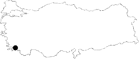 |
For photographs please click on the photo...  |
|
Type:
|
City |
|
Altitude:
|
m |
|
Region:
|
Aegean |
|
Province:
|
Mugla |
|
District:
|
Milas |
|
Village:
|
Merkez |
|
Investigation Method:
|
Excavation |
|
Period:
|
Classical Hellenistic Roman |
|
|
|
 |
|
| Location: It is located on the Becin rocks; 5 km south of the Milas District of the Mugla Province [Bean 2000:16-17]. The city was founded on a rocky land at the skirts of the Sodra mountain; and then enlarged toward the plain over time [Akarca 1954:76]. |
| Geography and Environment: The city was founded among four hills to the east of a 560 m high mountain and on a plain ground stretching in front of this mountain. The internal plain surrounded by mountains has an altitude of approximately 48 m; which might have facilitated the defense of the city [Akarca 1971:29-30]. |
| History: According to the ancient resources; the founder of Mylasa is Mylassos who lived in the Aiolia Island of the Mediterranean Sea. It is known that he is a descendent of Aiolos; who is the reign of winds. The Mycenaean sherds indicating the Mylasa - Mycenaea link have been uncovered at Gencik Tepe. According to the historian Plutarch from Boeotia who lived in the 2nd century AD; Arselis of Mylasa came to the assistance of Gyges in dominating Lydia. Based on the information provided; Arselis was the head of the Carian mercenaries in 680 BC. Mylasa was governed by the satraps under the hegemony of Persia after the mid 6th century BC. The Mylasa tyrant during the Persian war which was ignited by the Ionian revolt in 500 BC; was Oliatus; son of Ibanollis [Bean 2000:15-16]. He joined the military expedition to Naxos undertaken by the provocation of the Milesian tyrant Aristagoras. Once the expedition failed; the Milesian tyrant rebelled and took over some of the ships of the navy. Oliatus was in one of those ships so that his tyranny in Mylasa came to an end [Akarca 1954:77]. Heraclides; the brother of Oliatus; ambushed the Persian army at Pedasos in 497 BC. But the rebel was defeated and Mylasa was again under the hegemony of Persia. Heraclides sided with the Greeks during the Battle of Artemisium in 480 BC [Akarca 1954:77-78]. It is known that Mylasa regularly paid tribute from 450 to 440 BC to the Delian League that was founded in 478 BC. Mylasa regained its independence after the Battle of Eurymedon (Antalya-Koprucay) in 456 BC. But the Persian hegemony came back in 440 BC. It was the center of the satrapy of Caria from the end of the 5th century BC to 360 BC [Akarca 1954:79-80]. The most prosperous period of the capital Mylasa was at the beginning of the 4th century BC during the satrapy of Hyssaldomus; Hecatomnus and Mausolus. Hyssaldomus' son; Hecatomnus minted his own coins in Mylasa; with a depiction of Zeus Labraundos on the obverse; and of a lion on the reverse. It is concluded that there were some activities against the administration based on the inscriptions that are dated 367; 361 and 355 BC [Bean 2000:16]. Due to some events such as an assassination attempt against Mausolus; and an attack against the statue of his father; son of Tyssos; Araissis was sentenced to death; and son of Palatyas; Manites was killed on the stage after he attacked Mausolus in Labraunda [Akarca 1954:80]. Mausolus moved the capital from Mylasa to Halicarnassus [Bean 2000:17]. Mylasa became a territory of Egypt (Ptolemaic Kingdom) during Ptolemy II (283-246 BC). But Antiochus II took over the city after a while. His successor Seleucus II granted Mylasa its dependence. Seleucus rulership lasted until the occupation of Caria by the Macedonian Antigonus Doson. The Mylasans had good relationships with Macedonians until the reign of the successor of Doson; Philip V; who captured a sanctuary of the Mylasans in Labraunda in 220 BC. Then he defeated the Rhodian and Pergamen navies; and besieged Bargylia in 201 BC. A letter he wrote was found at where he called the Mylasans for their contribution. Following their rejection to help; he failed [Bean 2000:18]. An isopoliteia treaty was made between Mylasa and Miletus in 209-208 BC [Akarca 1954:80]. According to the treaty signed upon Mylasa's request; both cities were to give each other the right of citizenship. But settlement in that city was a prerequisite in order to benefit from that right. Mylasa re-minted coins from the date of treaty until the 3rd century AD. Among the first coins is a gold one imitating the staters of Philip II. During the first half of the 2nd century BC; drachms inspired from the Rhodian coins were common. The rest were copper. Besides the native gods; labrys and trident; the depictions included figures of horse; bull; roe deer; eagle; and clam [Akarca 1954:78]. There is also some information about the presense of a bank in the city at the beginning of the 3rd century AD. Antiochus III of the Seleucus Dynasty occupied Mylasa again. After Rome defeated Antiochus III in 189 BC; they handed Caria to Rhodians. Following the uprising against Rhodes in 167 BC; Caria claimed independence again with the conciliation of Rome [Bean 2000:18]. Mylasa took control of the neighboring cities with a sympoliteia treaty in an unidentified date. Euromos; Khalketor; Hydae and Olymos were among those cities. As a result of the treaty the people of these cities became Mylasans [Bean 2000:18-19]. Mylasa was assigned as a mediator in a land dispute between Priene and Magnesia in 143 BC. This gesture is an evidence of the fact that Mylasa was approved in the Greek world. A similar dispute is seen between Mylasa and Stratonikeia in those years [Bean 2000:19]. Mylasa recognized the Temple of Hecate in Lagina; and the right to celebrate the festivities at that location in 78 BC. According to this; the people praying in the temple would have been given no harm. The governor of Asia; Marcus Junius Silanus was given the title "Guardian of the City" in 76-75 BC. Mylasa became a convent center in 51 BC [Akarca 1954:80]. Hybreas and Euthydemos were the popular political leaders of Mylasa during the 1st century BC. When the Parts were dominant in Anatolia; Hybreas got into a dispute with Labineus; who was the ally of the Parthians. As a result of unfavorable developments; Labineus attacked Mylasa; and looted the city [Strabo 14; 2; 24; Akarca 1954:80-81]. The Mylasans made a complaint about Labineus to Augustus in 31 BC. As the inscription including the Augustus' reply presently is not available; it can only be presumed that he supported by building the Temples of Rome and Augustus [Bean 2000:20]. After Euthydemos and Hybreas; the secretary of the city died in 17-12 BC; they were declared heroes [Akarca 1954:82]. With economical problems; Mylasa regained its prosperity under the sovereignty of the Roman Empire; and continued to strike coins until the 3rd century AD. The Governor of the Asia State; C. Marcius Censorinus was entitled as "Savior and Benevolent" during the 2nd-3rd century AD. Censorinus probably contributed in the restoration process of the city after the destruction by Labineus [Akarca 1954:82]. The city became a cult center during the Byzantine Period under the control of Aphrodisias. |
| Research and Excavation: Pococke; who travelled in Anatolia in 1736 - 40; also visited Mylasa. He was followed by Chandler in 1770; Fellows in 1840; and Ross in 1844 [Madran 1989-228; 231-232]. It takes place in the registered archaeological sites list prepared by Ministry of Culture and Tourism. |
| Stratigraphy: |
| Small Finds: |
| Remains: Mylasa took the advantage of the presence of a rich and good quality bed of marble at the Sodra Mountain. According to the inscriptions; there were many public buildings; such as stoa; theater; gymnasium; palaistra; library; bath; agora; aqueduct; and temple in the city [Akarca 1954:86; Yildiz 2003:286]. However; the city has been heavily destructed due to the continuous settlement at the same location until today. According to some researchers; Mylasa of the Archaic Period was situated in Bercin; but later on it was moved to its present location due to the Hellenization politics of Mausolus. On the other hand; Akarca defends the opposite; he claims that most of the finds from Mylasa are from the Archaic Period; and also the land of Mylasa was much more suitable for settlement than Bercin. Although the city wall of Mylasa is dated to the 4th century BC; he believes that it is not an indication of absence of any earlier walls or presence of a newly founded city [Akarca 1971:29-30]. Harbor: The ancient port of Mylasa; Passala is today on the shore of the Hocat Lake at so called Sakiz (Sakizlik); approximately 3 km far from the sea. It was silted up by Saricay; and gradually became distant from the sea [Akarca 1954:89]. In an inscription from the 5th century AD; Passala was mentioned as a village of Mylasa. What survived from Passala is only a tower with a square plan from the Ancient Period; which is 9.5 m long; 6 m high; and 1.7 m wide; accessible from the west through a gateway enlarging inside. There are loopholes at the other directions [Akarca 1954:89]. City wall: The remains of the wall are very rare in Mylasa. The walls which have been preserved on the western side of the Hidirlik Hill separated from the Mount Sodra by a valley are 2.4 m wide; and 2.4 m high built with irregular cut stones. It looks like an interior fortress surrounded by fortifications. But only a few rows of walls has remained [Akarca 1954:86]. No fortification was found to the southeast of the hill. Absence of any traces of a structure inside the walls suggests that it was rather used as a shelter [Bean 2000:23]. To the north of the city lies the Baltali Gate. It was named after the labrys; depicted on the keystone at the exterior part of the arch of the marble gate; which is almost completely standing. The entablature of the gate; which actually consisted of two pillars with capitals decorated with palmetto and fluted ornamentations; and an entablature is presently not available. It is dated to the end of the 1st century BC based on its style. It is presumed that the aqueduct on the gate was hooked up to the aqueduct of the city coming from the east direction; during the first years of Christianity. Theater: It is located on the eastern slope of the Topbasi Hill. Temple/Sanctuary: The Sanctuary of Nemesis: The excavations carried out during the 19th century revealed a sanctuary; presumably dedicated to Nemesis; to the west of the Topbasi Hill. A main room and 4 corridors were uncovered. In the room; there is a mosaic with a depiction of two dolphins mouth to mouth; and a depiction of a bird in the corridor [Akarca 1954:86]. Among the finds are theater masks; probably brought here to be burnt. The Temple of Zeus Carios: Car; Lyd and Mys are brothers according to mythology; therefore Carius belonged to the Carians; Lydians; and Mysians in common. He was depicted on the mints of Mylasa half-naked; wearing a himation; with a stone in his right hand; and a wand in his left hand; and a stag looking up on his right side [Akarca 1954:85]. There are several views about the location of the temple. The eastern slope of the Hisarbasi Hill [Akarca 1954:85-86; Bean 2000:21; 25]; and the Becin Fortress; 4.8 km south of the present Milas (see Becin) [Bean 2000:35-37] are among the possibilities. There is a Corinthian column standing alone on a 3.5 m high podium on the eastern slope of the Hisarbasi Hill. It could have been inscribed; but unreadable. The eastern wall of the building is 91.4 m long; erected of regular blocks [Bean 2000:25]. It is proposed that it might have been built as a replacement of the old temple after Mylasa was looted by Labineus; and completed around 40 BC [Akarca 1954:86]. The heavily damaged inscription did not reveal exactly to which Zeus it was dedicated to. The Temple of Zeus Osogoa: Osogoa is the special god of the Otorkondeis tribe. It is also known as Zenoposeidon. He is represented on coins dressed in a short sleeve khiton and himation; holding an eagle in his right hand; and a trident in his left hand; with a crab next to the trident [Akarca 1954:83]. According to the ancient authors; the temple of Zeus Osogoa is situated in front of the Sodra Mountain to the north of the houses at Guvec Dede. The construction material of the temple was used in the modern structures. Based on the inscriptions and the information by the travellers; a retaining wall was built to prevent the landslide on the mountain side; but only 70 - 80 m of that wall survived. A well proportioned polygonal wall; presumably of the temple; was found. The 3 m high wall consists of large; and wide blocks of stones. One block is approximately 2.74x1.12 m. Based on the masonry; it is dated to the 5th century BC [Bean 2000:26]. The excavations yielded a colonnade; probably of a stoa. Four of those columns were inscribed with the names of the priests of Zeus Osogoa and Zeus Zenoposeidon; and it also records that the earlier priests of Zeus gave eight columns to Zeus Osogoa as votive. Based on the script characters and names of the priests; it was suggested that the portico is probably from the Roman Imperial Period [Bean 2000:26]. Additionally; some roughly carved trident depictions were found on some of the columns. According to the depictions on coins; the temple of Zeus Osogoa is an Ionic order temple with a four columned façade [Akarca 1954:83]. The Temple of Augustus: It was attested by Spon; Wheler and Pococke in the 17th ve 18th centuries; however no remains survived to the present day. According to inscriptions; it is likely that it was located to the north of the junior high school in Milas [Bean 2000:26]. According to the drawings of the travellers; there are 6 columns on short flanks; and 7 columns on longer flanks. It was in Ionic order; standing on a podium. The upper and lower parts of the column shafts were ornamented with leaf motifs. The frieze was decorated with heads of bulls; tripods; and phiales. As the dedication inscription on the façade showed the temple was dedicated to Emperor Augustus [Akarca 1954:82-83]. Uzun Yuva: The building referred to "Uzun Yuva" (Long Nest) was probably a shrine or another significant structure. Only a column with a Corinthian capital has been preserved. The capital is dated to the 1st century BC based on its characteristics; and the podium on which it stands is consistent with that based on the mastery [Boysal 1994:323]. The Sanctuary of Zeus Labraundos / Zeus Stratios: Please see Labraunda for details. Residences: A large structural complex uncovered during a foundation excavation at the Ahmet Cavus Quarter of Milas may have belonged to the perisytle house of a wealthy person. A variety of decorations with a good quality of artistry; high technique; and colorful stones is observed in the mosaics. The motifs include vegetation ornaments encircled with straight and wavy motif bands; series of zigzags; patterns of meanders; square prisms; basket weavings; geometrical drawings; crossing circles; and plaits. The mosaics bear the features of the Roman Empire; or the Late Ancient Period. Potsherds from the Geometrical Period to the Middle Ages were uncovered from the excavated soil. A partially broken olpe from the Geometrical Period looks very similar to the olpes with a buff texture uncovered at Hydae; Iassos and Becin [Kızıl 1999:223-226]. Necropolis/Graves: On the road to Gumusluk lie graves from the Roman Period at the skirts of the Sodra Mountain and slopes of the Hidirlik Hill. Some rock graves are found at the southern skirts of Hidirlik Hill as well. There are 2 or 3 benchs made for the dead and votives inside the graves of various sizes. Some graves also have small holes for the lamps. Most of the graves at the city entrance are vaulted [Akarca 1954:88-89]. Also found are graves from the Hellenistic Period. The Gumuskesen Memorial Tomb: It is located to the west of the city; in a well preserved condition. It consists of the basis including the burial chamber; a peristyle and a pyramid roof. It has a square plan. The burial chamber is accessible through a door to the west. It is decorated with plant and geometrical motifs. The conic hole on the floor of the peristyle probably served for libation to the dead [Bean 2000:27]. Four pillars on the corners of the peristyle support the upper floor. There are two Corinthian columns between each pillar. There is a low architrave with three fascia and a cornice above the pillars and columns. The roof; with a corbelling technique; consists of marble beams transversely accommodated. The ceiling is decorated with geometrical figures and embossed plants. The building is compared to the Baltali Gate in terms of craftmanship and proportions. It is presumed that it is dated to a period following the looting of the city by Labineus to the 1st century BC [Akarca 1954:87-88]. However; Bean believes that further architectural research is required; keeping the time interval longer; and dates the building to somewhere between the 1st century and 2nd century AD [Bean 2000:27]. Berber Ini (Berber Yatagi): It is situated at so called Suleyman Kavagi; 3.5 km on the road from Milas to Gulluk. It is a two-story rock grave like a temple in antis plan. The actual burial chamber is at the bottom floor. There are benches in the chamber which is accessed through a door. There is another door at the back [Bean 2000:27]. The upper floor looks like the façade of a temple with its two Doric columns flanking a pseudo door; two pillars; a two-stage architrave and a triangle fronton [Akarca 1954:88-89]. It is believed that the tomb might have belonged to either Hyssaldomos; or Hecatomnus as there are no similar samples in the region [Bean 2000:27-28]. Akarca dated the tomb to the 4th century BC; based on its echinus profile; and suggested that it belonged to either a ruler or a very influential person [Akarca 1971:36-37]. There is a tomb carved into the rock; 2.5 m left of the Berber Ini. Probably of a child; it has a curved ceiling. The hilly ground in front of that tomb is included within the borders of the modern cemetery of Milas. Some architectural remains; and the researches in the 18th and 19th centuries indicate the presence of an ancient cemetery. Analysis on a processed stone showed that it was part of a monumental tomb; made of the marble from Sodra. It was depicted with a man in pants; and a fire votive on the right; and a palmetto like tree on the left. The inscription records that the tomb was built for a man named Mirsinos by his wife Elpis. Based on the characters; it was dated to the Roman Period [Akarca 1971:37]. Miscellaneous: 100 fragments of terracotta figurines dating from the 5th century BC were uncovered near Milas. They have been already preserved at the Istanbul Archaeology Museum. It is likely that the findspot might have been a votive pitch near a sanctuary [Mellink 1969:221]. |
| Interpretation and Dating: |