|
©The Archaeological Settlements of Turkey - TAY Project
|
|
|
|
|
|
Bozhöyük |
|
|
For site maps and drawings please click on the picture...  |
For photographs please click on the photo... 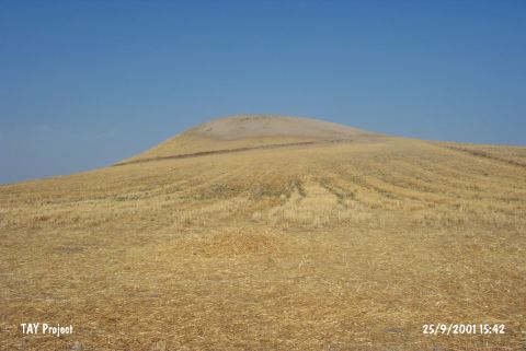 |
|
Type:
|
Mound |
|
Altitude:
|
520 m |
|
Region:
|
Southeastern Anatolia |
|
Province:
|
Adiyaman |
|
District:
|
Merkez |
|
Village:
|
Bozhüyük |
|
Investigation Method:
|
Survey |
|
Period:
|
EBA III |
|
|
|
 |
|
| It lies about 1 km northwest of Bozhöyük Village; northwest of Çalgan Sub-District; 14 km south of Adiyaman Province. The Çogunördü Spring on the north was; probably; meeting the water requirements of the inhabitants. It is not included in the 1:100.000 map. It is a medium sized mound. It measures 15-20 m in height and 125 m in diameter. During the surface collection; exteriorly and interiorly different colored Karaz/Khirbet Kerak ware and painted ware of EBA III were recovered. Also found are the finds dating from the Chalcolithic Age. It takes place in the registered archaeological sites list prepared by Ministry of Culture and Tourism. It was visited during the survey conducted by S. Ezer and his team in 2013. Pot sherds belonging to the 3rd and 2nd millennium BC were found on the surface [Ezer et al. 2015:179]. |
| Location: |
| Geography and Environment: |
| History: |
| Research and Excavation: |
| Stratigraphy: |
| Small Finds: |
| Remains: |
| Interpretation and Dating: |