|
©The Archaeological Settlements of Turkey - TAY Project
|
|
|
|
|
|
Beysehir Höyük C |
|
|
For site maps and drawings please click on the picture...  |
For photographs please click on the photo... 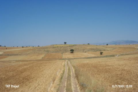 |
|
Type:
|
Mound |
|
Altitude:
|
1080 m |
|
Region:
|
Central Anatolia |
|
Province:
|
Konya |
|
District:
|
Beysehir |
|
Village:
|
Sadikhaci |
|
Investigation Method:
|
Survey |
|
Period:
|
EBA II EBA I |
|
|
|
 |
|
| This site lies south of Eflatunpinar; approximately 6 km west of Sadikhaci Village; north of the town of Beysehir; west-southwest of the city of Konya. It is located on the Beysehir-Sarkikaraagaç motorway where the ridges of Sülüklü overlook the Lake Beysehir. Since there are some other mounds; names unknown; in the surrounding territory; it was called Höyük C by J. Mellaart who discovered it. Sherds of EBA I and II were collected from the surface. It is mostly confused with Kusluca Cemetery discovered by Çokbanker. Particularly the eastern part of the lake should be investigated in detail. |
| Location: This site lies south of Eflatunpinar; approximately 6 km west of Sadikhaci Village; north of the town of Beysehir; west-southwest of the city of Konya. |
| Geography and Environment: This site referred to as Eflatun Höyük by Solecki is also known as Kocadere Höyük. In archaeological literature; the name Beysehir Höyük C seems to predominate. The dimensions of the mound are not reported. |
| History: |
| Research and Excavation: |
| Stratigraphy: |
| Small Finds: |
| Remains: |
| Interpretation and Dating: |