|
©The Archaeological Settlements of Turkey - TAY Project
|
|
|
|
|
|
No Name (Suhut / Agzikara) |
|
|
For site maps and drawings please click on the picture...  |
For photographs please click on the photo... 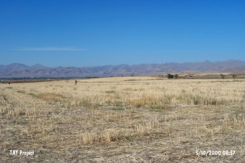 |
|
Type:
|
Mound |
|
Altitude:
|
1150 m |
|
Region:
|
Aegean |
|
Province:
|
Afyonkarahisar |
|
District:
|
Suhut |
|
Village:
|
Agzikara |
|
Investigation Method:
|
Survey |
|
Period:
|
|
|
|
|
 |
|
| It lies in Ganlica Mevkii; 2.9 km southeast of Agzikara Village; northeast of Suhut District of Afyonkarahisar. It is surrounded by planted areas; a building in northern view and a water pump northwest. There is an electricity pole on northwest part of the mound; a heap of stones on top and a terrace in north-south direction on its slope. This site has been observed and documented during TAYEx 2000 Aegean region [TAYEx 5.10.2000]. |
| Location: |
| Geography and Environment: |
| History: |
| Research and Excavation: |
| Stratigraphy: |
| Small Finds: |
| Remains: |
| Interpretation and Dating: |