|
©The Archaeological Settlements of Turkey - TAY Project
|
|
|
|
|
|
No Name (Köse / Kabaktepe) |
|
|
For site maps and drawings please click on the picture...  |
For photographs please click on the photo... 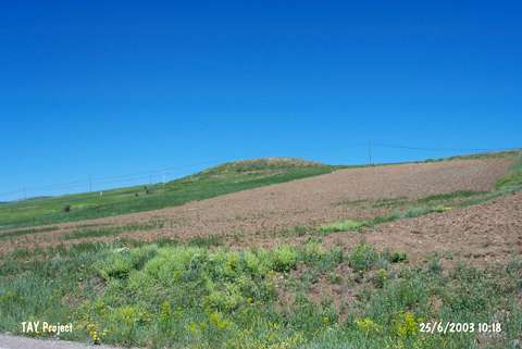 |
|
Type:
|
Mound |
|
Altitude:
|
1690 m |
|
Region:
|
Black Sea |
|
Province:
|
Gümüshane |
|
District:
|
Köse |
|
Village:
|
Kabaktepe |
|
Investigation Method:
|
Survey |
|
Period:
|
|
|
|
|
 |
|
| It ties to the northwest of Köse-Bayburt motorway; about 1 km south of the village of Kabaktepe; north of the district of Köse; southeast of the province of Gümüshane. The site and the area are locally known as Karakilise. The mound was observed and documented during TAYEx 2003 Blacksea-Eastern Anatolia regions [TAYEx 25.6.2003]. |
| Location: |
| Geography and Environment: |
| History: |
| Research and Excavation: |
| Stratigraphy: |
| Small Finds: |
| Remains: |
| Interpretation and Dating: |