|
©The Archaeological Settlements of Turkey - TAY Project
|
|
|
|
|
|
Mezraa Höyük |
|
|
For site maps and drawings please click on the picture... 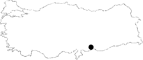 |
For photographs please click on the photo... 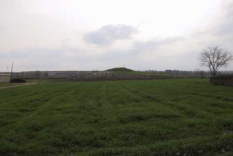 |
|
Type:
|
Mound |
|
Altitude:
|
490 m |
|
Region:
|
Southeastern Anatolia |
|
Province:
|
Sanliurfa |
|
District:
|
Birecik |
|
Village:
|
Mezraa |
|
Investigation Method:
|
Excavation |
|
Period:
|
|
|
|
|
 |
|
| Location: Mezraa Höyük is located southwest of Sanliurfa; 7 km south of the town of Birecik as the crow flies and 1.5 km southeast of Mezraa. |
| Geography and Environment: Mezraa Höyük is on a terrace of the flood plain of the Euphrates; approximately 335 m above the sea level and rises 13 m above the plateau where today vegetables and cotton are grown. The mound extends approximately 180 m from north to south and 140 m from east to west. Earth has been removed from an area of about 40 m at the east end of the mound in order to extend the agricultural land. The remains belonging to several phases of occupation are visible in the section that has been created here. The steep west slope of the mound and gentler north slope have been damaged by both erosion and agricultural activities [Ökse-Tekinalp 1999:175]. |
| History: |
| Research and Excavation: Mezraa Höyük was first investigated by Guilermo Algaze and his team in 1989; during the surveys in the Carchemish Dam region. The evidence indicated that he site was settled from the EBA II-III to MBA I; after which it was abandoned until the Iron Age; occupation continuing through the Hellenistic; Roman and Byzantine periods. During these times the size of the settlement was approximately 0.5 hectare. In 1998-99; researches carried out by A. Tuba Ökse and V. Macit Tekinalp during the Salvage Project of the Archaeological Heritage of the Ilisu and Carchemish Dam Reservoirs coordinated by METU TAÇDAM. The material collected in 1998 researches showed that the site could have a more earlier settlement so there made a detailed surface survey in 1999 and recorded the stratigraphy of the east terrace by closely examining its east section; exposed by the removal of soil. The aim of the excavation made by Derya Yalcikli and V. Macit Tekinalp during 2000-2002 was to uncover the levels of the periods identified in the surveys that had been carried out and record the architectural features as well as the settlement structure. The excavation focused on two areas; firstly; the terrace section at the top of the mound that had been investigated in 1999; and the east slope; where a large amount of Medieval pottery had been collected; secondly; the southeast slope; where the abundance of EBA pottery suggested that no levels of later period existed here [Ökse-Tekinalp 2002:159]. |
| Stratigraphy: Excavations made in two different areas on the east slope and the southeast slope. There are seven (I-VII) building levels on the east slope and six (I-VI) building levels on southeast slope. It has been determined that the early periods on the east slope of Mezraa Höyük were covered by the Medieval levels I-III. In this area; levels dating to the second half of the 3rd Millennium BC were revealed beneath levels IV-V belonging to the first quarter of the 2nd Millennium. Beneath the 3rd Millennium levels II and III on the southeast slope; which had been damaged by the Medieval silos of level I; were exposed levels IV and V; dating to the first half of the 3rd Millennium. Level VI; below these; can be dated to the end of the 4th Millennium. The excavations on the southeast slope indicate that there was unbroken seetlement at this part of the mound from the end of the 4th Millennium through to the second half of the 3rd Millennium BC [Yalçıklı-Tekinalp 2002:205-206]. The results of the 2000 excavation season suggested that while eastern slope was densely settled during the Medieval Period; there was no settlement on the southeastern slope; this area was used only for grain silos. The excavations on the south east slope indicate that there was unbroken settlement at this part of the mound from the end of the 4th through to the second half of the 3rd Millennium BC [Yalçıklı-Tekinalp 2002:206]. |
| Small Finds: Architecture: Excavations carried out on the east slope indicate that I-III levels date to Medieval Period and the architectural remains of an early period found in building levels IV-VII. The materials suggest that building levels IV-V date to the MBA and VI-VII date to the EBA III/IV. In building levels VI and VII found walls damaged by the destruction caused by field clearance in this part of the mound [Yalçıklı-Tekinalp 2002:194-95]. The architectural remains belonging to the EBA and Late Chalcolithic found in building levels II-VI at the excavations on southeast slope. In building level II which an EBA III/IV date was suggested; found a wall from limestone and uncovered a small section of a floor that seems to have been paved with flat stone slabs. To the southwest of the wall was a badly destroyed terrace wall; which served to support a street paved with small river stones. There is another wall belonging to this building level. The architecture in building level III; which is dated to the end of EBA I - beginning of EBA II is represented by an extremely damaged room. Some parts of the walls; constructed from limestone were uncovered. Only a small part of the floor in this room could be determined; since it had been damaged by the four silos of level I. Two phases of the floor (a and b) were identified. Beneath the floor was a ground fill of large mudbrick blocks. In level IV dated to EBA I uncovered part of a structure had two phases (a-b). There is an antechamber in both phases of the building and a limestone paving belonging to the early phase was uncovered. Building level V is dated to EBA I as the previous level and two parallel limestone walls were uncovered [Yalçıklı-Tekinalp 2002:190-92]. During 2007 campaign on the northeast slope, the researches performed in the west section of the wall of the building that lies in northeast-southwest direction which constitutes the building level IV discovered during the previous excavations and was dated to the second half of 3rd Millenium BC it was found that the building foundation consisted of a condensed adobe filling. This building is important so that it composed the east side of the building that was discovered through in situ findings that belong to the second half of 3rd Millenium BC found during 2002 campaign. Hearth basis were unearthed in three different levels on the southwest edge of the area. These findings suggest that the same area was used as a hearth location for a long period of time and belong to the second half of 3rd Millenium BC. The building level containing these hearths has a wall immediately below that was built using two courses of adobe bricks that extend in east to west direction, another wall that is in direct angle with this wall in north direction, meeting with it in north to south direction. Based on the findings this level belongs to the second half of the 3rd Millenium BC [Yalçikli 2009:130-131]. A room of a structure from Architecture Layer VII is encountered on the East slope in 2002. The Northeast and Southeast section of the room is excavated and it is observed that the floor is paved with irregular small stones. Remains of a tubular workshop that is not well-preserved is located in the centre of the room, as well as three depot-jars placed in front of the Northeast wall and two depot-jars placed in front of the Southeast wall [Yalçõklõ-Tekinalp 2011: 124]. In the Northwest slope below the Architecture Layer IV the walls and stone floor that are used by the upper layer are excavated. It is observed that two walls, one parallel and one perpendicular are creating a space in the East part of the wall. In Architecture Layer III one section of two rooms of the building which is constructed in Northwest-Southeast direction is unearthed. The rooms of this building are surrounded by 1.40 - 1.60 m thick walls constructed by four rows of adobe bricks. The walls and the floor or the building in the Northwest are plastered by white lime. On the Southeast wall of the room a niche is excavated while its walls and the floor are also plastered by white lime [Yalçõklõ-Tekinalp 2011: 126]. 2 m the North Wall and approximately 0.40 - 0.60 m of the West wall which is perpendicular is excavated from Layer VIII. The South looking face of the adobe wall structure that is preserved about 1 m high is covered with three layers of white plaster. One row of adobe bricks and a part from the foundation of another wall is located in the West of this room in the North-South direction [Yalçõklõ-Tekinalp 2011: 127]. Pottery: In building levels VI and VII dated to EBA III/IV on east slope found three types of ceramics. These are; "standard ware" group made of a paste containing a large amount of fine sand-temper and a small amount of lime and mica; was wheel-made; "caliciform ware" type is a rim sherd from a light brown-colored pot made of a paste containing fine lime and mica inclusions; wheel-made and fired at a high temperature; thin-walled; with horizontal grooves formed on the wheel and "ring burnished ware" type represented by two vessels; made of a red-brown fabric; are almost completely preserved. Both vessels have the same decorative characteristics common in the Middle Euphrates basin [Yalçıklı-Tekinalp 2002:199-201]. There are two types of ceramics in building level II at the southeast slope called standard and metallic ware. The pottery found on the floor of the destroyed building in level III can be divided into three groups. These are the examples of standard ware; cyma-recta ware which is represented by a light greenish colored base sherd with fine sand temper and reserved slip ware represented by body and shoulder sherds. In building level IV found two types of ceramics; standard ware and coarse ware. In building level V fine standard ware; medium coarse standard ware and coarse ware sherds found [Yalçıklı-Tekinalp 2002:201-204]. The sherds unearthed during the 2007 campaign during the researches on the east section of northeast slope mainly consist of chisel decorated cooking vessels with poured paint [Yalçikli 2009:130]. A floor was reached that was composed of stone plates during the same campaign. The floor is slowly losing its quality towards the southeast direction where it lowers. Among the in situ finds that were dated to the 2nd half of 3rd Millenium BC found on the stone plate floor there were metallic paint decorated drinking cup sherd specimens which are similar to those in Karkamis, Gre Virike, Harabezikan, Titris Höyük, Horum Höyük, Hayaz Höyük, Tall Bi'a, Tell Matsuma and Tell Hadidi [Yalçıklı 2009:133]. In 2002 an extraverted rimmed and sharp bodied crème pot is captured which is made of thin sand added rare porous lime-less paste in Grave M-16 which is unearthed in the East slope [Yalçõklõ-Tekinalp 2011: 124]. An extraverted rimmed pot among the potteries captured in the depot in Layer VII on the East slope is short necked, wide bodied and ring based with decorations made by burnishing stone. An unopened pouring lip exists on the lower part of the vessel. The fact that the pouring lip is unopened on this pot found in the depot and since its broken part was repaired with bitumen suggests that this vessel was utilized for storing liquids [Yalçõklõ-Tekinalp 2011: 125]. In situ vessel pieces are found on the stone base which is partially preserved in the Architecture Layer V in the Northwest slope. Various types of ceramic samples are captured in rooms of this architecture in Trenches M 12. Large and small pots constitute a major group named as "Standard Ceramics" among these. Horizontal groove decorated cups which are named as "Caliciform" and "Euphrates metallic" type cups represent other ceramic groups [Yalçõklõ-Tekinalp 2011: 126]. A pot which belongs to the standard pottery group used in Architecture Layer III is wheel made, light brown pasted and slipped, has an extraverted rim and concave base [Yalçõklõ-Tekinalp 2011: 126]. Clay Finds: In building level VII on the east slope found a half-preserved baked clay mould for producing metal objects; with a rectangular prismatic shape and negative spaces of various implements on four sides [Yalçıklı-Tekinalp 2002:201]. Human Remains: In the building level IV on the southeast slope a medium-sized pithos grave (M3) uncovered. The pithos with a squoted vessel placed at its side; had been placed with its mouth facing southeast. Inside the pithos was a skeleton of a 35-40 year old woman; in the hocker position. It is reported by the researchers that the connection between this grave and the surrounding structures was not possible to understand. An other grave was found in building level V on the southeast slope. A damaged jar burial (M1) found beneath the floor of building level I belonged to the early phase of the building. The grave was formed by sherds of four different jar placed side-by-side. Despite the upper part of the burial having been damaged; it was clear that the burial was of a newborn baby; placed in the hocker position [Yalçıklı-Tekinalp 2002:191-192]. The 2007 campaign unveiled a pithos grave placed underneath the floor in the east area. This grave belonged to a newborn and was made of a burnished kitchen vessel with triangle knobs. The baby skeleton was laid in hocker position. The bottom of a tripod with retouched sides used for covering the pithos and a terra cotta rattle were found next to the pithos grave [Yalçikli 2009:133]. In 2002 two simple earth ware graves and one pot grave are unearthed in Layers IV and V in the East slope the age of which is determined as MBA. The first of these graves is found in the Northeast of the Trench R 12 and the second in the West edge of Trench (M-9) S 13. Both graves are simple soil typed and skeletons inside are well preserved and laid in hocker position. The skeleton found in Grave M-16 is laid in Southwest-Northeast direction facing Southeast. Grave M-9 is laid on the stone floor belonging to Architecture Layer IV in Northwest-Southeast direction facing Northeast [Yalçõklõ-Tekinalp 2011: 124]. |
| Remains: |
| Interpretation and Dating: Although only the second season of the excavation has been completed; it is reported that the site has yielded evidence for a continuous settlement from the Late Chalcolithic to the end of the Middle Bronze Age. |