|
©The Archaeological Settlements of Turkey - TAY Project
|
|
|
|
|
|
Hünugu Tepesi |
|
|
For site maps and drawings please click on the picture...  |
For photographs please click on the photo... 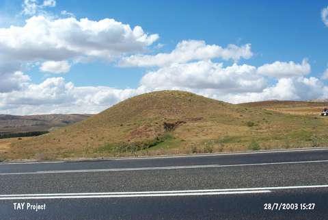 |
|
Type:
|
Mound |
|
Altitude:
|
1380 m |
|
Region:
|
Central Anatolia |
|
Province:
|
Sivas |
|
District:
|
Merkez |
|
Village:
|
Koyuncu |
|
Investigation Method:
|
Survey |
|
Period:
|
|
|
|
|
 |
|
| It is located in the 40th kilometer of the Sivas-Sarkisla highway; north of the village of Koyunlu; in the province of Sivas. The occupational layers of the 12 m high gypsum hill; located southeast of the motorway are 4-5 m in thickness and the settlement area is about 40-50 m in diameter. The hill is destructed by large pits. The collected material is dated to Roman and Byzantine periods and the ceramics found in the pits on the southern and western slopes belong to the Chalcolithic Period. |
| Location: |
| Geography and Environment: |
| History: |
| Research and Excavation: |
| Stratigraphy: |
| Small Finds: |
| Remains: |
| Interpretation and Dating: |