|
©The Archaeological Settlements of Turkey - TAY Project
|
|
|
|
|
|
Destimelik |
|
|
For site maps and drawings please click on the picture...  |
For photographs please click on the photo... 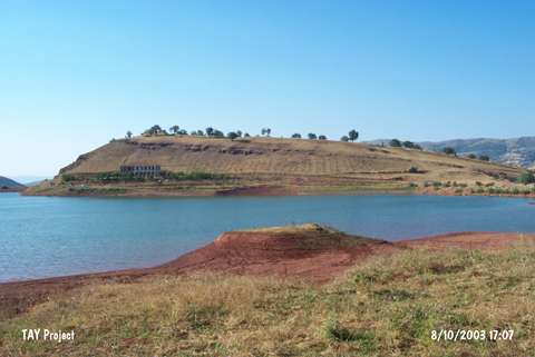 |
|
Type:
|
Upland Settlement |
|
Altitude:
|
1050 m |
|
Region:
|
Black Sea |
|
Province:
|
Tokat |
|
District:
|
Zile |
|
Village:
|
Güzelbeyli |
|
Investigation Method:
|
Survey |
|
Period:
|
|
|
|
|
 |
|
| It is immediately north of the Güzelbeyli (Belpinar) irrigation lake; 1 km southwest of the village of Güzelbeyli in the Zile District of the Tokat Province. It is an upland settlement about 25 m high from the lake level. A part of the hill is being used as a cemetery. Plenty of EBA; 2nd millennium BC and Roman pottery sherds were found around the pit on the southern section facing the lake. |
| Location: |
| Geography and Environment: |
| History: |
| Research and Excavation: |
| Stratigraphy: |
| Small Finds: |
| Remains: |
| Interpretation and Dating: |