|
©The Archaeological Settlements of Turkey - TAY Project
|
|
|
|
|
|
Yukari Maltepe Höyük |
|
|
For site maps and drawings please click on the picture...  |
For photographs please click on the photo... 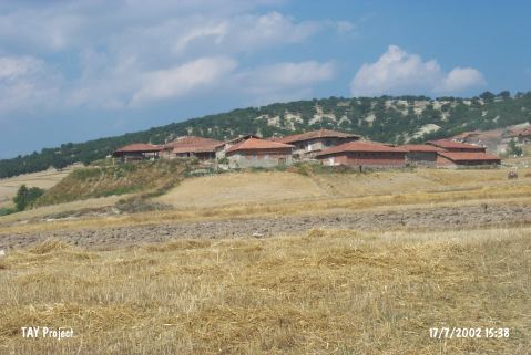 |
|
Type:
|
Mound |
|
Altitude:
|
775 m |
|
Region:
|
Central Anatolia |
|
Province:
|
Çorum |
|
District:
|
Iskilip |
|
Village:
|
Veletler |
|
Investigation Method:
|
Survey |
|
Period:
|
|
|
|
|
 |
|
| It extends in the northwest-southeast direction; beneath Veletler Village; southeast of Iskilip District of Çorum Province. 2.4 km west of the village Cingillioglu Bridge takes place. The mound is 10 m high and it is located on the northern border of the village. It has been obscured by the village houses. It lies on a natural alley opening to the Kizilirmak River. It was discovered during the 1997 Survey of Çorum conducted under T. Sipahi and T. Yildirim. Pottery of the EBA and the Iron Age was collected from the surface. |
| Location: |
| Geography and Environment: |
| History: |
| Research and Excavation: |
| Stratigraphy: |
| Small Finds: |
| Remains: |
| Interpretation and Dating: |