|
©The Archaeological Settlements of Turkey - TAY Project
|
|
|
|
|
|
Yikilgan Siginagi |
|
|
For site maps and drawings please click on the picture...  |
For photographs please click on the photo... 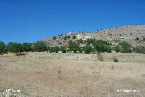 |
|
Type:
|
Rock Shelter |
|
Altitude:
|
980 m |
|
Region:
|
Eastern Anatolia |
|
Province:
|
Elazig |
|
District:
|
Agin |
|
Village:
|
Yenipayam |
|
Investigation Method:
|
Survey |
|
Period:
|
ÜP |
|
|
|
 |
|
| Location: This rock-shelter site is located northwest of the city of Elazig; east of the Arapkir Stream; northeast of the village of Yenipayam (also called Hastek); and 5 km west of the town of Agin. It locates 500 m south of Gedikler Mevkii. |
| Geography and Environment: The area between Agin and Elazig must have been suitable for Palaeolithic habitation and hunting because the region is rich in natural resources and because the Yikilgan rock-shelter provided a protected camping area. Yikilgan; a large rock-shelter whose front terrace has been blocked by stones; is fit to be used in the winter because the entrance faces away from the northern winds. Although it is reported that the rock-shelter is large; its dimensions have not been given. |
| History: |
| Research and Excavation: The site was discovered in 1971 by Kökten during survey of the prehistoric sites expected to be flooded by the Keban Dam Lake. |
| Stratigraphy: |
| Small Finds: Kökten found several chipped stone artifacts including large flake tools; points; scrapers and numerous flakes by the cave entrance. It is proposed that the shelter functioned as a workshop [Kökten 1974:2; fig.20]. Kökten believes that; if cleaned and researched; the front terrace by the entrance of the rock-shelter might yield important Palaeolithic finds. |
| Remains: |
| Interpretation and Dating: |