|
©The Archaeological Settlements of Turkey - TAY Project
|
|
|
|
|
|
Yenibademli Höyük |
|
|
For site maps and drawings please click on the picture... 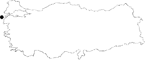 |
For photographs please click on the photo... 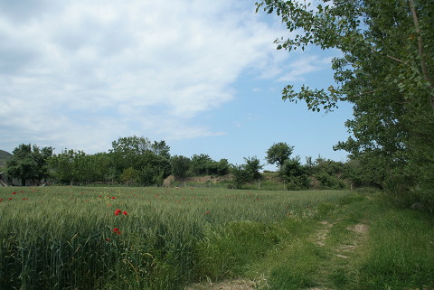 |
|
Type:
|
Mound |
|
Altitude:
|
0 m |
|
Region:
|
Marmara |
|
Province:
|
Çanakkale |
|
District:
|
Gökçeada |
|
Village:
|
Yenibademli |
|
Investigation Method:
|
Excavation |
|
Period:
|
EBA II |
|
|
|
 |
|
| Location: Gökçeada (Imroz) Island is 32 miles from the Çanakkale Harbor in the west of the Gelibolu Peninsula, in the Northern Aegean Sea. The mound lies 1.5 km far from the sea; 1 km southwest of the Yenibademli Village; some 1.7 km south-southwest of the Kaleköy settlement on the northern part of Gökçeada (Imroz) [Hüryilmaz 2001:map.2]. The mound is reached through an asphalt road running to Kaleköy, and can be observed from the road. |
| Geography and Environment: The Büyük Dere (Ilissos Stream) supplying the water requirements of the inhabitants of the mound being the biggest running water of the island; fed by small streams coming from the high hills in the center of the island; flows near the western part of the mound. The palaeogeographical and geoarchaeological studies proved that the site used to locate at the end of a bay during the third millennium BC. on the south-southeastern shore [Hüryilmaz 2000:232] and the bay was getting nearer on the west. To the south of the ramp giving the access to the settlement; the bedrock was reached at 3 m depth at present. The narrow bay was filled with the alluvial of the stream. The mound is 18 m high above the sea level; 5 m high above the lowland next to it and measures 130x120 m in dimensions. The cultural deposit is of 3-5 m thick. |
| History: |
| Research and Excavation: It was reported by N. Firatli in 1964. The excavation was started in 1996 under H. Hüryilmaz. The excavation is being carried out on the western; eastern and southern parts of the mound [Hüryilmaz 2001:draw.1]. In addition to the excavations by H. Hüryilmaz et al. that took place in 2005; the archaeozoological and lithological researches continued as well [Hüryilmaz 2007:341]. |
| Stratigraphy: Only the preliminary reports of the first four years were published. The general stratification is not reported definitely yet. Trench E 9 on the western terrace yielded 4 building levels while trench H 9-10 on the eastern terrace revealed 5 building levels. The trenches that will combine the eastern and western trenches were not opened yet. During the 2001 season; the excavation was focused on the northwestern section of trench H 10 and three architectural layers dating to EBA II were determined. It is reported that; aside settlement of the third millennium BC; there is also a settlement dating to the end of the second millennium BC (Late Mycenaean Period) on the southern part of the mound. As a result of the studies carried out in 1996-2013, the existence of three cultural periods were determined. These are; (in descending order) 1- The culture Rum (Greek) citizens, 2- Late Bronze Age, 3- Early Bronze Age II (according to Aegean chronology) [Hüryilmaz-Yalçikli 2015:335]. |
| Small Finds: Architecture: By the 1999 excavation campaign; walls of structures with quadrangular plans suggested to be contemporary with Troy I by the excavator were uncovered. The walls have stone foundations and probably stone bases and a mudbrick superstructure. The foundations were built by combining short and squat plate stones in good order with loam mortar in the outer and inner surface; and filled with small stones in between. Walls of some houses were battered either outward or inward [Hüryilmaz 1998:362] probably due to a massive earthquake. A floor coated with red clay was observed in one of the buildings. The ceilings were supported by wooden posts. A fortification wall (?) was uncovered on the western part of the trench E 9 while intense stone walled constructions were observed at trench H 10 on the eastern terrace [Hüryilmaz-Sevinç 1999:315]. The construction plans were not obtained clearly as the dimension of the trench is confined. Hüryilmaz states that they are long houses [Hüryilmaz 2000:230-231]. During the 2001 fieldwork; typical Aegean long houses with right angel corners were encountered and it was determined that there was not any change of material and construction technique between the layer. It is suggested that the 0.80-1 m thick wall; which was exposed in the northeastern trenches; might belong to a monumental structure [Hüryilmaz 2003:99]. During 2003 season fieldwork four building foundations uncovered at trench H7 which two of them (rooms 1 and 2) are on bedrock and the other two (rooms 3 and 4) inside bedrock. It is understood that the curved foundation 3; which is observed in the room called Pit Hut; is the extension of foundation 4; that is uncovered in 2002. After foundations 3 and 4 are removed bedrock excavated in a depth of 2 m and four phases observed. Four architectural layers found at trench G8 and three at trench H9 and all of them dated to EBA II [Hüryilmaz 2005:11-14]. 2004 season excavations carried on at the trenches G7; H10; G10 and F10. In trench G7 a cultural deposit of 6 m was excavated and 6 architectural layers of EBA II were observed. Western half of he Pit Hut was uncovered. It was 3.65 m in diameter with a single room and the finds showed that the it was contemporary with Troy I. Excavations revealed two architectural layers in trench H10 and three layers in both trenches G10 and F10 [Hüryilmaz 2006:261-264]. Many archaeological data was obtained through the building phases which are the contemporaries of the Troian 1 period; inside the trench F10; that coincides with the most destructed section of the hill's plain ground during the 2005 excavations. Two building foundations which were constructed in east-west; northeast-southwest directions did not provide a complete architectural entirety due to the destruction inside the trench where the architectural remains of four building phases were found. The preserved length of the foundation; constructed in east to west direction is 2.90 m; and it is 1.10 m wide. The inside filling of this foundation consists of small gathered stones; the external and internal surfaces consist of neatly worked midsize stones. The second foundation; that extends in northeast-southwest direction is 2.70 m long; the preserved width is 0.60 m. The stones that form the internal surface of this foundation where three layers of stones sit on one another; were found in a scattered state [Hüryilmaz 2007:342]. Just as the way the remains that identify the second building phase inside the F10 trench; a small bastion against which the narrow wall of the adjacent buildings leaned puts it in a significant position. The foundation remains in northwest-southeast direction found at the northeast corner of the trench (length: 3.20 m; width: 0.60 m); coincided with the foundation in northeast-southwest direction unearthed in 2004; to determine the corner of the building [Hüryilmaz 2007:342]. Among the other foundations of the 2nd building phase; the 1.2 m opening found at the southwestern tip of the foundation in northeast southwest direction; suggests the door location. The foundation of a small bastion was revealed which has an interior covered with irregular stones; and an exterior surface covered with neatly worked large; and flat stone plaques; that lean a gainst the a.m. foundation in southeast direction [Hüryilmaz 2007:343]. The building remain that represents the building phase IV; and which does not possess any architectural integrity was revealed at the western cross section level. The preserved length of the foundation extension; that is in the west direction is 2.10 m; its width is 0.80 m. The presence of holes meant for the erection of wooden profiles approximately 0.9 m deep were observed inside the stone construction of the foundation; which was planned larger than the upper building layers. Those holes are especially significant as proofs for the strengthening of the mud brick walls by the erected wooden logs. The flat schematic idol; chipped on both sides; and placed inside the foundation construction reconfirms that idols were placed in the foundations due to their beliefs [Hüryilmaz 2007:345]. It was found that the remains of the three building phases on the east side of the mound; east of the trench H9 are the contemporaries of Troia I period. Two foundation fragments of building phase I determine the corner of a building. But the fact that the long foundation in the south of the rectangular plan building could not be detected up to now can only be explained by the destruction of this section of the mound by the agricultural activities that have been going on for many years [Hüryilmaz 2007:344-345]. It is found that the building phase II foundations were seriously destructed during the construction of building phase I buildings [Hüryilmaz 2007:345]. It was determined that the building phase II architectural remains that produced more satisfactory results on the structure of the city; were three buildings in northeast-southwest direction. Those adjacent; rectangular plan buildings shared a long wall. The northwest building has a width of 5.20 m. When the sections revealed during the previous excavations are added; it is longer than 7.50 m [Hüryilmaz 2007:345]. Although adjacent to the northwest building the measured building size of the building which has the shorter side further south; is 3.40x10.40 m. When evaluated together; this building; and the northern building may be related with the typical Aegean EBA "House Row" [Hüryilmaz 2007:346]. The dimensions of a third building found in building phase II could not be determined [Hüryilmaz 2007:346]. Two building remains contemporary of Troia I period; and a street were found inside the trench SW; in the north of the mound. The remains of building phase I form the foundations of three separate buildings. The first of those in the southeastern direction was constructed in northeast-southwest direction. There are hearth remains inside which was built by gathered stones. The remains of the second building inside the same building phase were found as two separate foundations. Since it was not completely excavated the building plan is not known. There is a street not larger than 1.6 m between building 1 and 2. Small and midsize stones were used as pavement on the late phase of the street which apparently consisted of two phases; and larger stones were used in the latter phase. The third building on the northern section of the trench has apsidal plan [Hüryilmaz 2007:348-349]. During the 2006 campaign researches went on at three trenches on the plains of the mound's hill (H8, G8 and G9). Inside the trench H8 in the northeast of the mound the remains of four building levels that were dated to the first half of the 3rd millennium were found. A section of the remains that belong to the 1st building level right below the surface soil was found in the northwest of the trench, another section was found near the southwestern corner. These delimit the northeastern corner of the northeast-southwest lying building which was partially unearthed in 2002. Among the stone paved foundation fragments the comparatively small foundation unearthed in the west of the remains that lie in north-south direction is the extension of another building that was found in 2001. A part of the building remains that delimits the 2nd building level was found in the north, and another part was found in the west. Among these remains which are independent from each other the two northern foundation fragments belong to a building which was constructed in east-west direction. Although no reliable plan could be obtained out of the remains that represent the 3rd building level, it was found that these were the elements of two different buildings. Out of these the extension of the northern building was in the area that was not excavated. The western extension was heavily destructed. The second foundation fragment that was built in north-south direction was found in a better condition inside this trench. The southern extension could not be found during the researches in 2001. A fragment revealed inside the building level 4, which is at the same height with the eastern cross-section of the trench and the bottom half of a cereal jar which leaned against it in southern direction were researched inside a narrow area. The eastern extension of the building foundation which does not constitute an architectural integrity was found at the cross-section of the trench the western extension was found underneath one of the foundations in the 3rd level [Hüryilmaz 2008:430-432]. Inside the G8 trench in the northwest section of the plains on the hill four building levels were found which are the contemporaries of Troia I period. The remains of the building level I are located in the west of the small stone paved street which extends in northeast-southwest direction towards the center of the mound. These remains which start right below the surface soil belong to two different buildings. The narrow façades of these buildings which overlook the street were built by considering the position of the land, in northwest-southeast direction. The building remains that delimit the 2nd building level are more limited, and belong to a single building that lies in northeast-southwest direction. It was found that the entrance of this building was at the southwestern direction based on the door space and the threshold stone. This building is different compared to the buildings of Level 1 in terms of direction and gives certain clues on the alteration in the order the buildings in the northwestern section of the mound were built. The remains that were found inside the building level 3, are limited to the foundations of a building built in northeast-southwest direction. The western part of this building's foundation has a declination towards the northwest and some part of it was destructed. The height of the building is 0.80 m, and its entrance and dimensions could not be identified. The remains of the curved building inside the building level 4 is yet to be comprehended. The excavation direction has to be extended in northern direction in order to comprehend the wall that at one extension continues through the northern cross-section, and at the other makes a turn towards the southeast [Hüryilmaz 2008:432-433]. The last trench of the research in 2006 which is G9 is at a nearby location from the center of the mound. At that location the remains of five building levels that were dated to the first half of the EBA (contemporary to Troia I) were revealed. The remains that were identified in the northwestern corner of the trench that belong to the level 1, are the extension of the long wall of a building extending towards the center of the mound, which was unveiled in trench G8 in 2001. The rest of the same building's remains were found in the southern half of the trench. These delimit three different buildings. The southwestern corner of the northern building constitutes a right angle and the southeastern corner is an acute angle. The reason of this may be related to the topographic character of the land on which the building was erected and the difference of elevation. Parts of the remains that were revealed inside the building level 2, are located in the northern half of the trench. As far as the preserved part reveals, two foundation fragments that delimit the corner of the building near the eastern cross-section were connected making a right-angle. Another foundation fragment in this building level was found in the southeastern corner of the trench. These remains are underneath a foundation partially inside the level 1, and they extend in northeast-southwest direction. The remains inside the building level 3 that were researches within a narrow area were found inside the northern half of the trench. The building level which is represented by a small foundation fragment was revealed in the northeastern corner of the trench. The southern end of these remains in north-south direction lies underneath the area which could not be accessed yet. The remains of the building level 5 which was researched within a triangle in the north of the trench was preserved to a height approximately of 0.90 m [Hüryilmaz 2008:434-435]. Remains of four building levels that were dated to EBA II period were found in the east section of trench F10 north of stone paved ramp that provides access for Yenibademli in 2007. Due to their close locations to the surface the remains of the heavily destroyed building level 1, do not display an architectural integrity. The building foundation revealed in building level II and a portion of the foundation found in 2005 all together belong to a building constructed in northwest-southeast direction. Five building foundations were revealed in building level III. It is assumed that the remains that delimit the building level IV belong to a large size building. The building remains found inside the trench at plan square G9, were dated to Troia I period. Out of the five building levels found here the 1st contains a rectangular planned building that lies in northeast-southwest direction, the in situ doorjamb stone, two fragments of the wall foundations that belong to a rectangular planned long building, the west and south foundations of a trapezoid planned building at building level II, the stone masoned partition wall's foundations lying in northwest-southeast and the northwest corner of a building made with stone walls in building level V. This trench did not contain any building remains that belong to levels III. and IV. Only the culture deposits of these were identified. Three building remains were found at the trench inside the G10 plan square. These were dated to building level II [Hüryilmaz 2009:242-247]. Stone laid foundations of two building level I buildings were unearthed immediately underneath the ground surface at trench G8 located in the center of the north section of the mound in 2008. The remains were dated to EBA II, and the east building is 6.50 m long and lies in northwest-southeast direction. The sideways slide identified on the building's foundation may have taken place due to a relatively mild earthquake. The foundation remains of the second building were identified inside the west half of the trench. One of the remains marks the longer wall of the structure and the other one marks the division wall in between. The unearthed part of the building is 11 m so far, and has a northwest entrance. No remains were found inside building level II and III's deposits at trench G8. Some remains that suggest two separate structures on the west side of the trench belong to building level IV. Of these EBA II period dated structures the ones next to the west cross-section consists of two parts and those interconnect through a right angle [Hüryilmaz 2010:232-234]. Three EBA II building level remains and assemblages were revealed in the G9 trench located at the center of the mound. Out of those building levels the first was identified underneath the east remains of the chapel with preserved foundation stones in the northwest of the plain at the peak of the hill, and named "monastery" by the islanders. In order to prevent a possible mix-up that level was named "Pre-Yenibademli I". This increased the number of building levels to 8. Although the building remains of a level that was built following a fire disaster have not revealed its plan considering the building material and construction technique a similar style was maintained. Remains that consist of two stone laid foundation parts suggest it was designed in northwest-southeast direction. Other remains of Yenibademli building level I were identified underneath that level. Remains of building level I in the north half of the trench point out at three structures. Two of those are located on both ends of a stone paved street laying in northeast-southwest direction, the third is underneath the Pre-Yenibademli I remains. The narrow side of the first building located west of the street is in parallel with the street and together with the building in its north these compose a building block. The structure built in the east of the street has a rectangular plan and its longer side is in parallel with the street. The stone laid third building's foundation remains were identified in the north half of the trench and those suggest that the building lied in northwest-southeast direction. The four building foundations identified in the south half of the G9 trench are the extensions of the building foundations unearthed at trench G10 in 2004. One part of of the building remains that represent Yenibademli building level II was identified in the center of the trench and the other part was identified in the south half. The northeast-southwest lying building foundation located in the center is not related to other buildings. The other building foundations identified on the southeast corner of the trench belong to the foundations on the entrance side of the large building that lies in northwest-southeast direction which had apparently gone through a fire disaster unearthed at trench G9 in 2007. The north one of the two foundation remains east of the trench belongs to the long structure wall. The shorter wall on the entrance side of the same building and the 1.10 m wide gate opening on this wall were also discovered. The doorjamb was found in situ inside the main room. The other remains composing a direct angle at the long wall south of the large building thus providing a clue for the identification of the door opening form the front part of the trapezoid planned second large building unearthed at trench G9 in 2007. Considering the other two buildings unearthed during previous excavations south of that building it is observed that the structure group with commonly shared long walls at this section of the settlement was extended towards the center of the mound [Hüryilmaz 2010:234-237]. Architecture remains that belong to EBA II in the G8 trench which started to be excavated in 2008 and extended in western direction in 2009. Evidences are found that the structures in this part of the mound extend in northwest-southeast direction. The tall wall and its support stones that belong to the stander which is adjacent to a building's East face that determines the Layer I out of four layers which belong to EBA II are excavated. The wall remains which are detected in the Northern profile of the trench and shifted in Eastern direction helped identify Layer II. The wall of Layer III is preserved up to 1.45 m height. Some facts bring to mind the possibility of an earthquake: that the top stone row shifted 1.25 m in eastern direction, that there is a gap on the Southern walling, and that lowest stones are exposed [Hüryilmaz 2011:128-129]. During the studies carried out in 2009 on the G9 trench it was found out that the building was erected in northeast-southwest direction and its entrance was on the narrow wall in the South. The layer I building which is right under the structure and erected almost in the same direction was exposed to fire. A wall is unearthed under the arrow wall in the North which is erected in the Northwest-Southeast direction and built using the fishbone style which proves the existence of genetic links between Yenibademli and Troia I settlements [Hüryilmaz 2011:130-131]. Plans of the two buildings dated EBA II opened in G9 trench have become clear in 2008. The floors of these two buildings erected in the northwest-southeast direction are pressurized clay. The entrance of the building in the northeast is from northwest. It is rectangular planned consisting of a single space. It has an oven with the mouth facing northeast. The entrance of the building in the south which is narrower is from southeast. There is no passage in the wall between the two buildings which were being used as houses [Hüryilmaz 2011:131-132]. The studies in 2010 were continued in the trenches G8, F8, F9 and F9-west. Locating on the eastern side of Trench G8, the wall is tilted from vertical axis to 1.30 m east. On the stone masonry of the extension of the wall in the north direction, traces of sliding, spaces between stones were observed. And the last stone rows of the wall were fallen and found on the north terrace. Therefore, it has been suggested that the destruction and sliding observed on the wall could be connected with the earthquake. In addition to this, no defensive wall could be found on the northwest section of the plains of the hill. The north section of the settlement was kept open to the sea and the north wind, since no defensive wall was found on the northeast trenches of the plain. Architectural remains of three building levels which are dated to EBA II were found in Trench F8. The structures found in Building Level I helped to define two adjacent buildings which were located in the same direction. The foundation with stone masonry of the one on northeast shows that the building extending on the northwest-southeast direction is with a length of 15 m and a width of 5.40 m. The second building is adjacent to the long wall of the first building on the southwest direction. Only one of the long walls and a set of stones supporting wooden posts, which are assumed to be located inside the building, were recovered. Discovered on the south half of the trench, the foundation of a structure that extends on the northeast-southwest direction and a group of stones supporting a wooden post belong to Building Level II. Belonging to Building Level III, the remains, which form the corner of a structure, are located to the northwest direction of the trench. There are remains of a chapel indicating the Late Period and the remains belonging to EBA II were discovered on the east and the south side of the chapel. To the west of these remains there is another foundation of a structure extending in the northwest-southeast direction was found on the lower building level. This structure shows the existence of another structure. In the same area, the corner of a structure, which its plan couldn't be defined, has been discovered below this building level. In the following building level, remains of an architectural structure extending in the northeast-southwest direction were recovered. Remains of two structures dated to EBA II were also discovered in Trench F9-west. The entrances of these structures are located on the southeast direction and the one on the northeast has two rooms. The small room is trapezoid while the big one is rectangular shaped. Located to the southwestern side of the first structure, the second structure was also planned as two roomed. The small room is in shape like a narrow cell, the big room is rectangular shaped [Hüryilmaz 2012:2-9]. In 2011, the foundation level of the wall numbered 6 was reached in Trench G8. The foundation of the structure numbered 1 with no certain architectural integrity was exposed in the trench. Only a part of 2.20 m of this foundation extending on the northwest-southeast was exposed. Handmade potsherds contemporary with Troia I, miniature bowls with pierced lug, fragments of clay hooks, bone awls, spatulas, schematic stone idol, whetstone, smoothing tool, flint blades and lower grinding stone were found. Under the fill related to the foundation of the structure numbered 1, the fragment belonging the foundation numbered 2 that only south face of it can be seen was recovered on the southwest section of the trench. Two sides of the foundation are in the profiles. After removing the fill of the foundation fragment numbered 2 extending towards the east, foundations belonging to two structures (No. 3 and 4) which were built in the northwest-southeast direction were recovered on the north of the area. The extensions of these foundations are in the profile. The bottom level of the foundation of the structure numbered 9 was reached in Trench F8. The west section of this structure measures about 5 m and the preserved height is 0.65 m. It is observed that 1.30 m of the south section slopes 0.25 m. Four architectural remains belonging to three different structures dated to EBA II were exposed on the southeast quadrant of the trench. It is observed that the first one numbered 2 extending on the northeast-southwest direction joins with the foundation numbered 3 that was erected in the northwest-southeast direction. The test trench between the trenches of G8 / G9 was dug to 1.38 m depth and architectural remains of the three building levels were documented. The building level I yielded the extensions of the foundations of the buildings numbered 3 and 4 extending in the northwest-southeast direction which was exposed in 2010 in Trench F8, a part of the structure located next to the street on the east of the test trench and a cluster of stone which were used for supporting the post. Upper and lower grinding stones, grindstones, pestles and bone borers were found in the fill of this building level. The remains numbered 1 and 4 that characterize the building level II are located on the different directions and they belong to the structure built in the northwest-southeast direction. Pestles and upper grinding stones were recovered from the fill between these two remains. On the east of the chapel in Trench F9, architectural remains belonging to EBA II were exposed. The test trench extending in the north-south direction on the southeast of Trench F9 yielded very important data as well. The sections which form a foundation for the long wall and back wall of a structure (the interior of the structure measures 4.75x7.75 m) were exposed and the plan of the structure that was built in northwest-southeast direction was revealed. The entrance of the structure is located on the northwest section. In the fill of this structure that extends into the test trench, spindle whorl and upper grinding stone were found as well as the potsherds belonging to cooking pots. On the north of the structure in question which was built on an area went through a fire, foundation remains of a second structure belonging to the lower level were reached. A small part of the third structure which partially extends under the foundation on the north of the second structure was discovered. The fourth structure was built parallel to to the foundation on the north of the third structure and it slopes towards southwest. Only 1.75 m of the stone walled remain belonging to the fourth structure was exposed in 2011. During the excavations conducted in the test trench extending in the east-west direction on the south of Trench F9, the sections of five different structures dated to EBA II were exposed. The extensions of the remains dated to EBA II were recovered and it is revealed that these remains belong to two different structure lying in the same direction which were built on an area went through a fire. All the architectural remains discovered in the test trench extending in the east-west direction on the south of West Trench F9 belong to the structures that were built in the northwest-southeast direction dated to EBA II [Hüryilmaz 2013:169-175]. In 2012, the studies were continued in four trenches (G8, F9/F10 and G9) in which the excavations were started in previous years. The foundation remains belonging to two building levels dated to the EBA II were found in Trench G8 in the northwest of the plain area of the hill. The foundation no. 1, which is the most recent one, lies in the northeast-southwest direction. 2.60 m of it was preserved. Its height is 0.50 m. The foundation continues towards the north and west sections. The foundation no. 2, which is located under the foundation no. 1, extends in the north-south direction. 1.10 m of it could be exposed so far. It was preserved up to 0.45 m high and it ends before reaching the north terrace. Under the foundation no. 2, a fire level with a thickness of 0.20-0.35 m. About 0.15 m under of this level, the bedrock was reached. 10 foundations belonging to the four building levels dated to the EBA II were exposed in Trench F9/G9 that is located on the highest section of the plain area of the hill. The foundations no. 1 and no. 2, which were exposed in the building level I, extend in the northeast-southwest direction. The total length of the remains is 5.80 m. An oven was unearthed in the west of these remains. The floor of the oven was paved with flat stones and plastered. The fill of the building level II yielded five foundation remains. These remains belong to two structures found in the trench. The structure in the north is 7.80 m in length and it measures 3.60 m width inside. Another foundation fragment with a height of 0.65 m was discovered in the fill of the building level III. A door opening with a height of 1 m was found at the eastern edge of the building remain. Foundation remains belonging to two structures were unearthed in the building level IV. The foundation in the north was constructed on a mud brick platform. The foundation remains belonging to the second structure exposed in the southern half of the trench extend in the northwest-southeast direction. The plan of this structure remained unclear. To the northeast of the structure, a pavement covered with stones was found. Five building levels were determined in Trench F9/F10 in the southwest of the plain area of the hill. The foundation no. 1 that was exposed in the building level I belongs to the long wall and only 4.90 m of it could be unearthed. The foundation extends in the northwest-southeast direction. Based on the current data, it is believed that the structure has a single storey. The foundation no. 2 and no. 6 that were exposed in the building level II were independently built. The plan of these remains was not yet clarified. The remains no. 3, 4, 5 and 7 found in the building level III show that the structures in this area have been heavily damaged. The situation is the same for the building level IV as well. The building level V discovered in the center of the trench yielded remains belonging to two foundations. These remains probably belong to two separate buildings. In Trench G9, located to the center of the plain area of the hill, three new building levels dated to the EBA II were discovered. In the north of the trench, 4.40 m of the foundation no. 1 of the building level I was exposed. The foundation reaches towards the northwest-southeast and it sits on a mud brick platform with a thickness of 0.20 m. The foundation no. 2 belonging to the building level II points a structure with larger foundations. This foundation remain belonging to the structure that was built after a heavy fire was preserved up to 0.65 m high. A fire level with a thickness of about 0.50 m was found under the building level II. Another foundation labeled as 3 was discovered in the building level III that is located below the fire level fill [Hüryilmaz 2014:16-21]. In 2013, the excavations were carried out in two areas between the trenches F/G 10 and G 9/10 and three trenches (G 9, F 10 and G 10) on the plain area of the hill. The excavations conducted in the area between the trenches F 10 and G 10 yielded the extensions of architectural remains found in these trenches. It was seen that the remains belonging to the building level I are the extensions of foundations of the structures located in the east and west. A lid sherd with chevron motif found among the remnants indicates that it is dated to EBA II. The excavations carried out in the area between the trenches G 9 and G 10 yielded six foundation fragments. Located to the west, the foundation no.1 and no.2 belonging to the building level I show the existence of two separate buildings dated to EBA II. The foundation no.5 belongs to the building level II. It is the extension of the building exposed in Trench G 9. The foundation no.3 and no.4, on the other hand, belong to the building level III. The remnant no.6 forms a section of the long wall of rectangular planned building in the northwest. Along with the foundation belonging to EBA II exposed in Trench G 9 in 2012, a second foundation was encountered at the northwest edge. These remnants are connected to each other and they form a megaron-like structure. However, these remains are too small in size to be a megaron. In Trench F 10, remains belonging to four building levels dated to EBA II were reached. The architectural remains exposed in Trench F 10 indicate there was no hiatus between those four building levels. In Trench G 10, foundation remain belonging to the building level III of EBA II were unearthed. This remnant belongs to the rectangular planned building in Trench G 10 exposed in previous seasons [Hüryilmaz-Yalçikli 2015:337-342]. During the 2014 studies, a 2.72 m thick cultural layer was excavated in the hiatus between the architectural remains of the building level V under the fill of the trapezoidal structure, which was revealed in the previous seasons in Trench F9, in order to investigate the new building level and to reach the bedrock. It is determined that the scattered small stones found on top of the layer show no architectural integrity. The deepening studies carried out in the same area yielded two fire levels and the remains indicating a new building level. During the 2014 studies carried out in Trench G9, the continuation of the foundation extending in the northwest-southeast direction, which was exposed in the north part of the trench in 2013, was searched. The stone foundation fragment in question belongs to the building level III and it is determined that it does not extend to the eastern profile of the trench but it joins with the architectural feature, extending in the northeast-southwest direction, located in the eastern part of the area. These architectural remains, which were built in different directions and forming corners, border a rectangular space from two directions. All the remains in the trench belong to the same level depending on the floor that they were built on and all of them suggest that the building, which measures 3.40 m in width, were built in the northeast-southwest direction and had two spaces [Hüryilmaz 2016:84-86]. In 2015, the architectural remains in Trench H 10 and Trench G 10 were excavated. The studies carried out in the residential building (dated to EBA II), which was exposed in Trench H 10 in the previous seasons. It is seen that this structure, which has a rectangular plan, is connected to the corners at right angles and has an entrance from the northwest, shows similar architectural plan with the other three buildings in the south. Considering all of the residential buildings, it can be seen that the entrances of these buildings were alternately displaced, and that these openings were not always located at the central axis. During the studies carried out in the south section of the trench in order to reveal the foundation of the structure called "pithos magazine", the foundation defining the blocked back wall was reached. It is determined that this EBA II structure extending in the northwest-southeast direction undergone fire and repair. The small foundation fragment connected to the outer face of the long foundation extending in the northwest-southeast direction of this structure suggests that the pithos magazine is not a freestanding structure and may be associated with other structures in the north. As a result of the studies conducted in the north trench G 10, an oven floor, which has ash remains and charcoal fragments, was found in the west section at the building level V. The floor of the oven, which is bordered with two rows of stones from the east and south sides, yielded bone tools, a stone disc, a grinding stone and a pitcher which are known from EBA II period of Yenibademli and similar finds are also known from the late phase of Blue Poliochni Period and island settlements of Thermi. The studies were initiated in the third trench of G 10 South during this excavation season. The aim of these studies was to determine the plan of the building group showing radial plan, and the extension of the stone-paved road extending in the northwest-southeast direction which is located to the south of the building group. The threshold of the east room of this building is located on the short side, near the long wall in the north. A group of stone, which was used as a base for the wooden post supporting the roof of this EBA II building, was found at the room in the south direction [Hüryilmaz 2017:77-79]. Pottery: Bowls with unrolled rims; tunnel-handled bowls; jugs with flat cut rims; three footed jugs; lids and spouted pitchers of all handmade; black and brown burnished ware belonging to the culture of Troy I were recovered [Hüryilmaz 2001:pic.3-4]. Some are decorated. Similar samples of the zigzag scratch decorated handle fragments of Emporio and Thermi dating to EBA; along with a jug fragment with its body and bottom decorated with various motifs; and Troia 6 type of bowl fragments with black slip and scratch decorations were found between the foundations which were connected making an acute angle in F10 trench during the 2005 excavations [Hüryilmaz 2007:342]. Jugs with compressed sphere bodies were unearthed in building phase II. Those samples are brown; and black coated and their surfaces are brilliant burnished. One of the jugs with round cut handles has a body decorated with embossed; upside down "V" letters [Hüryilmaz 2007:343]. Embossed wave decorated bowl exterior rim fragment was found in the building phase II filling [Hüryilmaz 2007:344]. Handmade sherds were revealed in the excavated part of the building phase III [Hüryilmaz 2007:345]. In addition to the handmade brown paste; burnished surface jug found in trench H9 in building layer I sherds which could not be reconstructed were revealed as well [Hüryilmaz 2007:345]. Bottom halves of two large jars used for storing cereals were found inside the building phase III at the northwestern rectangular building. In addition to those pre-emptied jars; a bowl with scratched chevron motif; and a D9 crown type closure seen in Troia closure typologie were revealed. This type of samples are also known in protesilaos phases I. and II.; as well as in Panderma; in blue Poliochni and Gavurtepe mound [Hüryilmaz 2007:345-346]. The bottom half of a cereal jar; and a series of bowls which all together represent the production of the same conceptual framework were found on a clay pavement in a building in south direction. Among the vessels there are jugs and bowls in various sizes found in addition to a jar filled with a white material inside. These are not limited to the large and small size brown and black slip jugs; there are also single handle type of jugs with three lumps on their bodies; and vertical string hole handled pyxis type of vessels [Hüryilmaz 2007:346]. In addition to the semi oval stone construction revealed inside the filling in the building which is in building phase II; brown coated short and narrow neck sphere body jug was found to be similar to a red phase Poliochni jug well known in Cyclades culture [Hüryilmaz 2007:347]. Tunnel handle bowls that were widely used at the Troia I; and Western Anatolian coasts during the EBA; and schematic idols were unearthed in the embankment inside the second building of the building phase I in the SW trench. Vessels in context; terra cotta hooks; and spinning wheels were found on the surface covered with red clay between the apsis planned third building and the second building. It is found that there is a remarkable jar among the vessels which was filled with very tiny grains of a white material [Hüryilmaz 2007:349]. During the 2006 campaign, among the important vessel finds a small jug with string holes was found inside the soil of building level 1 in the trench H8 which is located in the northeast of the mound. A similar find of the kitchen vessel with tripod was revealed at Thermi settlement on the Lesbos island and there are also crown shaped closures with double or four handles which is characteristic to Besik-Tepe, which is a center of "Troia's Maritime Culture" in the northwest Anatolia. The flat axes, grinding stones and elliptic terra cotta loomweights used for weaving found inside the same building level are particularly remarkable. The inventory of the building level 2 is rather related with the work tools. Inside the fill dirt in building level 3, a closure with four string holes and a handle was found, which is similar to the specimens known in the Aegean [Hüryilmaz 2008:430-431]. The bottom half of a small jug, two bowls in which calcite was stored, and the fragments of a large jug were found inside the southwestern building which was used as a storage inside the building level 1 in trench G8. Besides these, a miniature vessel with a tripod, chisel and puncture decorations which are specific to the settlement, and the sherd with two spheres at the rim which was also used during the late phase of the blue period of Poliochni are important finds. A black coated jug similar to the one found at Poliochni and a bottom fragment with a mat impression were found inside the building level 3 [Hüryilmaz 2008:432-433]. A fragment of a vessel with an extraverted rim, and the description of a man made by chiseling, and an encrusted bowl fragment with chisel decoration and a hole underneath the rim found inside the building level 1 at trench G9 are similar to the specimens found at Troia 1, therefore prove the connection with the Troia 1 culture. After reaching the building level 2 platform a large jug's fragments were found which was used for the storage of cereals. Similar specimens of these horizontal line decorated sherds were revealed at Troia and Tarsus-Gözlü Kule [Hüryilmaz 2008:434-435]. Vessel sherds contemporary with Troia I period were found inside the deposit of building level I of the four building levels discovered inside the trench F10 during 2007 campaign. The deposit of building level II contained vessels with spout shaped knobs which is a novelty for the variety of vessels found at Yenibademli in addition to the inside decorated sherds and the ones with beak-shaped spouts. Level III contained a limited amount of sherds. Undecorated handmade vessel sherds, small amount of chisel decorated sherds and sherds with geometric motifs filled inside with white matter, jugs and bowls were found inside trench G9. Large amount of vessels for daily kitchen use were found inside trench G10 [Hüryilmaz 2009:242-247]. In 2008 Troia I contemporary pottery were unearthed inside the building level deposit I at trench G8 [Hüryilmaz 2010:233]. Handmade pottery were yielded that could be dated to Troia I period inside the Pre-Yenibademli I building level that was recently unearthed at trench G9 [Hüryilmaz 2010:235]. Among the sherds yielded in the north half of trench G9 and inside the third building deposit under "Pre-Yenibademli" building level bowls and jugs compose the majority and flat bottomed jars, tripoded jars and lids were also yielded. Carbonized cereal were found inside some of the bowls [Hüryilmaz 2010:236]. The fact that similar examples of open squat or globular bodied round base or tripod jugs, as well as knobbed large crown shaped lids which were found almost intact in G9 trench in 2009 are found in Thermi (class A and B jugs) and in Troia (B14 type jugs and D10 type lids) show that Yenibademli has links with Lesbos Island as well as the mainland [Hüryilmaz 2011.129]. In 2010, a handmade, black slipped vessel with one handle and a black slipped broken jug were recovered in Trench G8. Jug and potsherds resembling Troia I ware were found in Trench F9 as well as a complete figurine. This figurine has made a contribution as a new type to the figurine craft which was developed during EBA II in the north Aegean region [Hüryilmaz 2012:3-7]. During the 2014 studies conducted in Trench G 10, the pithos with everted rim and neck-handled was found in upright position and to the south of this, fragments of another pithos were recovered. All of these pithoi are located under the foundation of the short wall of the structure on the top. Fragments belonging to the third pithos were found in the west section of the trench. The fact that the number of the large storage pots found in Trench G10 so far has reached 7 makes it easier to define this structure as "Pithos Magazine". In G10 East Control Set, the vessels in various forms found in two different places bear the characteristics of a cluster and belong to the period in which the potter's wheel has not yet been used. The vessels accumulated on the north mainly consist of pitchers and bowls with tubular lugs and collar-necked jars that are common in Troia I period [Hüryilmaz 2016:87, 89]. During the 2015 studies, a base belonging to a storage pot and various kinds of vessels were recovered in the building level III of Trench G10. The diameter of the storage pot, the upper section of which has been destroyed during the construction of the structure belonging to the building level II, measures larger than 1 m. The pitcher with a pressed globular body and oval rim, which was found to the west of the storage pot, is a local production and resembles the pitcher used in the late phase of Blue Poliochni. The bowl with inverted rim, found in the same area, represents the bowls belonging to Troia A 12 Type [Hüryilmaz 2017:79-80]. Clay: Fragments of idols were collected among the foundations [Hüryilmaz 1998:pic.14]. A clay idol resembling the idols of Early Cyclades I and a clay hook and a clay hoe handle were found. A figurine fragment was found; that was described with a necklace on its neck; along with a figurine decorated with horizontal lines; zigzags and punctured points on the neck; and face details described by the scratched lines; inside the building layer II; during the 2005 excavations [Hüryilmaz 2007:344]. The excavations performed at the trench G8, in 2006 revealed clay hooks inside the building levels 3 and 4. Particularly the clay hook specimen found inside the building level 4 is very different compared to the ones known in the Aegean and Balkan regions. This contributed to the rich hook grouping of Yenibademli with a new type [Hüryilmaz 2008:433]. A female figurine that reminds Thermi of Lesbos Island was found inside building level II of trench F10 during 2007 campaign in addition to the flat schematic idol inside building level IV, three terra cotta figurines and terra cotta spindle whorls inside trench G9 of building level I, a cup with a handle containing perforations at building level II, a cup fragment with human descriptions that contain arm and breast reliefs [Hüryilmaz 2009:242-247]. A clay hook fragment was found inside the building level I deposit at trench G8 in 2008 [Hüryilmaz 2010:233]. A clay piece of anchor defined as Mihaliç-type which is captured on the basis of layer II of G8 trench which started to be excavated in 2008 and extended in western direction in 2009 is similar to those found in Early Hellas II and III Periods in Kritsana, Argissa and Tiryns [Hüryilmaz 2011:129]. The handle of a clay hook which was frequently encountered during EBA II was found in Trench F8, F9 and F9 West in 2010 [Hüryilmaz 2012:5-8]. In 2014, a clay spoon was found in the cultural fill of Trench F9. Similar artefacts are also known from the building level VII of Ezero in Bulgaria, IV. settlement of Thermi in Lesbos, House I in Heraion of Samos, V. Period of Emporio in Choios, Blue Poliochni Period of Lemnos, Troia and Liman Tepe [Hüryilmaz 2016:85]. In 2015, a stylized animal figurine was found in Trench H 10 in the excavated section of the magazine in which storage pots and the group of stone (used for post hole) are located [Hüryilmaz 2017:78]. Chipped Stone: Knives and scrapers of silex flakes and blades and spearheads were recovered. 13 types of stones found as raw material and the finds grouped as debitages; flakes; retouched tools; coated and headed samples; blades and cores. Microlith tools were considered as the first samples in northwest Anatolia dated to EBA [Hüryilmaz 2006:266]. Ground Stone: Flat and shaft-holed axes; schematized idol of Troy II; upper and lower grinding stones; sling pebbles were found. Two mortars and a pestle were found in the space between the foundations in the building phase II during the 2005 excavations. Similar finds related with the agricultural economy were found in building phases II of Protesilaosand; and the building phase I of Troia. In addition to those mortars used during the black-red periods in the island settlement of Poliochni and mainland in the Aegean region; similar mortars were found in Emporio and Aspripetra [Hüryilmaz 2007:342-343]. The researches in 2006 revealed inside the building level 2, at the trench H8 andesite mortar, bottom grinding stone, and a sphere shaped loomstone with two bulbs on it [Hüryilmaz 2008:431]. There is a stone amulet inside the building level 1 at the trench G8. The stone tools found inside the building level 2 mortars used for agriculture and similar objects, a stone artifact with groove decorations as known from the excavations of Schliemann at Troia, which was possibly used for leveling metal objects or smoothing their surfaces [Hüryilmaz 2008:432-433]. Stone shaft-hole axes similar to the decorated ones dated to EBA previously found in Ezero, Bulgaria, tools made of flintstone, burnishing stone, spindle whorl and mortar were unearthed in various building levels inside trenches F10, G9 and G10 during 2007 campaign [Hüryilmaz 2009:242-247]. A burnisher stone was found inside building level I deposit, pestles, hammer and burnishing stones, a stone axe with piercing for rod handle, a bone piercing tool and spatules inside building level IV deposit at trench G8 in 2008. Four flat idols and two idols with jagged decorations on their sides are also included in that assemblage [Hüryilmaz 2010:233-234]. The ground stone findings found in 2014 indicate that sedimentary and igneous rocks were used as raw material. Ground stones, grinding stones, mortars and jambs were commonly made out of andesite. Total number of these artefacts is 22. All raw materials are local [Hüryilmaz 2016:93]. Bone/Antler: The excavations performed at the trench G8 in 2006 unearthed flat bone disc with a hole in the middle and a bone spatula were found inside the earth filling at building level 2. The flat disc is not only specific to Yenibademli but it was also used during different periods in Romania, continental Greece, Lemnos, Eastern and Southern Anatolia. A mattock made of antler was found for the first time in building level 3. The similar finds were found in Bulgaria, at building levels 4, 6 and 7 of Ezero. The similar specimens of the bone piercers found at the platform of the building remains at building level 4, were also found at the 3rd settlement of Thermi and the EBA levels of Ezero [Hüryilmaz 2008:432-433]. Various bone tools, perforators, broches were unearthed at different building levels inside trenches F10, G9 and G10 during 2007 excavations [Hüryilmaz 2009:242-247]. According to the analysis on the bone material performed in 2007 the finds were produced mostly of sheep and deer type animals' legs. Ribs of cattle and alike were less preferred. Based on technical analysis the finds were made of kitchen water and the functional tips were pointed by a metal knife. The characteristics of the functional tips of the tools were mostly used in the work on animal skin [Hüryilmaz 2009:247]. The bone needle and two-pointed bone perforator which are found on the basis of layer II of G8 trench which started to be excavated in 2008 and extended in Western direction in 2009 are similar to those found in Troia and Poliochni [Hüryilmaz 2011:129]. In 2014, the tools found in leather workshop area or the ones used for burnishing vessels or ornamentation show less variety. Common finds such as awl, spatula and pin were exposed [Hüryilmaz 2016:93]. The 2015 studies yielded a small number of awls. All of them were made of sheep/goat bones and their context indicates that they were used for leather working [Hüryilmaz 2017:80]. Metal: Copper/bronze pins and a knife were brought to light. A bronze/copper piercing tool was found in the excavated parts of the building phase III inside the trench F10 during the 2005 excavations which was similar to the one produced in Thermi III settlement [Hüryilmaz 2007:345]. Human Remains: First remains of Yenibademli individuals are found in the west of the wall of layer III of G8 trench which started to be excavated in 2008 and extended in western direction in 2009. Out of 9 skeletons located, one is a baby, one is a child, four are males, one is a female and one is an adult whose gender is not yet known [Hüryilmaz 2011:129]. In 2010, skeleton remains which have been exposed to natural disaster were found in Trench G8. Two of the skeletons belonging to adult individuals were discovered on the north of the trench and the other two were found on the south direction. The bottom parts of the skeletons were remained within the north section. Their lying positions could be designated only after they were exposed completely [Hüryilmaz 2012:2-3]. Fauna: The analysis yielded residues of vertebrates like pig; sheep; goat; wolf; lamb; cow; ox; dog and deer and of invertebrates like mussel; sea snail; oyster; snail and gastropods. Remains of squids which live in flocks in the Aegean and Mediterranean Seas were found inside the building level 3 at trench H8 during the researches in 2006 [Hüryilmaz 2008:431]. Fish bones were found in Trench F8 in 2010 [Hüryilmaz 2012:5]. The 2014 studies yielded bones belonging to cattle, sheep, boar, deer and various birds [Hüryilmaz 2016:93-94]. During the excavations conducted in 2015, remains belonging to marine species were found in three trenches. 11 species belonging to Mollusca were defined. It is determined that 6 of them belong "bivalvia" class and 5 of them are of "gastropoda" class. Based on the quantitative analysis, it is seen that the most consumed species is "patella caerulea" known as the Mediterranean patella. It is believed that this species clinging to the rocks, which remain on the water level and are wet by wave motion or the rocks that remain underwater, were hand-picked from non-threatening shores [Hüryilmaz 2017:80]. Flora: It was identified that EBA people of Yenibademli Mevki consumed wheat; barley; beans; grapes; vetch and pea. It was found that the 46 grains unearthed inside the building level II of trench G9 in 2007 campaign were emmers [Triticum dicoccum] [Hüryilmaz 2009:247-248]. In 2012, the plant remains obtained from the fire layer in Trench G9 were analyzed and it was observed that the majority (637 samples) of the samples consists of carbonized vine grains (Vitis vinifera). The barley grains (Hordeum vulgare) are represented by 6 samples. There are 3 samples representing lentil (Lens culinaris). Among the remains, there are about 1000 trefoil samples (Trifolium) [Hüryilmaz 2014:22-23]. In 2014, 9,600 einkorn and hulled wheat grains were defined in the third storage pot in the west in G10 West Control Set. The first storage pot in the east yielded 314,000 peavines (Lathyrus sativus) and 111,090 peavines and about 4,300 barley grains were recovered in the second storage pot in the south. This data shows that not only grains but also peavines belonging to legume family, which were consumed during the harsh winter period, were stored in the pithos magazine. In 2014, carbonized branch fragments belonging to oak and 14,862 einkorn and hulled wheat grains, which were collected among pottery sherds, were found in G10 East Control Set. In the same area, 14,500 peavines found inside the large pots show that the dominant legume is peavine in the diet of the inhabitants of Yenibademli. In another pot, 400 vetch seeds and about 6,600 peas belonging to legume family were recovered. The results of archaeobotanical studies carried out between 1996 and 2004 reveal that %78 of the food production is based on legumes, while %18 of it grains [Hüryilmaz 2016:87, 90]. Other: In 2015, a stone idol with lateral notches in Troia I B Type, which is commonly seen in Yenibademli, was found in the eastern section of the magazine in Trench H 10 [Hüryilmaz 2017:78]. |
| Remains: |
| Interpretation and Dating: The finds expose that EBA II (Troy I) settlements had a mixed nutrition economy dependent on hunting and intense fishing together with cereals and animal husbandry. The geological surveys accompanied with archaeological excavations were very helpful in demonstrating the changes between the period settlements was established and the present in this region. It may be assumed that the cereal produce was kept; and processed inside the silos in the residences at Yenibademli when the mortars and pestles found in 2005; and the large cereal jar along with the ground stones found in the trench F10 in 2004 are evaluated as an entity [Hüryilmaz 2007:343]. It was not very surprising to find out that the rectangular plan bastion found in building phase II was included inside the settlement; since we are familiar with this based on the northern Aegean islands settlements. A small bastion was built on the shorter side of the single room adjacent buildings (B2; B3) of a "B" building complex; which were sharing a wall; and extending towards the street as seen in Lesvos; Thermi IIIA settlement. The fact that the Yenibademli bastion which differs in detail from the Thermi example by its rectangular plan has no connections with the buildings in the southeast direction; and it has access to the street; shows that the same was practiced in both centers [Hüryilmaz 2007:343-344]. The bowl fragment decorated with the embossed wave figure on its exterior rim surface found in building phase II embankment helped establishing a relationship with blue Poliochni; another bowl fragment with the bulged and pierced rim helped establishing the relationship between Yenibademli and Troia I settlement [Hüryilmaz 2007:344]. Finds such as sewing needles; awls; spatulas revealing the bone tools industry; found in the same building did not produce any new data on the tool types found in Yenibademli to date. The suggestion that similar tools were produced in northern Aegean in the same manner can be supported by the finds in blue Poliochnoi and Thermi settlements [Hüryilmaz 2007:344]. The Yenibademli idols and figurines that were found in the building phase II during the 2005 excavations and researched based on the religious beliefs; were decorated in accordance with the refined arts and culture level of the Aegean. A figurine fragment with its neck decorated with scratched horizontal lines; zigzags; and puncture holes; was especially significant due to the indirect informations given on the jewels by the locals of Yenibademli. Another figurine fragment with a violin shape body; identified as the "Troian type" by O. Höckmann; was described with a necklace on her neck. Based on the human figurines revealed in the settlement until today those were found to be able to compete with the ones from Thermi settlement; and even created new types in the Aegean [Hüryilmaz 2007:344]. Finds such as squid remains that were found inside the building level 3 at trench H8 during the 2006 campaign, were also found at Liman Tepe, a Western Anatolian coastal settlement. This fish type which usually lives out in the open seas and far from the shores, hardly comes near the coast. In winter squids usually live at depths around 40-100 m in spring and summer they live in relatively shallower waters. Since the remains of marine products revealed at Yenibademli point out at the hunting on the shores, it is possible that this fish was hunted as it neared the coast [Hüryilmaz 2008:341]. The extremity and chin bones of cattle and ovine yielded inside kitchen waste at building level II during 2008 excavations gives an idea about the nourishment. The settlers fulfilled their protein necessity through the consumption of landly animals, but continued shore hunting even in this building level and consumed mostly mollusca such as Patella and Cardium [Hüryilmaz 2010:237]. The wall that is built with a fishbone technique which was unearthed in 2009 in G9 trench adds a new dimension in understanding of the architecture of Yenibademli during EBA II. This technique is applied in the early and late phases of Thermi, in Thasos Island during the earliest building phase of Skala Soteros during EBA and in continental Greece during Early Hellas II period and it is regarded as an important evidence for relative aging [Hüryilmaz 2011:131]. |