|
©The Archaeological Settlements of Turkey - TAY Project
|
|
|
|
|
|
Tilbes Höyük |
|
|
For site maps and drawings please click on the picture... 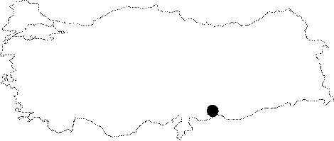 |
For photographs please click on the photo...  |
|
Type:
|
Mound |
|
Altitude:
|
360 m |
|
Region:
|
Southeastern Anatolia |
|
Province:
|
Sanliurfa |
|
District:
|
Birecik |
|
Village:
|
Keskince |
|
Investigation Method:
|
Excavation |
|
Period:
|
Middle Late |
|
|
|
 |
|
| Location: It was located 2 km north-northeast of Keskince (Tilmusa) Village on the eastern bank of the Euphrates; about 22 km northwest of the Birecik District; west of the Sanliurfa Province. Local meaning of Tilbes is the "Last Hill". |
| Geography and Environment: It was a conical mound located near the Euphrates measuring 12 m in height above the river bank and 110x100 m in dimensions. The cultural deposit was informed to be of 14.5 m thick. The slopes were like stepped terraces; and the western slope facing the Euphrates was steeper than the others. The Euphrates was flowing through a wide basin right below the mound; therefore it can be suggested that this site was a pathway for pedestrians. It was submerged by the Birecik Dam. |
| History: |
| Research and Excavation: It was discovered during a survey conducted by G. Algaze in the name of the Chicago University in 1989 [Algaze 1994:32; map 5]. The salvage digs started by a Spanish excavation team under the support of the Alicante University by J.G. Fuensanta were planned to continue until the mound was flooded by the Birecik Dam. The excavations were completed by an international team in 2000. It takes place in the registered archaeological sites list prepared by Ministry of Culture and Tourism. |
| Stratigraphy: Both the survey and the excavation have laid out that the site had been occupied during the Obeid Period (Chalcolithic Age); Post-Uruk (EBA I); end of third millennium BC-beginning of the second millennium BC (EBA III-IV); MBA; Middle Iron Age; Late Iron Age/Akhamenid; Hellenistic; Roman and Islamic periods. It had been abandoned for a long period of time from MBA II. The excavator reports that the thickness of EBA I; III/IV is more than 10 m. |
| Small Finds: It is discovered during the Tigris-Euphrates Archaeological Reconnaissance Survey conducted by Algaze. Sherds in Ubaid painted ware; Uruk/Late Chalcolithic Age pottery finds (rim-slipped bowls); EBA 3/MBA 1; Hellenistic and Roman Period pottery sherds are collected from the lower skirts of the mound. The site covering an approximate area of 1.1 hectares is going to be inundated by Birecik Dam. Excavations conducted by J. Fuensanta as a part of a joint project with Sanliurfa Museum (A. Misir) on the mound in 1996-2000. A fragment of a hollow clay bulla was found. Another find may represent either a large token or a peculiarly shaped numerical tablet bearing only numbers. Architecture: For 2004, as the main target, we continued research on the Northern Ubaid-like site inside the Birecik Dam area, near Tilbes Höyük. Our archaeological rescue activities there exposed about 1200 square metres of a Northern Ubaid-related Chalcolithic site with at least a dozen buildings. It was occupied only for a short time. The building plans show a well-planned site. Among the plans we distinguished at least one tripartite and two bipartite buildings. To date, these are the northernmost buildings of the site. As an alternative hypothesis, we think most of the "buildings" may be a bigger inter-connected structure, rather than simple isolated buildings. The likely biggest structure has an area of over 90 square metres. The nicest finds and highest concentration of Ubaid painted pottery come from this place. Pottery: We distinguished just a few motifs on the painted pottery, and mostly a combination of several of them. Most of the unusual motifs (for example, the "two inclined rectangles") come from this biggest building. The exceptions are a few sherds found in the northern bipartite and tripartite structures. Most of the sherds showing painted, schematic, human-like figurines appeared inside the southernmost building. They occur in different combinations. The geometric designs depicted include straight lines, cross-hatching or waves, and these are the most usual painted motifs at the site. Very unusual were several painted motifs that resemble pictographic signs. They were found on the underside of a jar lug. The sample of motifs found in the other structures includes the above-mentioned cross-hatching, rectangles and waves, isolated or in combination, but covering only a small area of the pot. We also have common ware open shapes, jars and bowls with out-turned or inturned rims. A Coba bowl sherd is a guide to the proper chronological setting of the site, as we could not use the painted motifs as a chronogical guide. A lot of sherds show traces of the wheel or slow-wheel. The grit percentage of the ware places it in the 4th millennium BC (LC 1 of the SAR chronology) [http://cat.une.edu.au/page/tilbes%20hoyuk; 24.11.2009, 10:50]. |
| Remains: |
| Interpretation and Dating: A few hundred metres from Tilbes Höyük appeared remains of other constructions, with similar wares and painted Northern Ubaid-like pots. Their construction on the hills east of Tilbes may provide evidence of a river flood early in the 4th millenium, after the Late Ubaid phases [http://cat.une.edu.au/page/tilbes%20hoyuk; 24.11.2009, 10:50]. |