|
©The Archaeological Settlements of Turkey - TAY Project
|
|
|
|
|
|
Saraga |
|
|
For site maps and drawings please click on the picture...  |
For photographs please click on the photo... 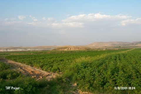 |
|
Type:
|
Mound |
|
Altitude:
|
520 m |
|
Region:
|
Southeastern Anatolia |
|
Province:
|
Gaziantep |
|
District:
|
Karkamis |
|
Village:
|
Kelekli |
|
Investigation Method:
|
Excavation |
|
Period:
|
|
|
|
|
 |
|
| Location: Saraga is located on the west bank of the Euphrates; about 800 m northeast of the village of Keleklioglu; in the Karkamis district of the province of Gaziantep. The village is reached by an asphalt road that runs parallel to the river after leaving the Gaziantep-Urfa highway at Birecik. The mound is 10 km north of the ancient site of Carchemish. The sites of Gre Virike; Akarçay Tepe and Akarçay Höyük are all opposite of Saraga; on the east bank of the river. |
| Geography and Environment: A small stream with its source in the foothills of the Nizip Plateau runs into the Euphrates just south of the mound. The mound extends 200 m north-south and 150 m east-west; and is approximately 22 m high. Apart from the natural section created by the Euphrates on the northeast; all skirts of the mound have been cut back in order to create agricultural land and for road construction. |
| History: |
| Research and Excavation: The mound was first discovered in 1989 by a team under the leadership of G. Algaze. It was surveyed by the Museum of Gaziantep in 1998; during the METU TAÇDAM Salvage Project of the Archaeological Heritage of the Ilisu and Carchemish Dam Reservoirs. In 1999 and 2000; salvage excavations were conducted under the co-direction of K. Sertok (Gaziantep Museum) and F. Kulakoğlu (University of Ankara; Faculty of Languages; History and Geography) as a part of the same project. It takes place in the registered archaeological sites list prepared by Ministry of Culture and Tourism. |
| Stratigraphy: The settlement has yielded layers belonging to Late Uruk; Early Bronze Age; Middle Bronze Age; Late Bronze Age; Iron Age and the Medieval ages. While EBA is represented by three phases; at least two phases were determined for MBA. A specific change indicating the transition between the Middle and Late Bronze ages was not found. The Iron Age materials were encountered immediately beneath the surface. The cultural layers of the Medieval ages were located on the southern trenches. |
| Small Finds: Architecture: In the trench K soundage; within the 150 cm thick layer; three architectural phases of the Early Bronze Age were traced. The uppermost phase consists a wall with an east-west orientation and an associated second wall oriented north-south; representing part of two rooms. The floor of the western room was laid in places with large pebbles and had been renewed several times. A large part of the hearth with a plaster floor found at the north was destroyed by the erosion on the slopes of the mound. The next phase was represented by a room whose enclosing walls partly survived on the north; south and east sides; its west half being beyond the baulk of the trench. Consequently; it was possible to excavate only half of a circular hearth; at a higher level than the floor. Found in situ in this room were a cooking-pot and the lower part of a storage jar. The earliest phase was covered with a thick stone fill. The stones; of different sizes; were set in compacted earth of a very mixed composition; consisting of clay; mud brick; sand and ash. Within this mixed sediment; were found two parallel foundation walls oriented north-south. At the north of the trench; an upturned jar; had been used for a child's burial; was encountered. Compared to the monumental Middle Bronze Age building; the Early Bronze Age structures are simple; with the characteristics of ordinary dwellings [Sertok-Kulakoglu 2001:478]. Pottery: The Early Bronze Age pottery of Saraga consists of mass produced vessels that appear in the middle of the Early Bronze Age and are known from numerous sites in Northern Syria and especially the Middle Euphrates basin. These vessels were made on a fast-turning wheel; are very hard fired; with thin or very thin walls; and of good quality paste with a very fine-grained consistency. Most of the pedestalled examples have ring bases. Fewer in number; but typical examples; are the tripod vessels with cylindrical legs. Besides the examples with plain surfaces; which constitute most of the larger vessels with a bulging out-flaring rim; the repertoire has been enriched by the use of the fast-turning wheel; producing two further groups of pottery comprise vessels with surfaces decorated with horizontal wavy red bands or grooved; line-burnished red bands; and cooking pots made from a gray-brown fabric with sizeable inclusions. Among the cooking pots are examples with triangular logs on the rim and a lightly burnished exterior surface [Sertok-Kulakoğlu 2001:478;479]. Clay: Baked clay bull figurines were encountered. Chipped Stone: Typical chipped stone finds are flint knives (Cananian blades). |
| Remains: |
| Interpretation and Dating: Saraga; which has yielded significant information about the cultural history of the region; is the only contender showing an unbroken stratigraphic sequence from the Late Uruk period to the end of the Iron Age among the rescue excavations being conducted in the Carcemish Dam reservoir region. The Early Bronze Age cemetery located about 800 m southwest of the mound; indicates a settlement dating to the earlier phases of this age. |