|
©The Archaeological Settlements of Turkey - TAY Project
|
|
|
|
|
|
Sehzade Höyük / Turlu |
|
|
For site maps and drawings please click on the picture... 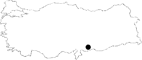 |
For photographs please click on the photo... 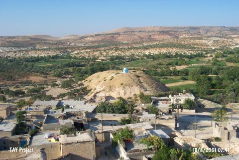 |
|
Type:
|
Mound |
|
Altitude:
|
700 m |
|
Region:
|
Southeastern Anatolia |
|
Province:
|
Gaziantep |
|
District:
|
Nizip |
|
Village:
|
Turlu |
|
Investigation Method:
|
Excavation |
|
Period:
|
OP |
|
|
|
 |
|
| Location: This site lies 48 km east of the city of Gaziantep; north of the town of Nizip; near the Turlu District; along the Nizip highway. |
| Geography and Environment: The site; which in many archaeological publications is described as a Halaf site; lies in a narrow valley. |
| History: |
| Research and Excavation: J. Perrot discovered the Palaeolithic component of this site during his 1961 survey in southeast Anatolia; around Sehzadehöyük. He reports that the Palaeolithic chipped stone tools he found are not associated with the mound. The geographic location of the site must have been attractive to post-Middle Palaeolithic people. A short-term excavation in 1962 by J. Perrot were conducted on the mound. Seven main building levels from Halaf Period were recovered in the sounding on the western slope of the 30 m high mound. It takes place in the registered archaeological sites list prepared by Ministry of Culture and Tourism. |
| Stratigraphy: |
| Small Finds: Perrot's survey yielded abraded Moustérien type flakes with patinas [Perrot 1962:17; fig.7-8]. Detailed information on the characteristics of the finds is not provided. |
| Remains: |
| Interpretation and Dating: |