|
©The Archaeological Settlements of Turkey - TAY Project
|
|
|
|
|
|
Peynirçiçegi Magarasi |
|
|
For site maps and drawings please click on the picture...  |
For photographs please click on the photo... 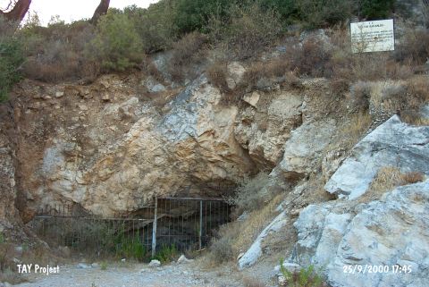 |
|
Type:
|
Cave |
|
Altitude:
|
56 m |
|
Region:
|
Aegean |
|
Province:
|
Mugla |
|
District:
|
Bodrum |
|
Village:
|
Gündogan |
|
Investigation Method:
|
Survey |
|
Period:
|
|
|
|
|
 |
|
| The cave is located in a rocky hill in Gündogan quarter of Bodrum; 200 m south of Gündogan junction on Gölköy-Yalikavak road. First research in the cave was conducted in 1992 by the archaeologists from the Bodrum Underwater Archaeological Museum; H. Özdas; B. Berkaya and photographer O. Hamza. Expeditions have continued during 1993-94 by I. Yalçinkaya; A. Özten; and B. Alpagut from the University of Ankara. The soundings in the cave have exposed Chalcolithic Age and Early Bronze Age settlement remains. The cave is protected by a door. It takes place in the registered archaeological sites list prepared by Ministry of Culture and Tourism. |
| Location: It is located on a rocky ridge 200 m south of the junction on Gölköy-Yalikavak motorway separating to Gündogan territory of Bodrum District of Mugla. |
| Geography and Environment: |
| History: |
| Research and Excavation: |
| Stratigraphy: |
| Small Finds: |
| Remains: |
| Interpretation and Dating: |