|
©The Archaeological Settlements of Turkey - TAY Project
|
|
|
|
|
|
Minareli / Tilwa Höyük |
|
|
For site maps and drawings please click on the picture...  |
For photographs please click on the photo... 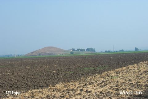 |
|
Type:
|
Mound |
|
Altitude:
|
90 m |
|
Region:
|
Mediterranean |
|
Province:
|
Osmaniye |
|
District:
|
Toprakkale |
|
Village:
|
Aslanpinari |
|
Investigation Method:
|
Survey |
|
Period:
|
Middle |
|
|
|
 |
|
| The mound lies 2.3 km west-southwest of Aslanpinari Village; 7 km north of Toprakkale District; east of Adana Province. It is named as Tilwa Höyük in some publications and also locally known as Kursunlu-Telkova. The conical mound Ñwhich constitutes only a portion of the settlementÑ lies on a natural basalt elevation and the total height from the plain level is 40 m. It is discovered during the 1951 Cilicia Survey by M.V. Seton-Williams. Sherds collected from the surface verify settlement from probably Chalcolithic Age to Islamic Period. Sherds in Coba ware of Chalcolithic Age are recovered. It is assumed that this location is the settlement named Magarali Höyük found 7 km from Sayhöyük Village of Toprakkale District in 2008, by F. Tülek [Tülek 2010:74-75]. |
| Location: |
| Geography and Environment: |
| History: |
| Research and Excavation: |
| Stratigraphy: |
| Small Finds: |
| Remains: |
| Interpretation and Dating: |