|
©The Archaeological Settlements of Turkey - TAY Project
|
|
|
|
|
|
Adir Höyük ve Kale |
|
|
For site maps and drawings please click on the picture...  |
For photographs please click on the photo... 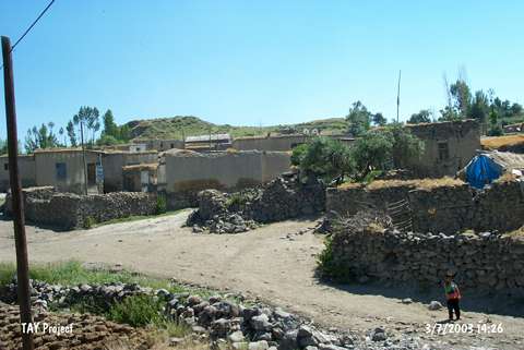 |
|
Type:
|
Mound |
|
Altitude:
|
1680 m |
|
Region:
|
Eastern Anatolia |
|
Province:
|
Van |
|
District:
|
Merkez |
|
Village:
|
Yayliyaka |
|
Investigation Method:
|
Survey |
|
Period:
|
|
|
|
|
 |
|
| It is situated southwest of Yayliyaka (Adir) Village; about 47 km north; northwest of Van Province. To the north of it is the road to the village of Amik (Yesilsu). It was discovered in 1996 by O. Belli during the survey of the irrigation dams from the Urartu Period. It was named after the village where it is located under. It stands on an andesite rock. It measures ca. 24 m in height together with this elevation and 164 m in length in the east-west direction. The eastern part was deeply engraved by the Akdere Stream. Remains of a fortress and dwellings are seen on the mound looking like a double hill. O. Belli reports that settlements with such sound stone walls are very rare among the settlements of Urartu Period. Pottery collected from the surface exposes that the site had been inhabited from the EBA to the Middle Age. |
| Location: |
| Geography and Environment: |
| History: |
| Research and Excavation: |
| Stratigraphy: |
| Small Finds: |
| Remains: |
| Interpretation and Dating: |