|
©The Archaeological Settlements of Turkey - TAY Project
|
|
|
|
|
|
Kusura |
|
|
For site maps and drawings please click on the picture... 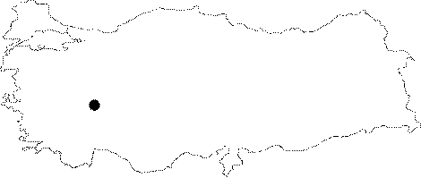 |
For photographs please click on the photo...  |
|
Type:
|
Mound and Cemetery |
|
Altitude:
|
1080 m |
|
Region:
|
Aegean |
|
Province:
|
Afyonkarahisar |
|
District:
|
Sandikli |
|
Village:
|
Dogansu |
|
Investigation Method:
|
Excavation |
|
Period:
|
EBA I EBA II EBA III |
|
|
|
 |
|
| Location: It is to the west of the village it was named after; about 12 km south of the Sandikli District; 55 km southwest of the Afyonkarahisar Province. |
| Geography and Environment: It is one of the medium sized mounds of the fertile Sandikli Plain. It measures 14 m in height and 400 m in diameter. Trench opened under the northern section revealed that the cultural deposit goes down 1.5 m deeper. Almost all northern side of the mound has been destroyed by the local villagers to remove clay soil. This removal; in turn; resulted in a section lengthwise. It is claimed by W. Lamb that the first inhabitants of this site (Layer A) chose to be settled on a rocky hill of ca. 4 m because the area was a swamp. To the north lie arable fields and a channel. Cemetery; reported belonging to Layer A; is located in the area in front of the school building; which was used as excavation house during the excavations; on a ridge next to the channel on the northern part of the mound. Although; the ridge looks like a sharp one when you look down from the mound; it extends to the north with a soft inclination. |
| History: |
| Research and Excavation: The excavation was initiated in 1935 under W. Lamb; University of Cambridge in the collaboration of E. W. Gardner; and continued in 1936 and 1937 again under W. Lamb. Altough; the destructed area of the mound gave the opportunity to uncover the village of the first inhabitants; excavation leader was satisfied with a small trench at this point and concentrated the main excavation on the uphill. It takes place in the registered archaeological sites list prepared by Ministry of Culture and Tourism. |
| Stratigraphy: Three layers were discovered under A; B and C. Layer A was found at trench no. II opened in the destructed area; and it is also represented by an extramural cemetery on the north-northwest of the mound while Layer B was opened in a pretty wide area. It covers six building levels. Included in the midst of the third millennium BC; this layer was identified as Copper Age covering the end of EBA II and beginning of EBA III. Intermediate level from B to C (?) is dated to the end of the third millennium BC and beginning of the second millennium B.C while layer C is identified as Hittite Period (Assyrian Colony Period and MBA) by the excavation leader. Virgin soil was reached. Exposure of various finds like vessels and idols purchased both by the Museum of Afyon and private collectors exposes that the pre-excavation illicit diggings continue even after the excavation. |
| Small Finds: Architecture: No architectural remains were uncovered in layer A. Ash layers are observed. Trench no. XII yielded plenty of sherds followed by burnt trees [Lamb 1938:219]. Seven building levels were uncovered in layer B; building level 1-6 dating to EBA and level 7 to the transition from B to C. Those levels can be summarized from lowest to the upper levels respectively as follows: Lowest levels; building level 1 and 2 yielded only the corner of a mudbrick construction having a compressed floor [Lamb 1938: fig.1] while excavated parts of 3 building levels of Level B revealed that the houses are lined along a street. Two house complexes were uncovered. To the south; there is an empty area probably used as a courtyard. Constructions have rectangular plans. One of the rooms of the western house has a crooked shape. Remains of the wall in the narrow and long hall identified as street; hearth and floors with different altitudes expose that this level consists of several phases. One room of the western construction fronts this street. It is difficult to get an exact plan because all of them do not front the street. There is a pretty small kiln in the western corner of the Room No. 7. Rooms of the eastern construction are interconnected while the western construction does not have such a feature [Lamb 1938:fig 2]. It is also unclear if those constructions are entered through the roof. Construction elements consist of stone foundations or mudbricks on mantel base. Walls are whitewashed (?). Roofs of the single story houses are probably flat; and they were built by putting thin branches over wooden beams; and then reeds/rush finally covered by waterproof earth. It was revealed that the construction plan didn't change in levels 4-6; furthermore some of the constructions (like room no. 5;3 and 7) were built in the same plan [Lamb 1938:fig.3]. Remains of quarterly circular small hearths and ovens were uncovered. Floors are again of compressed earth. Presence of piled mudbrick technique is observed as well as mudbrick walls. Structures of the latest building level of EBA II architecture [Lamb 1938:fig.4] were destroyed by the intermediate level. Pottery: Sherds of handmade; thin dark grey-coloured pasted; black washed and very qualified burnished ware are dense in layer A. Decorations are white painted. Usually bowls were found [Lamb 1937:14]. All building levels of Layer B yielded intact vessels and sherds of buff; gray or red washed and light buff colored ware; mostly wheel-made. Some of them are burnished. Light buff colored ware was not found in the lower building levels. Also found are samples of wash decorated wares produced by non-appliance of red wash or by scraping. Twisted handles and groove decorated samples can be seen throughout the all phases. Red cross decorated bowls expose the relation of the settlement with the Western Anatolia Region. Some vessels preserved at the Museum of Afyonkarahisar demonstrate the rich variation of Kusura pottery industry [Topbas et al. 1998:83; draw.184-191]. Double handled mug; horizontal groove decorated depas; burnished depas and spouted pitcher are good examples of the above mentioned wares. Clay: Terra cotta idols and animal figurines were recovered. Identical of a small idol recovered from Layer B is claimed to be at Ahlatlibel and Alisar [Lamb 1937:28; fig.11; no.2]. Head of an idol recovered by the local villagers following the excavations and preserved at the Museum of Afyonkarahisar indicates that the female figures with a big nose and eyebrows in relief are produced in the Central Anatolia Region [Bilgi 1979:134; fig.3]. Also found are plenty of spindle whorls; some are decorated as well as seal stamps and beads. Spindle whorls are incision and excision decorated; mostly in spiral patterns. Loomweights made of terra cotta indicate that the societies lived here were involved in weaving heavily. Ground Stone: Various types of stone tools seen at all EBA cities of Anatolia like flat axe; shaft-holed hammer/axe; shaft-holed mace; crushers; pestles etc. were recovered. Stone beads and spindle whorls indicate that those objects were also produced by stone. There is no distinctive and significant style. Most amazing group of finds of Kusura in that category are flat violin-like idols. Most beautiful samples of those finds; schematized depictions different from terra cotta idols are big idols found by the local villagers before and after the excavations [Alp 1965:3-5]. W. Lamb highlights that early samples of disc-headed idols bear indications of eyes and eyebrows [Lamb 1938:266]. Bone/Antler: Awls in different sizes [Lamb 1938:fig.27] and hammers in bone are interesting. Metal: EBA layer of the settlement yielded largely copper finds. Analyses carried out in 1937 revealed that all of the finds are made of copper. Square headed pins; burins; blades and earrings were found [Lamb 1938:fig.21/2; 3; 9; 21]. Human Remains: Layer A was renown by its extramural cemetery yielding finds contemporary with Troy I. Only one of the 14 graves is simple pit burial; 10 of them are pithos graves and the rest are cist graves. 15 skeletons were found. In the simple pit burial; dead was buried in hocker position (contracted) leaning on his right side; head oriented toward the west while in the pithos graves; dead were buried into three types of pithoi. Graves 1; 6; 7 and 13 are typical pithos graves. Second type is represented by graves 3; 8 and 11. Those are pithos-like graves made by breaking a pithos into two and putting them onto the dead facing each other. Third type of the burials are the broken pithoi placed into the pit as the inner part is up and dead are put into and then covered by the broken fragments of the pithoi. Grave no. 12 is an example of such burials. Burials were interred in hocker position into the pithos graves. T. Özgüç proposes that unburnished pithoi made of straw and grit tempered paste and reddish brown and red brown surfaces are produced only for burial purposes [Özgüç 1948:17]. Bottom of them is usually rounded. Handles are attached onto the neck or ventral part of the pithoi. Handled vessels made of coarse ware were left as grave goods together with the burials. The burials are all adults except one. Rarely jugs were left outside the pithos. Cist graves were found in the same cemetery. Their four-cornered walls were erected by standing smooth big flat stones vertically side by side; and capped by one or two stones. the lateral side is always toward the southeast. They have different measurements such as 80x63 cm; 140x73 cm; 163x85 cm. Heads of the adults are oriented toward the east. They are buried in hocker position; too. One of them house double burials [Özgüç 1948:32-33] while the others belong to single burials. Copper pins; aside vessels; were left as grave goods. They are considered as shroud pins. No cemetery was found for Layer B. It should be investigated in the neighbouring territory. |
| Remains: |
| Interpretation and Dating: W. Lamb; excavator of the Kusura settlement; started the dating of Layer A from the fourth millennium BC in his first publication; however included it in EBA I as an early phase of Layer B in his following publications. This level is also dated to EBA I and IIa by M. Korfmann whereas Layer B is dated to the end of the second millennium BC by W. Lamb and EBA IIb by M. Korfmann. We have very rich information about the EBA settlement of Kusura. In spite of the limited excavated area; it is obvious that we are dealing with an urban settlement. Construction plan of Layer B is similar to the construction plan of Troy IIg. Architecture doesn't differ from other Anatolian settlements. It has a pottery industry specific to the region. Yet; relations with cultures of Western Anatolia like Troy are certain. It can also be considered within the territory of the Aegean shore. M.J. Mellink reports the presence of finds belonging to EBA III during the illicit diggings carried out by the local villagers after 1940's. It is revealed that the architecture differ from the lower levels during so called "Transition Period" while moving from B to C. An exact dating is difficult as no samples of 14C were taken during the excavation. |