|
©The Archaeological Settlements of Turkey - TAY Project
|
|
|
|
|
|
Kinik |
|
|
For site maps and drawings please click on the picture...  |
For photographs please click on the photo... 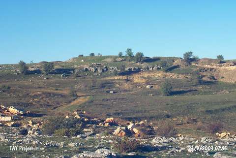 |
|
Type:
|
Slope Settlement |
|
Altitude:
|
1070 m |
|
Region:
|
Black Sea |
|
Province:
|
Kastamonu |
|
District:
|
Devrekani |
|
Village:
|
Kinik |
|
Investigation Method:
|
Excavation |
|
Period:
|
EBA III EBA II |
|
|
|
 |
|
| Location: It is located on Delibeyoglu Ridge in the territory of the Kulaksizlar Dam; northwest of Kinik Village; 10 km northeast of Devrakani District and Kastamonu Province. |
| Geography and Environment: |
| History: |
| Research and Excavation: The site was discovered in 1990 during the preparation of the dam construction project in the vicinity of Kinik and first known by the Hittite pottery. These finds were delivered to the museum and then studied by A. Çinaroglu. The site was excavated during 1994-97 in collaboration of the Kastamonu Museum and the University of Ankara under A. Çinaroglu [Çinaroglu-Genç 2004:355]. After five years of break the excavations restarted in 2002 and continued ever since. The site takes place in the registered archaeological sites list prepared by Ministry of Culture and Tourism. |
| Stratigraphy: The excavations carried out immediate north of the area where Hittite metallic ware uncovered in 1994. Three levels and a flat settlement containing their subphases were discovered. Since the bedrock was reached the stratigraphy numbered from ground to top. Level I; goes down to 4th millennium BC (dating to Late Chalcolithic/Early Bronze I); Layer II has two phases (II-1 and II-2) and dated from second half of 3rd millennium BC to the beginning of 2nd millennium BC (dating to the end of the Early Bronze Age and transition to Middle Bronze) and in Level III there is an Iron Age settlement with several architectural phases [Çinaroglu-Çelik 2006:7;9; cat.une.edu.au/page/kinik]. |
| Small Finds: Architecture: In the 1st phase of Level II; the land which is slope from south to north has been levelled by carving in order to form terraced areas. There are rooms with stone walls and garbage pits cut into he bedrock at this area. Rooms have adjacent walls made of single line of flat collected stones. Walls are 30-40 m thick and in some places preserved about 1.5 m high [Çinaroglu-Genç 2004:356]. There is a stone foundation on the northern slope and a 90 cm metal kiln was found accompanied with a clay-plastered spouting section in stone. Due to typical EBA III - MBA pottery collected from this level; the lower workshop for metal smelting is indefinitely dated to the transition period [Bilgen 1999:270-272;277]. Excavations focused on the building in Level II in 2003. Adapting to the sloping ground the building lies in north-south direction. 51 m part of the enclosing wall is uncovered. The wall is 2.5 m in width and it is built with big stones inside and outside and then filled with the smaller ones. Foundation stones are fixed with plaster. There are six rooms of the building uncovered by now. The rooms are generally rectangular and they have mudbrick walls on stone foundation. Foundation stones are 1.5-2 m in dimensions and limestone. Stones are flattened and mud plaster was The building has been preserved 1.5 m in height [Çinaroglu-Genç 2005:279]. In 2004 the uncovered part of the building reached 63 m and the difference in the elevation was determined as 12 m. It was observed that the wall with big blocks of stones was made up without using any plaster and the holes filled with smaller stones. The walls were heighten by rectangular mudbricks with 51.5x43x9 m dimensions. Traces of plaster found on the mudbricks. In 2004 room 4 was excavated and lots of finds were encountered [Çinaroglu-Çelik 2006:8]. In 2006 the area where the the workshops were revealed during the previous years was expanded in north-south direction. The level II belongs to two different building phases. The level II-1represents the early and level II-2 represents the late phase. These areas are usually covered by buildings made on the bedrock and cinder pits carved into the bedrock. This trench gets lower from south to north. The bedrock was carved and leveled at places and terraced areas were built. The inhabitants of level II-1 destructed the level I of the previous inhabitants and placed their buildings on the bedrock. The length of the building which started to be revealed at level II-2 in 1996, reached 82.5 m in 2006. The building which is 2.5 m in width could not be completely revealed. The center of the fortress which was fortified from inside and outside by large rocks, was also fortified in the center by small rocks. Additionally, the wall body of the fortress was fortified by saw edge constructions built with intervals, the same way its contemporaneous Troia Level VI fortress was. Some of the external wall elements weigh over 7 tons. This should be pointing out at the fact that the buildings inside the fortress were important. The building that was revealed inside the trench extends in south-north direction, which is in line with the declination on the field. There is a height difference between the two ends which is 12 m. Furnace and stove bases were found inside the room nr 5 which is accessed through the building which has a width of 11 m, the room was placed on the bedrock but the walls could not be preserved due to the destruction [Çınaroğlu-Çelik 2008:514]. Pottery: All the pottery found in the 1st phase of Level I was handmade and red polished mugs and bowls were tha most common forms. Also finds are bowls with horse shoe shaped handles and polished black ware. It was observed that the pottery was parallel with the EBA settlements in the Kizilirmak Curve and besides this similarity there were also traces of a local culture [Çınaroğlu-Genç 2004:357]. During the excavations in 2006 an amorphous vessel that shows a widespread disribution starting in 3rd Millenium BC at level II-1 [Çınaroğlu-Çelik 2008:515]. Inside the level II-2 some new vessel forms and a small amount of other vessels made on tournettes were found which were not found at level II-1. Metal: A bronze bull head; a pin and some bronze objects found in Level II [Çınaroğlu-Genç 2005:279]. The sphere headed bronze pin with the oval cross-section, and the bracelet fragments that were found in 2006 show that the ornamentation objects were also produced besides the metallic vessels which were previously found [Çınaroğlu-Çelik 2008:515]. Other: Curicbles; stone and bronze tools were found [Çinaroglu-Genç 2005:278]. It was found that the stone workbench tool found in 2006 was used for sanding the pins. The spindl whorls found inside the level II-2 workshops were used as spindl heads, this shows the presence of the textile industry [Çınaroğlu-Çelik 2008:515]. |
| Remains: |
| Interpretation and Dating: As a result of the researches performed in 2006 many loomweights revealedat level II, the presence of plenty of metal finds and smashing-grinding stones shows the widespread availability of production at this location [Çınaroğlu-Çeliık 2008:514]. The production tradition inside this excavation area where the most metal finds from II-2 were revealed, started in 3rd Millenium BC, and made the peak in 2nd Millenium BC. One of the most important reasons for that was the location of the mines which was very near [Çınaroğlu-Çelik 2008:515]. |