|
©The Archaeological Settlements of Turkey - TAY Project
|
|
|
|
|
|
Kanligeçit |
|
|
For site maps and drawings please click on the picture...  |
For photographs please click on the photo... 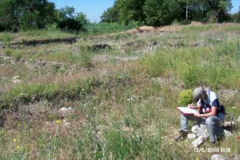 |
|
Type:
|
Mound |
|
Altitude:
|
138 m |
|
Region:
|
Marmara |
|
Province:
|
Kirklareli |
|
District:
|
Merkez |
|
Village:
|
Merkez |
|
Investigation Method:
|
Excavation |
|
Period:
|
EBA III EBA II |
|
|
|
 |
|
| Location: It lies on both banks of the Haydar stream; 250 m east of the road running to the Asilbeyli Village from Kirklareli; about 500 m south of the Kirklareli Province. |
| Geography and Environment: The Kanligecit settlement has been partly destroyed by the Kirklareli railroad. It divides the settlement into two. When discovered in 1981; the settlement was evaluated separately in three parts; Kanligecit north (B5/17); Kanligecit south (B5/18) and Kanligecit east (B5/16). Kanligecit North is an acropolis of the EBA settlement. After the excavation; the walls in the trenches were supported with wooden beams; the trenches were covered with nylon for protection. |
| History: |
| Research and Excavation: It was discovered by M. Özdogan in 1981; and excavated starting in 1994 by a team under M. Özdogan and H. Parzinger. After H. Parzinger left the group; the excavation went on under the direction of M. Özdogan. The excavation was intensely continued until 1998; slowed down in 1999; and discontinued in 2000 [Özdogan et al 2001:85]. The excavations restarted in 2004. It takes place in the registered archaeological sites list prepared by Ministry of Culture and Tourism. |
| Stratigraphy: The surface of the settlement has been severely damaged by ploughing and by the railway. Therefore; no information was obtained about the upper deposits. But; exposure of the sherds dating to Classical and Hellenistic Periods recovered from the surface evidences the presence of a small settlement belonging to the fifth century BC. The excavation on the acropolis revealed that the site had been continuously occupied from the beginning of the third millennium BC. The surface pits yielded at least one layer belonging to the transition between EBA and MBA on the top; and this layer is probably related with the preceding megaron layer. It is noted that the megarons were flattened during EBA III and moved to the western part of the mound. They have three renewal phases and were renewed with a "temenos" wall each time. The preceding two levels of "temenos" walls yielded a gateway. The gateway was; later; bricked up. A fortification wall surrounding the acropolis in a diameter of 55 m was uncovered in the same section. Following the two building levels after megaron level; ca. a 1m thick layer yielding typical Ezero pottery was found. Beneath this layer; a homogenous deposit was encountered disrupting the archaeological deposits while former deposits yielded traces of cultural levels belonging to the Late and Middle Chalcolithic Ages including a hiatus layer formed by watery deposits. |
| Small Finds: Architecture: The section called Acropolis in the Kanligecit North yielded a fortification wall built by big flat quarry stones and the outer sloping walls filled with stones in glacis (coated) form. It is not well understood if the walls were completely built of stones or the superstructure was of mudbrick because the remains are too close to the surface. Although uncertain; the settlement of ca. 65 m in diameter was probably entered through a monumental gate on the northwest. The entrance to the gate is from northwest. Even though the location and direction of the gate are not correlated with the walls; the renewed phase; slightly different from the preceding phase; is contemporary with the walls [Özdogan et al. 2000:98]. Its relation to the walls is still unclear because the structure of the gate has only been recently uncovered. The renewal is observed in the walls as well. In the lower level; 3 megarons were uncovered; all with stone foundations and two well preserved [Özdogan et al. 2000:pic.11]. The thickness of the megaron walls placed parallel to each other with a gap of 1.5 m is 60 cm. They all have big circular hearths (fire places with concave bottom) in the middle while one yielded altars or small fire pits. The northern megaron measures 6.30x14.90 m while the southern 7.20x15.50 m in dimensions. Underneath the megarons; a blockade is observed. Under the floors of the megaron structures; there are storage pithoi. A temenos wall of 60 cm thick encircles the megarons. The same technique was utilised to build the wall as in the other structures. Megarons and temenos walls had been through at least two to three renewal phases. The oldest phase of the temenos wall was pierced by a gateway; but it was bricked up later [Özdogan 1999: pic.18]. It is commented by the excavators that the lower phase of the monumental gate on the northwest is contemporary with the megarons. The outer dimensions of the quadrangular gate on the northwest - southeast axis measure 6.5x6 m. There is a threshold made of flat stones at the entrance of the outer gate which is 2.5 m wide. The gate is flanked on both sides by small rooms. The relation of the monumental gate to the temenos wall or if it pierces a fortification wall could not exactly be understood. The direction of the gate is in a straight angle to the temenos wall. It is stated that the temenos wall pierced by one gate continues under the fortification wall on the northwest. The area next to the megaron buildings is suggested to be an open courtyard. Traces of fenced framework and clay plastered oval structures of 100x30 cm were uncovered in this area. In addition to these places identified as workshops; there are remains which were built in different levels; believed to be domed kilns. A thin level was observed under this layer followed by a thick level which underwent a massive fire. This level yielded remains of wattle and daub structures. At least; two rooms were found. The extension of a citadel wall with 2 or 3 building phases in northwest-southeast direction was found which was previously found in the excavated northwestern section; just underneath the well preserved latest phase during the researches in 2005. But the wall was interrupted by a large pit in the west direction. The wall and the other wall extensions in north and south directions suggest the presence of a building remain at this section. It is still possible though; to assume that this building was related to a defense or surrounding system. A stone pavement type of a stone embankment cut by pits was found just underneath the fortification. The embankment expands onto a large area in northwest-southeast direction through two rows of stones placed on top of each other; and turns into the shape of a "glasi" or a blockage from the earlier phases of the fortification. Following that in the northwest the blockage; the fortification and wall were cut through by a narrow wall which was renovated three times. The research on the clarification of the burnt layers underneath the megaron planned buildings recealed a burnt adobe embankment; and the remains of three hearths which were previously started to be unearthed. Those remains which consist of dome shape hearths probably inside a room; looked more like a workshop; than a burnt residence. Due to the significance of the mine ores in terms of establishing the foundation of a settlement on the Istrancalar it may be assumed that this workshop area was meant for the processing of metals. But the lack of enough slag in the area makes it hard to reach a final verdict on the subject [Özdogan (E) et al. 2007:260]. The 2008 excavation area was expanded in south direction and it was found that the remains at this section belongs to a large structure in megaron plan. Just like the three megara found further northeast it lies in southeast-northwest direction but it is larger (27,5x11,20 m). The average width of the long walls is 1m, these were supported with 1 m wide buttresses every 2-2.5 m. There is an ante on the front side of the megaron that faces southeast which is also seen on all other three megara [Özdogan (E) et al. 2010:362-363]. Pottery: All the pottery recovered from the megaron level show the typical characteristics of the end of EBA III of the Central Anatolia and Central-Aegean regions. Preceding level yielded a pottery industry of red washed ware dating to the beginning of EBA III [Özdogan 2000:fig.14]. Forms of juglets; vessels with double rims; horn projected plates are common. Vast majority of the red washed pottery is wheel-made. Also found is the local pottery of black polished and burnished; washed and coarse handmade ware. This level is followed by a level yielding pottery industry of Late Ezero-Sveti Krilovo typical of the Balkans. Anatolian type red coated EBA II sherds contemporary of the megaron were yielded inside a 4 m wide, 2.9 m deep hole inside the ante in front of the megaron that was unearthed in 2008. Due to the votive characteristics of the large hole in front of it, and its size suggest it is a public structure [Özdogan (E) et al. 2010:363]. Clay: Lots of spindle whorls and loomweights were found [Özdogan et al. 2000:pic.14] especially in the lower level of the lower city. The 1998 excavations revealed two figurines. These terra cotta idols are flat faced with head coverings and... noses [Özdogan 2000:fig.13]. Chipped Stone: A sample of winged arrowhead made of silex has been published [Özdogan et al. 2000:pic.15]. Bone/Antler: Hammer-pickaxes made of deer horns were found in the courtyard next to the megaron buildings. |
| Remains: |
| Interpretation and Dating: Kanligecit was a small village at the beginning of EBA displaying similar characteristics with the Late Ezero culture of the Balkans. It is noted that a group of people who had their roots in the Central Anatolia rearranged the settlement during the third phase of EBA. During this period; it definitely becomes a colonial settlement. The fortification walls surrounding the acropolis and the temenos walls with megaron-like structures belong to that period. The urban characteristics such as administrative buildings and temples as well as a lower city and fortification walls are observed. The megaron-like structures are almost identical to the Troy megarons. It is amazing that no small finds related with daily life were found in the megarons. Some are suggested to be built for religious purposes. The monumental gate is in Anatolian style rather than Troian. The exposure of an architecture and pottery displaying Anatolian characteristics during EBA III indicates that Kanligecit was a colonial settlement during this last period. It is noted that the city-states in Anatolia developing in this period were trying to bring their system into the Thrace; but could not succeed in this for a long period of time. M. Özdogan claims that this colonial settlement belonged to a group which wanted to run the copper mines in the Istranca Mountains; or to purchase the copper from the locals and sell it and they moved from Anatolia to the Thrace [Özdogan 2000:74]. It is suggested that the colony was founded in ca. 2400 BC; and destroyed probably by fire in ca. 2100-2000 BC. The central and north-western Anatolia originated ware of EBA III was also found at Galabovo in Bulgaria and Kaynaklar II/Sülecik settlements; other than Kanligeçit. As they were not excavated; it is unknown if there are other similar colonies. |