|
©The Archaeological Settlements of Turkey - TAY Project
|
|
|
|
|
|
Kabarsa |
|
|
For site maps and drawings please click on the picture... 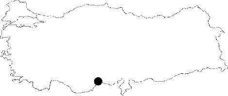 |
For photographs please click on the photo... 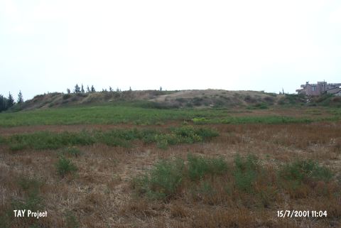 |
|
Type:
|
Mound |
|
Altitude:
|
130 m |
|
Region:
|
Mediterranean |
|
Province:
|
Mersin |
|
District:
|
Tarsus |
|
Village:
|
Mahmutaga |
|
Investigation Method:
|
Excavation |
|
Period:
|
Ceramic |
|
|
|
 |
|
| Location: This site lies in Mahmutaga Village; south of the Tarsus-Adana highway; 7 km east of the town of Tarsus; northeast of the city of Mersin. |
| Geography and Environment: The mound is 10-12 m high. |
| History: |
| Research and Excavation: A small sounding was conducted on the mound by the Tarsus American Research team. Later; in 1951 the mound was surveyed by M.V. Seton-Williams during his Cilicia Survey. The collection methods of the survey have not been reported. It takes place in the registered archaeological sites list prepared by Ministry of Culture and Tourism. |
| Stratigraphy: The surface survey on the mound yielded sherds from all periods from the Early Bronze Age to the Roman Period and possibly some Late Neolithic-Early Chalcolithic material. |
| Small Finds: Pottery: The site of Kabarsa is listed among sites where burnished Late Neolithic-Early Chalcolithic ceramics were found [Seton-Williams 1954:130]. The ware is probably dark and burnished. The finds from this site and other sites surveyed in Cilicia and especially the Içel-Adana Provinces have been dated after the Mersin Yumuktepe ceramic seriation. |
| Remains: |
| Interpretation and Dating: The ware found at Kabarsa resembles burnished ware from Mersin Yumuktepe XXVI-XXIV. A more careful comparison should be made. The site can skeptically be called a pre-Halafian; Late Neolithic-Early Chalcolithic site. In ASPRO; the site has been placed in phase 6/2 as a proto-Chalcolithic site [Hours et al. 1994:190]. |