|
©The Archaeological Settlements of Turkey - TAY Project
|
|
|
|
|
|
Kortik Tepe |
|
|
For site maps and drawings please click on the picture...  |
For photographs please click on the photo... 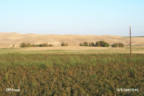 |
|
Type:
|
Mound |
|
Altitude:
|
500 m |
|
Region:
|
Southeastern Anatolia |
|
Province:
|
Diyarbakir |
|
District:
|
Bismil |
|
Village:
|
Agil |
|
Investigation Method:
|
Excavation |
|
Period:
|
EP |
|
|
|
 |
|
| Location: The site is located nearby the Agil village and Asagi Sazlik location of Bismil district in Diyarbakir province. It lies between Batman and Bismil; in the area where the Batman Su and Tigris rivers join. It is approximately 14 km southwest of Batman [Özkaya et al. 2002:739]. |
| Geography and Environment: The site covers an area about 50x100 m and being used for agricultural activities today. The settlement of Ziyaret Tepe located to the northeast; is directly connected to Kortik Tepe and represents the later phase of the settlement spreading over a wide area. Asagi Sazlik Mevkii; located to the north of the settlement; is another part of this extent in a similar way [Özkaya et al. 2002:739]. The site has an importance by its close position to the sites of Gre Dimse; Çayönü; Hallan Çemi and Demirköy. |
| History: |
| Research and Excavation: The site was discovered in 1991 during the survey conducted by Algaze in the Ilisu Dam Reservoir survey. The excavations were started in 2000 by the University of Dicle; Department of Archaeology and Art History as a part of the METU TAÇDAM Salvage Project of the Archaeological Heritage of the Ilisu and Carchemish Dam Reservoirs. The excavations resumed after 2 years in 2005 [Özkaya 2007:29]. It takes place in the registered archaeological sites list prepared by Ministry of Culture and Tourism. |
| Stratigraphy: |
| Small Finds: Architecture: In 2011, a multi-layered Epipaleolithic building and two Epipaleolithic pits were excavated in 2011. Trench A104 is located in the southwestern part of the tell, 20 m southeast of the deep cut in Trench A80. Locus 1: It is a large pit, of which the southwestern quadrant was excavated in Square D4. If it is circular, its full diameter is about 180-200 cm. The pit, which was dug into the natural soil, resembles an inverted bell in shape. A similar bell-shaped structure was observed at Demirköy. Two fireplaces located in the uppermost filling layer of Locus 1 probably belong to a later use of this space after Locus 1 had been filled and the fill settled. The fact that Locus 1 did not have straight wall and narrowed towards its bottom makes it unlikely that it was a habitation. More likely, it was used for storage, though its large diameter makes it a rather large structure for such a function. Locus 2: It is a fireplace located to the south of Locus 1. The stones within the fireplaces were cracked and blackened. Locus 3: It is a fireplace located in the eastern part of Locus 1 was probably later than the pit itself. It has at least two distinguishable phases. Locus 4: It is a round structure with a diameter of 80 cm. Although it was dug into the natural soil, it is not possible to determine its original height due to the later destruction (Neolithic). There are some small postholes in the west and the southwest sections. A large posthole was observed in the northern profile. Locus 5: It extends from Squares D1-2 to E1-3 in a quarter of a circle. Locus 5_2 is a pit narrowing from about 1.40 m wide on the top to 1.30 m wide on the bottom. Its north-south extent hasn't been exposed yet. On its east section, a small podium which could have served as an emplacement for some kind of wooden support was found. Locus 5_1 is a large round or oval structure with a depth of 40 cm. In the northern border of Locus 5, a square shaped posthole, one side of which is 20 cm, was found. About 50 cm to the west, a rectangular clay post (20x25 cm) was documented. It is possible that these two features mark the entrance, though 50 cm would seem to be rather narrow for a doorway. To the east and west of these two features were curving depressions bending to the southeast and west, possibly the remains of a wooden wall which continued along the postholes in Square D3. On the eastern border of Locus 5, another large posthole was discovered right above the earlier-mentioned podium in Locus 5_2. All of these data indicates that Locus 5 was used for living purposes. Chipped Stone: A great number of obsidian artefacts and flints were found in Locus 1. Among the obsidian artefacts, there is also an obsidian lunate. The flints mostly consist of medium and large sized flakes. A few microliths were also found. In Locus 5_1, flint flakes, cores and some tools were recovered. A large flint nodule was discovered in the southeastern corner of Square D1. In addition to this findings, Loci 2 and 3 contain a great number of flints as well. Ground Stone: Locus 5_1 yielded a large stone bead. In Locus 1, a teardrop-shaped black pendant was found. Bone/Antler: A bone point was recovered from Locus 5_1. Fauna: An animal jaw the size of those of sheep and goat was found lying under each fireplace in Locus 1. Locus 1 also yielded some animal bones, mostly of smaller species, a shell and many fish bones. An anthracite-colored and two mother-of-pearl ring beads are among the finds recovered. Loci 2 and 3 contain a great number of fish bones. In Locus 3, flints, burnt clay fragments and charcoal were discovered together with a few animal bones. Locus 4 is moslty devoid of findings. However, between Loci 4 and 5 an animal jaw with sharp teeth, probably belonging to a canidae or felidae, was discovered. In Locus 5_1, bones belonging to bird wing, vertebra of a large animal and the remains of a turtle shell were encountered. Flora: As the results of the botanical studies, 13 different plant families were identified. Among them, two families are prominent: cruciferous plants (Brassicaceae) and grasses (Poaceae). The goosefoot (Chenopodiacae) and knotweed (Polygonaceae) are also relatively frequent. A few grains of rye, einkorn and barley were identified. Wheat is much less frequent [Benz et al 2013]. |
| Remains: |
| Interpretation and Dating: The studies show that Locus 3, which is located on the top of the filling of Locus 1, is the most recent feature. Locus 1 had probably been dug down from a layer above Locus 4 and thus should be more recent than Loci 4 and 5. Since Locus 5 ends south of the northern profile, it is not yet possible to determine its stratigraphical relationship to Locus 4. Locus 5_1 belongs to the first occupational phase of Locus 5 and Locus 5_2 represents the earliest occupation of this trench. Changes in building traditions in Trench A80 and the radiocarbon data obtained from the upper layers suggest that occupation began at the site during the Younger Dryas in the second half of the 11th millennium BC cal and continued into the early Holocene. Despite the changes in ecology occured with the advent of the Holocene, the inhabitants of Körtik Tepe stayed at that location and adapted to their new environment. |