|
©The Archaeological Settlements of Turkey - TAY Project
|
|
|
|
|
|
Habusu Körtepe |
|
|
For site maps and drawings please click on the picture... 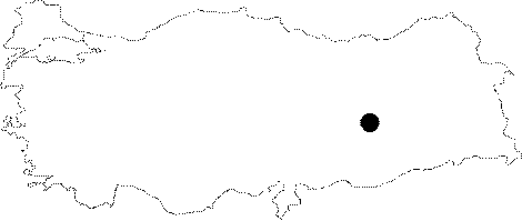 |
For photographs please click on the photo...  |
|
Type:
|
Mound |
|
Altitude:
|
812 m |
|
Region:
|
Eastern Anatolia |
|
Province:
|
Elazig |
|
District:
|
Merkez |
|
Village:
|
Ikizdemir |
|
Investigation Method:
|
Excavation |
|
Period:
|
EBA I EBA II |
|
|
|
 |
|
| It was a settlement truncated by a railway and a motorway; 1-1.5 km east of İkizdemir (Habusu) Village of Altinova; east of Elazig Province. It was flooded by the Keban Dam. It was a very low; wide and flat mound. When it was discovered during the survey of R. Whallon and S. Kantman in 1967; it was investigated in two parts. Considering it as two different findspots; northern part was coded under 0 55 / 8 and southern part under 0 55 / 9. The northern part was almost diminished to the EBA level during the construction of the railway. It was 4.5 m in height and 240x130 m in dimensions. The survey yielded an occupation from the Neolithic Age to the Iron Age. It was excavated under H. Hauptmann in 1972 in order to open the settlement of the Chalcolithic Age. During the survey; samples of Karaz ware; simple plain ware and red washed EBA ware were recovered. To prevent any confusion with other Körtepe mounds; another name was added; Habusu. |
| Location: The site lies approximately 44 km away from Elazig; approximately 1 km east of Ikizdemir (Habusu) Village; 1 km west of Korucutepe; and 4 km northeast of Norsuntepe. It is located on both sides of the Old Elazig-Bingöl Road; and was split into two during the construction of the railway. Therefore; the northern part is named as Habusu Körtepe I (Location code: O 55 / 8); and the southern part is named as Habusu Körtepe II (Location code: O 55 / 9). |
| Geography and Environment: The mound measured 240 m long from north to south; and 130 m long from east to west before it was damaged. |
| History: |
| Research and Excavation: |
| Stratigraphy: |
| Small Finds: |
| Remains: |
| Interpretation and Dating: |