|
©The Archaeological Settlements of Turkey - TAY Project
|
|
|
|
|
|
Habusu Körtepe |
|
|
For site maps and drawings please click on the picture... 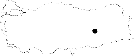 |
For photographs please click on the photo...  |
|
Type:
|
Mound |
|
Altitude:
|
812 m |
|
Region:
|
Eastern Anatolia |
|
Province:
|
Elazig |
|
District:
|
Merkez |
|
Village:
|
Ikizdemir |
|
Investigation Method:
|
Excavation |
|
Period:
|
Early |
|
|
|
 |
|
| Location: The site lies approximately 44 km away from Elazig; approximately 1 km east of Ikizdemir (Habusu) Village; 1 km west of Korucutepe; and 4 km northeast of Norsuntepe. It is located on both sides of the Old Elazig-Bingöl Road; and was split into two during the construction of the railway. Therefore; the northern part is named as Habusu Körtepe I (Location code: O 55 / 8); and the southern part is named as Habusu Körtepe II (Location code: O 55 / 9). |
| Geography and Environment: The mound measured 240 m long from north to south; and 130 m long from east to west before it was damaged. |
| History: |
| Research and Excavation: The site was researched during the surface surveys conducted by R. Whallon and S. Kantman as a part of the project for documenting the sites that are going to be inundated by Keban Dam; in 1967. Excavations were conducted by H. Hauptmann from the Near Eastern Institute of the University of Berlin with Norsuntepe team in 1972. |
| Stratigraphy: Although EIA; EBA; Late Chalcolithic Age; Early Chalcolithic Age; and Neolithic Age remains were found during the surface surveys; only the Early Chalcolithic Age levels; which were revealed after the damage of the railway; were excavated. Four levels were revealed at the Early Chalcolithic Age; one meter thick deposit in the 9 x 4 m sounding [Hauptmann 1973a:47-48]. |
| Small Finds: Architecture: An approximately 0.50 m wide mud-brick wall segment and a round hearth; 1.70 / 1.95 m in diameter; were revealed at the uppermost level; Level 1. The floor of the hearth is covered with sherds; and a clay plaster is observed on top of this. The mud-brick walls revealed from Level 2 are observed to be the southern corner of a house with two rooms. A rectangular hearth and the remains of a paved floor are revealed from the Level 3. It was not understood to what kind of a structure the mud-brick walls from Level 4 belonged [Hauptmann 1973a:47; 1976a:25-26]. Pottery: The majority of the Early Chalcolithic Age pottery of Habusu are straw and heavy sand-tempered; thick-walled; light brown; dark brown; light or dark gray faced vessels. Forms are necked jars with S-profiles; jars with round bellies; and large storage jars. Vertical jagged decorated or finger print decorated relief horizontal bands are observed. Knobbed lugs or horizantal handles are existent. Halafian paint decorated sherds were recovered in small amounts. Thin-pasted; dark gray or black sherds are rare [Hauptmann 1973a:47; 1976a:26]. Clay: Baked clay spindle-whorls and a steatopic figurine of a woman were found [Hauptmann 1973a:48; 1976a:26]. Chipped Stone: A long; triangle-shaped arrowhead with a wide handle made of obsidian is observed to be one of the most interesting finds of the chipped stone industry [Hauptmann 1973a:48; 1976a:26]. Bone / Antler: Tools made of bone were recovered. Fauna: 95% of the animals are domesticated. Sheep and goat are abundant. There are also cattle; pig; and dogs. Deer and wild pig are abundant among the hunting animals. Bones of wild cattle (Bos primigenius) and bison suggest that these animals once lived in Altinova [von der Driesch 1976:27-31]. Flora: Charred grains were found on the paved floor of Level 3 [Hauptmann 1973a:47]. Other: Of the eight fresh water mussels; five are observed to be used in burnishing [von der Driesch 1976:28]. |
| Remains: |
| Interpretation and Dating: Although the interrelations between the Early Chalcolithic Age culture at Habusutepe and Anatolia; and Mesopotomia are not yet clear after the first excavation season; the site seems to be in perfect harmony with the other Chalcolithic sites at Altinova due to the pottery finds [Hauptman 1976a:26]. |